New at the Archives – Engineering Richmond

Part of an ongoing program to digitize historical images at the City of Richmond Archives are 980 slides taken by Richmond’s Engineering Department documenting a variety of major infrastructure projects in the municipality between 1969 and 1977. Highlighted here are just two projects from 1969: the construction of the Dinsmore Bridge and the Gilbert Trunk Sewer.

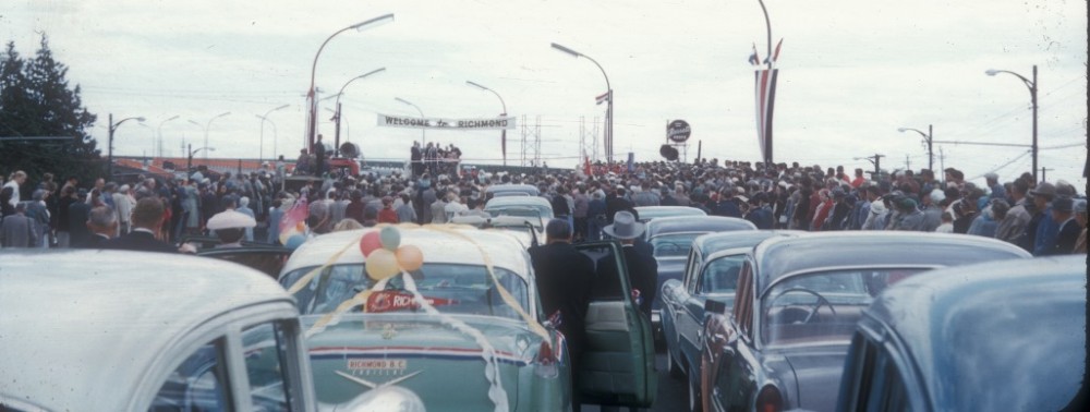
Dinsmore Bridge under Construction

Dinsmore Bridge under Construction, February 1969. (City of Richmond Archives Photograph 1988 123 461)

Before the opening of the bridge in 1969, the only connection between Sea Island and Lulu Island was the Moray Channel Bridge, built in 1957 to replace the old Middle Arm span of the Marpole Bridge. While the Dinsmore Bridge itself was built with funding from the Federal government, the approaches to the new bridge connecting Gilbert Road to Russ Baker Way were the responsibility of the municipal government. Part of the construction of the bridge approaches required the crossing of some of Richmond’s existing infrastructure, such as the Lansdowne Canal, as shown below.
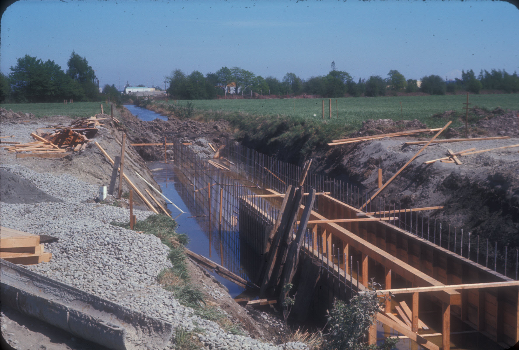
Crossing for Lansdowne Canal

Construction of the Crossing for Lansdowne Canal from the Dinsmore Bridge. (City of Richmond Archives Photograph 1988 123 472)

Another major construction project in 1969 was the Gilbert Road Trunk sewer, designed to collect sewage from lateral feeder pipes extending east and west to transport raw sewage south to an outfall in the South Arm of the Fraser.

Gilbert Road Trunk Sewer - Laying  Pipe

Gilbert Road Trunk Sewer – Laying Pipe near Westminster Highway, March 1969. (City of Richmond Archives Photograph 1988 123 431)

The new sewage system was designed to replace an older patchwork of collectors and outfalls. Today, the Gilbert Road Trunk Sewer No. 2, a parallel system,  is under construction by Metro Vancouver.

Gilbert Road Trunk Sewer

The Gilbert Road Trunk Sewer – Looking North from Westminster Highway. (City of Richmond Archives Photograph 1988 123 430)

Before 1973, when the Lulu Island Wastewater Treatment Plant at the south end of Gilbert Road became operational, the pipe discharged untreated sewage directly into the south arm of the Fraser River near the foot of Gilbert Road.

Sewer Outfall - the launch

The Placement of the Gilbert Road Sewer Outfall at the South Arm. (City of Richmond Archives Photograph 1988 123 401)

Other Engineering Department activities documented by the recently-digitized group of photographs include dyking and drainage projects, traffic and intersection studies, and aerial surveying of fire halls, municipal buildings and parks and recreation areas.

From the Archives Kitchen – Hermit Cookies

Freshly-baked hermits, using Hettie London's 1902 cookbook. John Campbell photograph

Freshly-baked hermits, using Mrs. Charles London’s 1902 cookbook. (John Campbell photograph)

Imagine yourself in the kitchen of the farmhouse at London Farm in the early part of the last century, thinking about a nice treat for your cook to bake for the family. You go through your favourite cookbook and voila, you find a healthy, yet simple recipe for hermit cookies.

Cover of "Woman's Favorite Cook Book," published in 1902 and used by the London family. City of Richmond Archives reference file

Cover of “Woman’s Favorite Cook Book,” published in 1902 and used by the London family. City of Richmond Archives reference files

This is what Hetty London, wife of pioneer farmer Charles London, might have done using her “Woman’s Favorite Cook Book”, published in 1902, and found with old records of the London family now in the holdings of the City of Richmond Archives.

London Farmhouse, 1908. City of Richmond Archives Photograph 2009 16 75

London Farmhouse, 1908. City of Richmond Archives Photograph 2009 16 75

Charles London and his brother William purchased land in the South Arm district of Richmond in the 1880s, the area taking on the name of “London”. After their marriage, Charles and his wife Henrietta (Hetty) built their farmhouse, where they raised a family of eight children (three of whom died as infants.)  In 1978, the farmhouse was designated as a heritage site and the next year was purchased by the municipality to be restored as a heritage property.

London Farmhouse after restoration by the municipality. City of Richmond Archives Photograph 2009 16 13-4-3-1

London Farmhouse after restoration by the municipality. City of Richmond Archives Photograph 2009 16 13-4-3-1

The recipe for “hermits” found in Mrs. London’s old cookbook was particularly appealing to Precilla Huang, professional pastry chef and Board member of the Friends of the Richmond Archives, because it represented simpler times and the use of wholesome ingredients.

Recipe for Hermits from "Woman's Favorite Cook Book." City of Richmond Archives reference files

Recipe for Hermits from “Woman’s Favorite Cook Book.” City of Richmond Archives reference files

The result of Precilla’s baking was a tasty drop cookie, not too sweet but rich with buttermilk and lightly spiced with a hint of nutmeg.

A plate of hermit cookies hot out of the oven. (John Campbell photograph)

A plate of hermit cookies hot out of the oven. (John Campbell photograph)

Imagine the fragrance of the batch of cookies coming out of the oven, and the enjoyment they would have brought to the London family and guests.

Focus on the Record – Records of Taxation

Municipal governments in BC have the authority to tax property owners to pay for the costs of governance and local services.

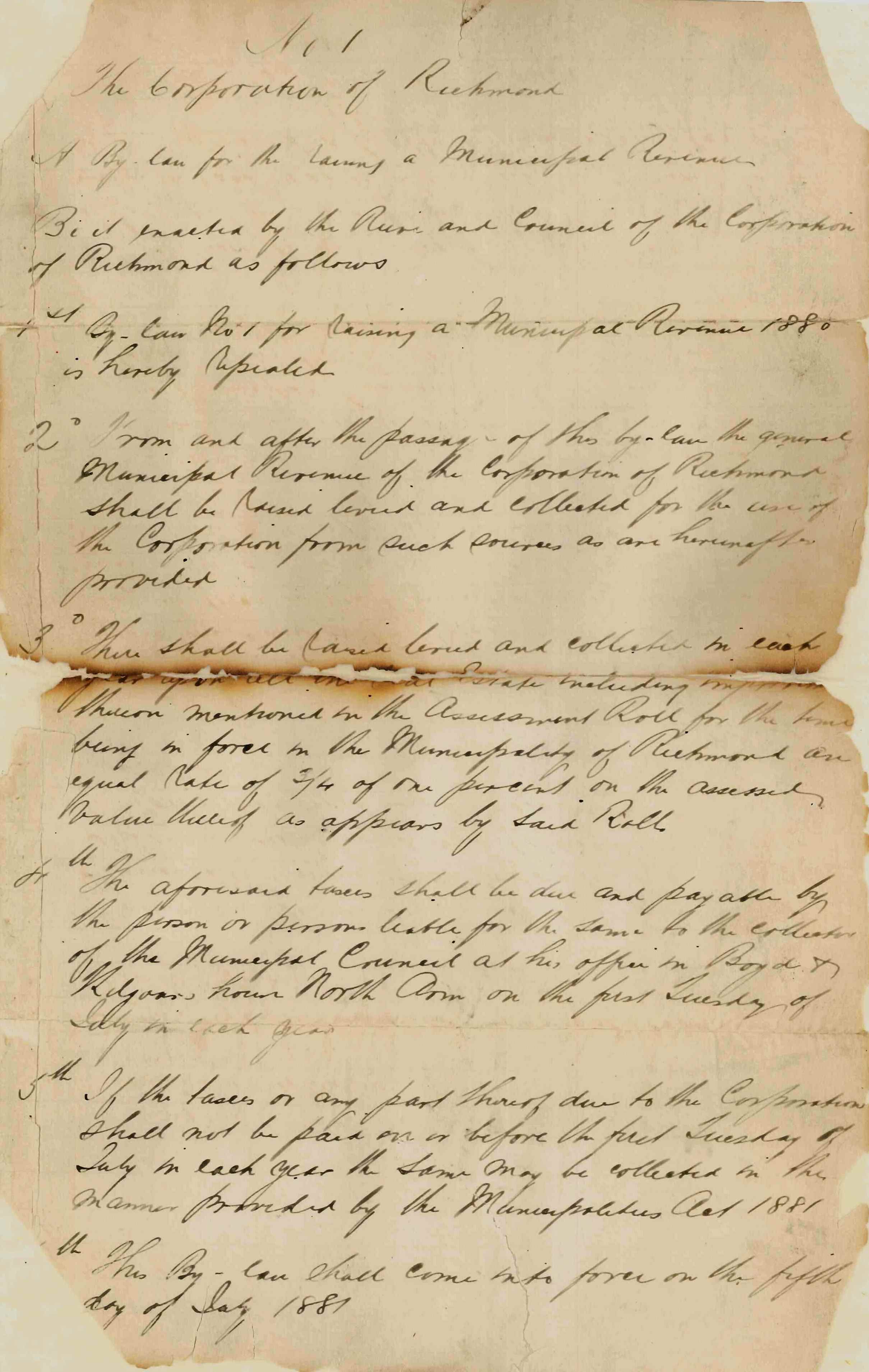
Bylaw 1 of 1881 - Bylaw to raise municipal revenue.

Bylaw 1 of 1881 – Bylaw “for the raising a Municipal Revenue.” (Note: document damaged in 1913 fire which destroyed Richmond’s first Town Hall.) City of Richmond Archives Bylaws

The City of Richmond Archives holds records of these activities carried out in Richmond dating back to the earliest years of the municipality. These include property assessment and the preparation of assessment and local improvement tax rolls, the collection of taxes, tax sales, and the hearing of taxpayer appeals.

Page from municipal Tax Ledger, 1887. City of Richmond Archives Tax Ledgers

Page from municipal Tax Ledger, 1887. City of Richmond Archives Financial Ledgers

The municipality was responsible for tax assessments until 1974 when the BC Assessment Authority was established. Tax assessment and collection rolls dating from 1905 are available on microfilm for research at the Archives.  From 1896 to1974 a Court of Revision for assessments sat to hear appeals from property owners. The Archives holds original minutes of these meetings.

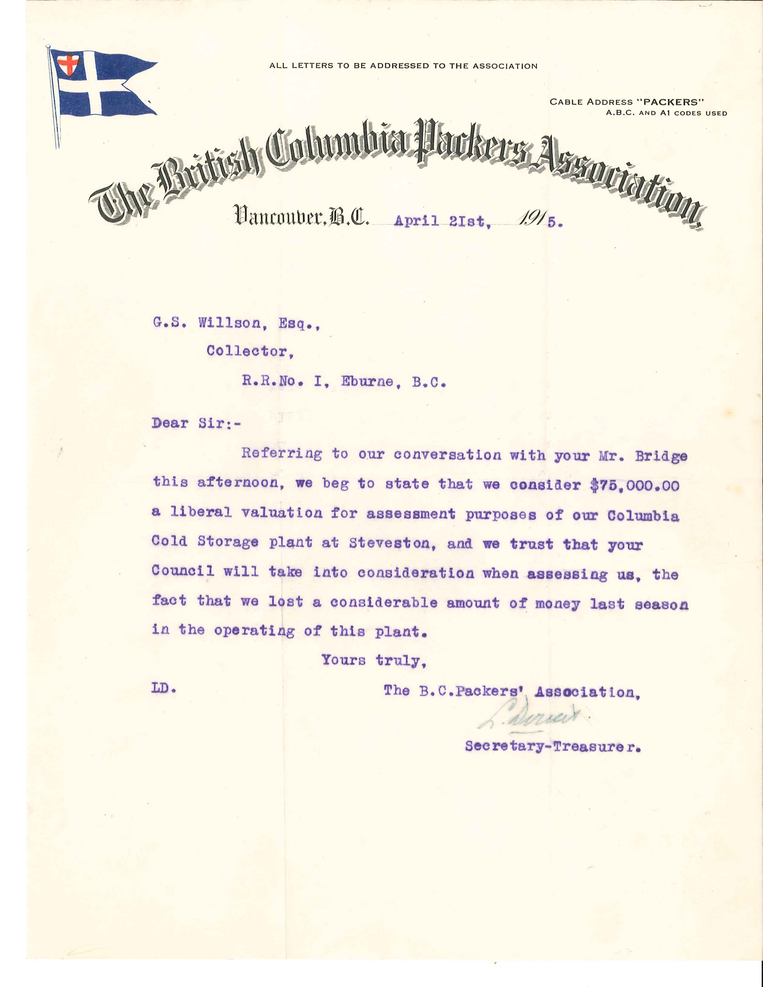
Letter from the BC Packers Association requesting change in tax assessment.

Letter from the BC Packers Association requesting change in tax assessment, 1915. City of Richmond Archives MR 2, File 5

Other records relating to taxation in the Archives’ holdings include early ledgers recording the collection of taxes and delinquencies, early Clerk’s Department correspondence files, files relating to tax sales and taxation policy, and photographs of buildings taken by the municipal Assessor.

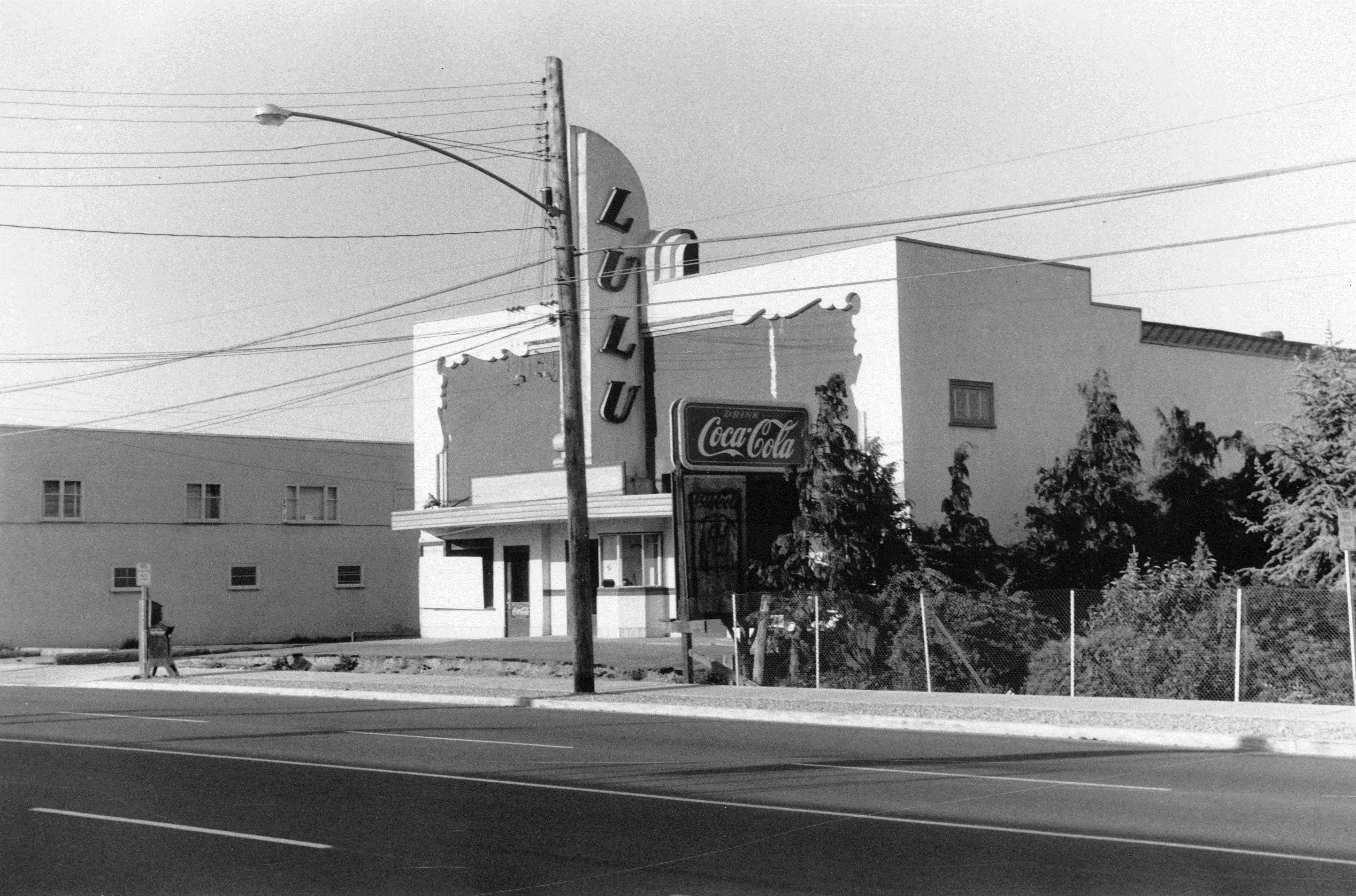
Assessor's photograph of Lulu Theatre, 1958. City of Richmond Archives Photograph 1988 18 31

Assessor’s photograph of Lulu Theatre, 1958. City of Richmond Archives Photograph 1988 18 31

[Note – this is an updated version of an article first published in the Spring 2013 issue of the Archives News]

Traffic Congestion in Richmond – Bumper-to-Bumper Through the Years

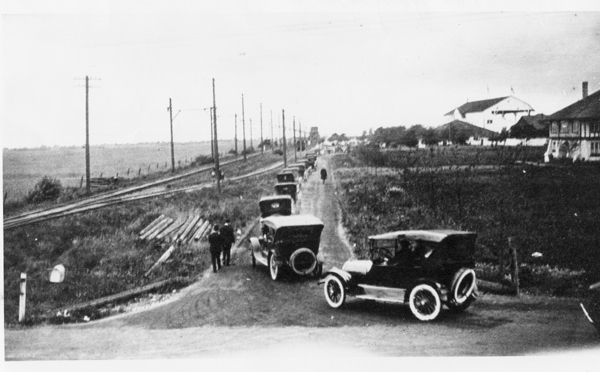
Traffic congestion has been a major topic of conversation among Richmondites from the early age of motor cars to the present day.

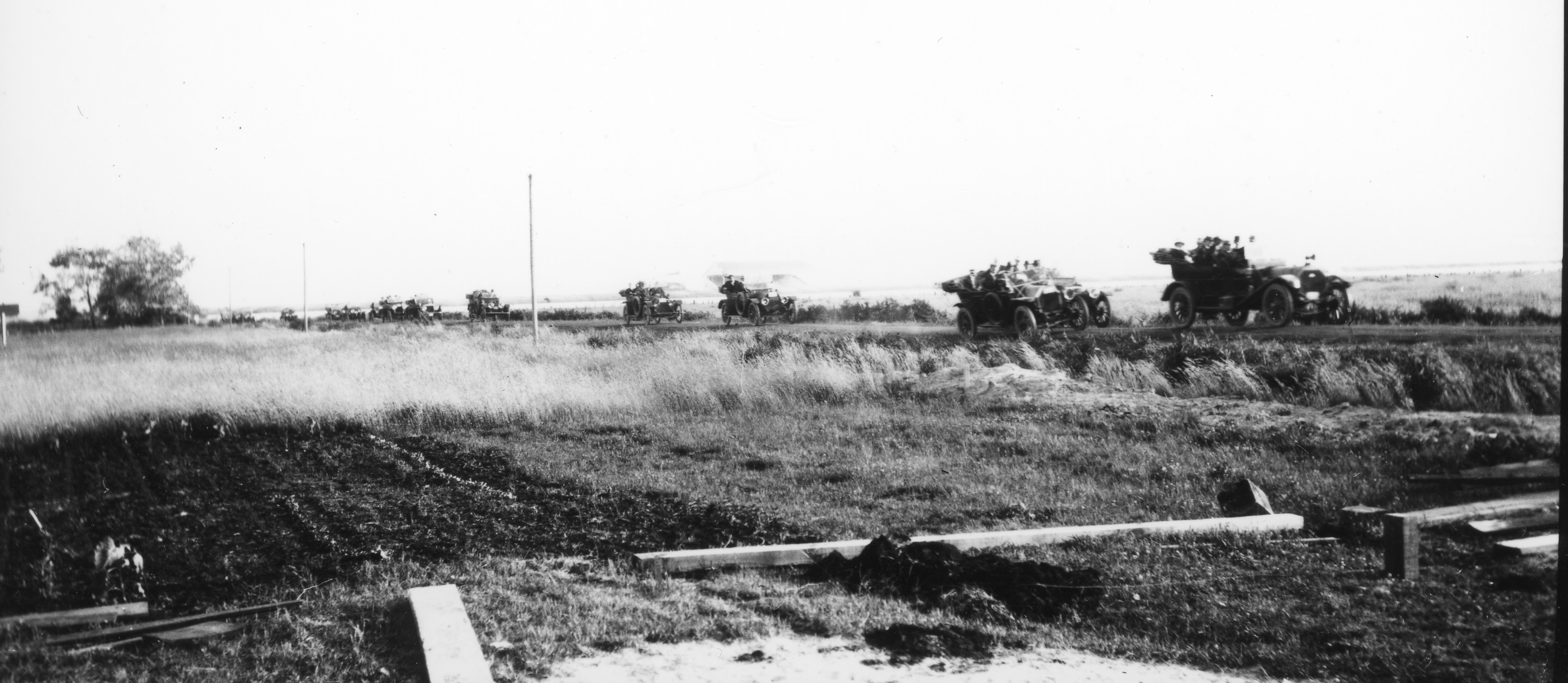
1988 95 1

Traffic on No. 3 Road, as viewed from the Ackroyd farm, ca. 1915. City of Richmond Archives Photograph 1988 95 1

Roads like No. 3 Road have always been problematic for traffic, witness Council minutes and resolutions like this: “Decision to place Danger Signs near the corner (curve) at the end of No. 3 Road on the River Road owing to two bad curves and congested traffic.” (June 25, 1923)

Traffic at Brighouse Park Race Track, 1921. City of Richmond Archives Photograph 1978 13 5

Traffic at Brighouse Park Race Track, 1921. City of Richmond Archives Photograph 1978 13 5

Special celebrations and events have always caused traffic congestion and parking problems.  From sporting events and May Day celebrations to horse racing fixtures at the two Richmond thoroughbred tracks, travel often meant long line ups and delays.

Line-up for the Ladner ferry on No. 5 Road, 1947. City of Richmond Archives Photograph 1997 16 19

Line-up for the Ladner ferry on No. 5 Road, 1947. City of Richmond Archives Photograph 1997 16 19

Richmond’s geographic location on islands in the Fraser River has always posed problems for traffic at river crossings.

Whether it be the ferry to Ladner or crossing the old Marpole and Fraser Street Bridges, bumper-to-bumper traffic was a normal component of a commuter’s day.

Bumper-to-bumper traffic on the Sea Island side of the Marpole Bridge, 1955. City of Richmond Archives Photograph 1997 42 3 145

Traffic congestion on the Sea Island side of the Marpole Bridge, 1955. City of Richmond Archives Photograph 1997 42 3 145

Here’s an account by Grant Thompson of the Sea Island Heritage Society of the problem of crossing the Marpole Bridge at rush hour in the 1950s:

“One of the results of these traffic jams was that both Lancaster Cres. and Catalina Cres. were turned into one-way streets south bound. During rush hour many drivers would race north down either street and then try to cut back onto Miller in the case of Catalina or back onto “Airport Highway” at the north end of Lancaster. Barricades blocked access to Miller Road at Wellington Cres. and at the lane on the east side of Sea Island School. Add to this the traffic from the Airforce Base on Miller Road and the traffic from Cora Brown on Grauer Road turning left onto the Bridge and you had one big mess coming from Sea Island.  Also contributing to this back up was traffic heading to the Lansdowne Race Track which backed up in old Marpole and also the traffic making a left turn cutting across the Air Port Highway to use the Bridgeport bridge and traffic coming from the west from Lulu Island merging onto the Marpole Bridge in front of Grauer’s store. Add to this the opening of the Marpole Bridge for boat traffic which happened often depending on which way the tide in the river was going. It was quite often 8 o’clock in the evening before the traffic eased off. The odd configuration of the street intersection didn’t help matters in Marpole. During these back-ups there were two Vancouver policemen detailed to directing traffic in Marpole. The parking lot at the ANAF club was always full; people would stop and have a few beer and wait out the rush hour. In fact it was much faster to walk the mile from Burkeville, go to the show at the Marpole Theater and catch the bus home after the movie. The Fraser Bridge was not much better as it also backed up for many of the same reasons.”

Construction tie-ups on No. 3 Road, 1985. City of Richmond Archives - Richmond Review Photograph 1988 121 - August 21 1985.

Construction tie-ups on No. 3 Road, 1985. City of Richmond Archives – Richmond Review Photograph 1988 121 – August 21 1985.

Modern transportation and traffic planning and the return of commuter rail to Richmond with the Canada Line have alleviated some of the earlier traffic nightmares.  Traffic congestion and its associated problems, however, still remain a major challenge for Richmond and other municipalities in the Lower Mainland.


Focus on the Record – Records of Heritage Preservation

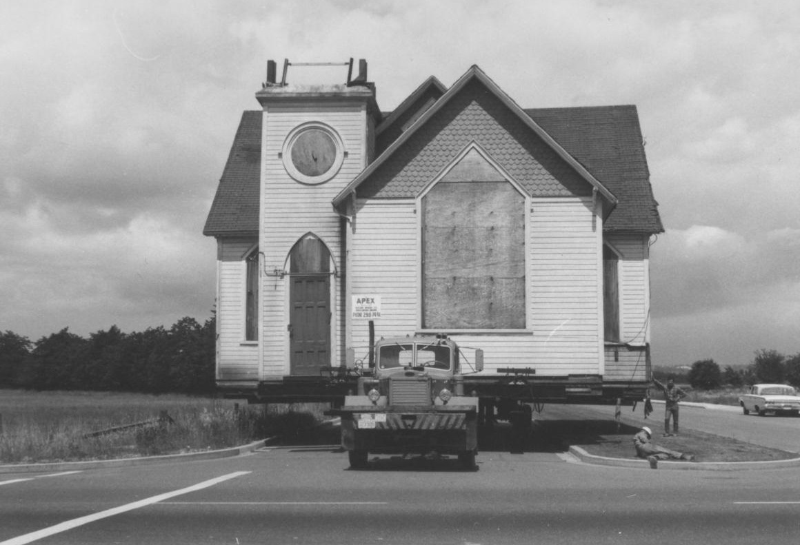
Since 1961 when the Historical and Museum Advisory Committee was formed, Richmond’s municipal government has been involved in identifying and preserving heritage sites in the community.

The old Richmond United/Methodist Church building being moved to Minoru Park, 1967. City of Richmond Archives Photograph 1989 33 1

The old Richmond United/Methodist Church building being moved to Minoru Park, 1967. City of Richmond Archives Photograph 1989 33 1

One of the first major heritage projects undertaken was in 1967, when the original Richmond United/Methodist Church building at the corner of River Road and Cambie was purchased by the municipality, moved to Minoru Park and renamed Minoru Chapel.

Steveston Museum and Post Office (formerly Royal Bank / Northern Bank) during restoration, 1980. City of Richmond Archives Photograph 1997 42 1 125

Steveston Museum and Post Office (formerly Royal Bank / Northern Bank) during restoration, 1980. City of Richmond Archives Photograph 1997 42 1 125


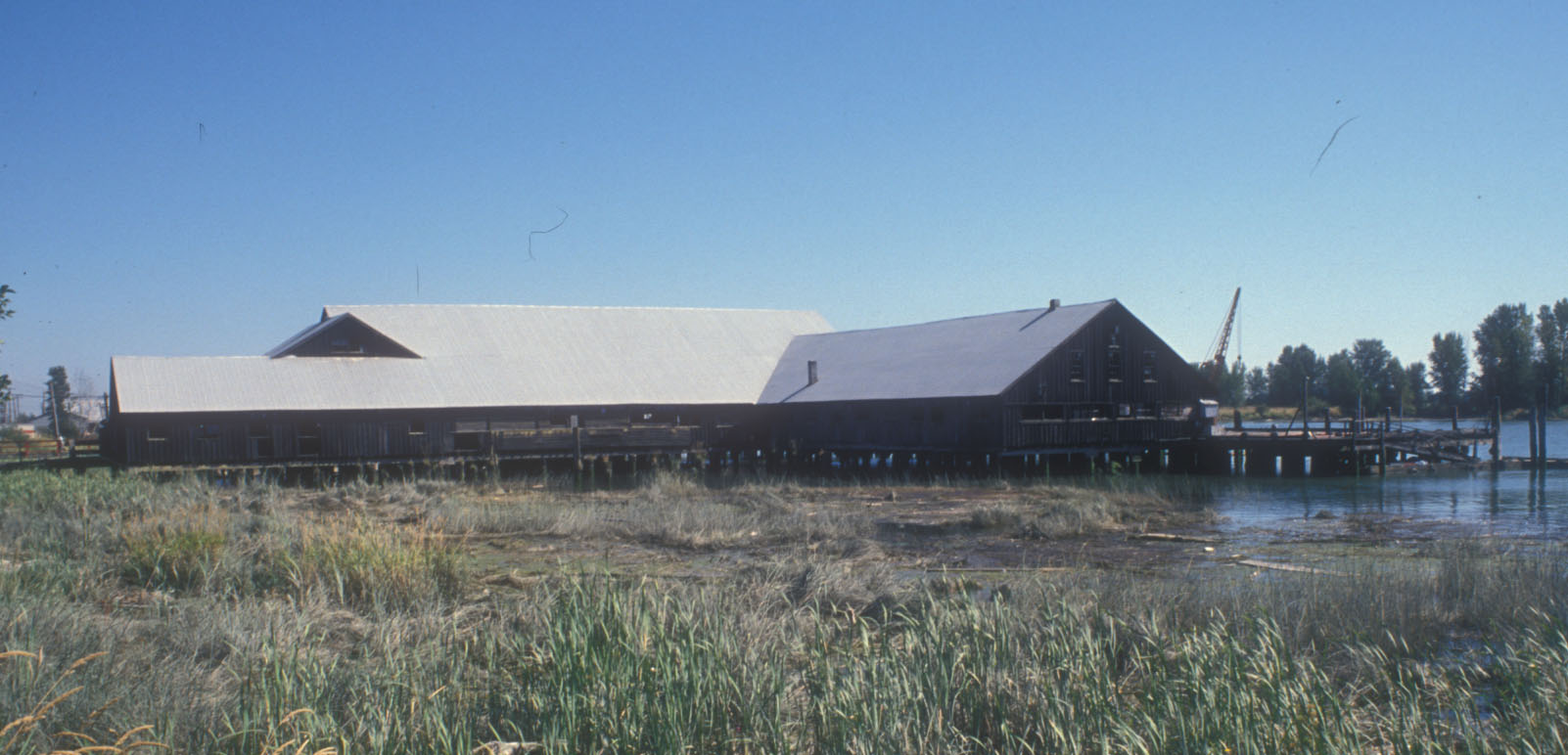
The acquisition and restoration of heritage buildings by the municipality continued in the 1970s and 1980s, with the Royal Bank (originally Northern Bank) in Steveston, London Farm, and the Britannia Shipyard being the most notable during this time.

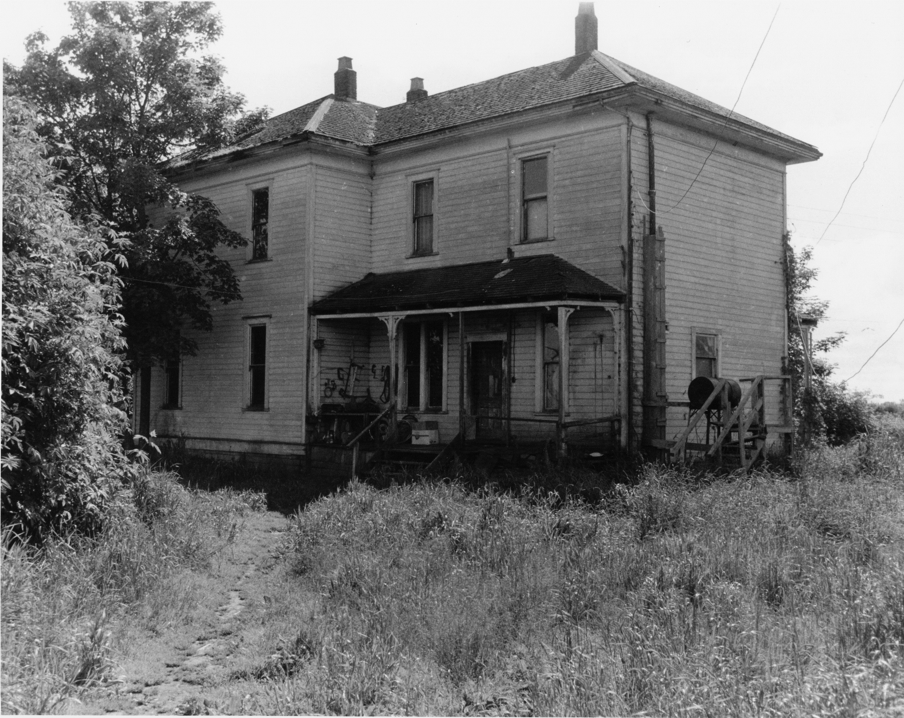
London Farm before restoration, 1977. City of Richmond Archives Photograph 1985 187 7

London Farm before restoration, 1977. City of Richmond Archives Photograph 1985 187 7

Britannia Shipyard area, 1988. City of Richmond Archives, Heritage Advisory Committee, File 2-1-3

Britannia Shipyard area, 1988. City of Richmond Archives, Heritage Advisory Committee, File 2-1-3

Other important heritage preservation activities included the establishment of the Steveston Heritage Conservation Area and the development and preservation of Garry Point Park and Scotch Pond.

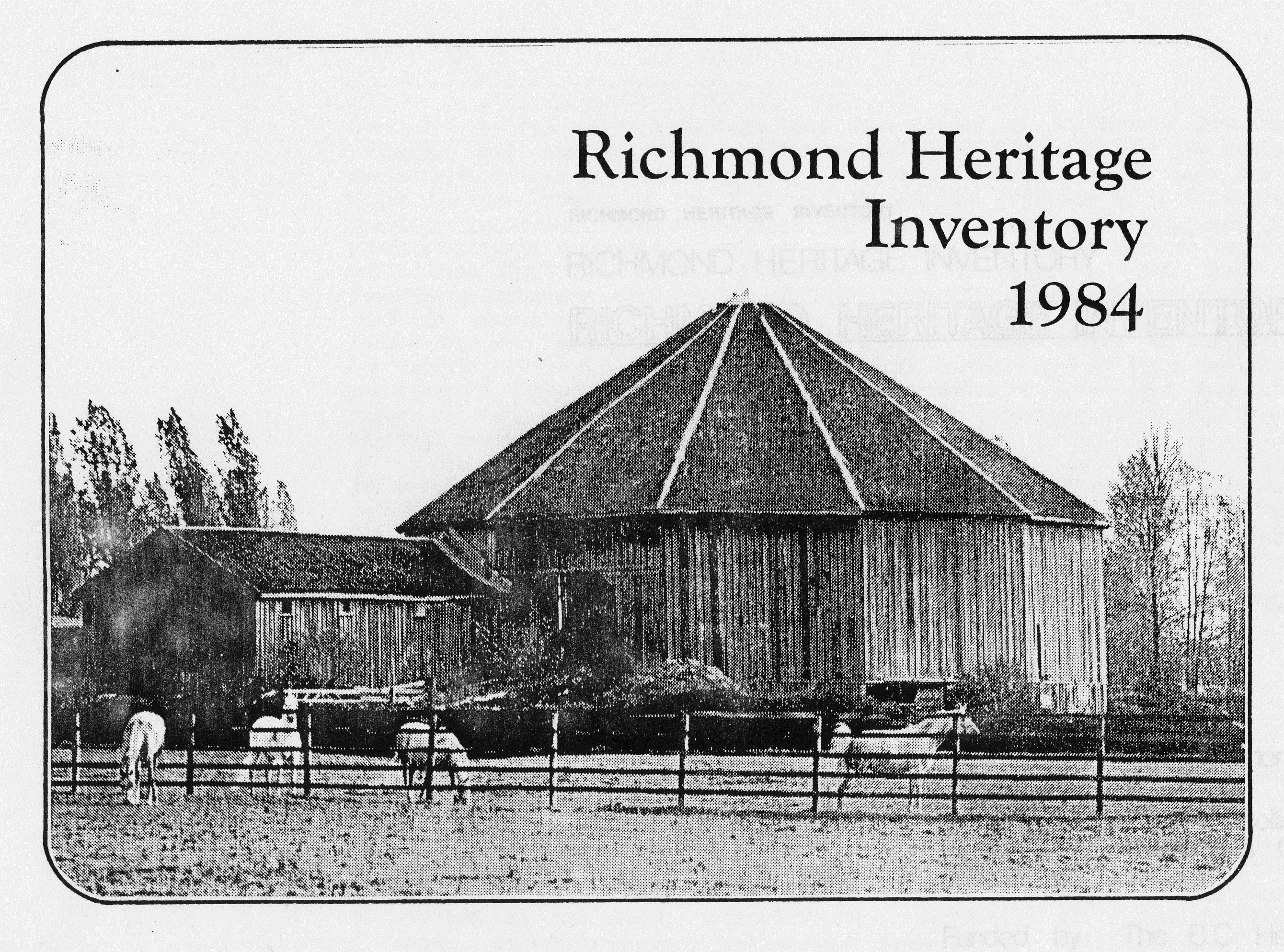
Cover of the first Heritage Inventory for Richmond, 1984. City of Richmond Archives GP 34

Cover of the first Heritage Inventory for Richmond, 1984. City of Richmond Archives GP 34

The establishment of a Heritage Advisory Committee by the municipality in 1984 marked the beginning of a formalized program for heritage preservation. That committee, later reconstituted as the Richmond Heritage Commission, conducted a number of important heritage studies, not the least of which was a formal Heritage Inventory for Richmond. The first inventory was published in 1984 and several updates have been made since.

The City of Richmond Archives has comprehensive records documenting heritage preservation activities in the community, dating back to the records of the Historical and Museum Advisory Committee and including minutes, research files, project files, studies and reports of the Heritage Advisory Committee/Heritage Commission. In addition, records of the Engineering Department and the Leisure Services Department document restoration, maintenance and programming activities at municipally-owned heritage sites. Records of the Planning Department, Law Department and Clerk’s Office provide an accurate picture of the process by which heritage properties were acquired, and how policies relating to non-City owned property of heritage significance have developed.

[Note – this is an updated version of an article first published in the Fall 2014 issue of the Archives News]