
In the early days of navigation, mariners depended heavily on knowledge of landmarks and geographical features to find their way. This was especially true when entering harbours and river mouths. Early navigational charts showed important physical features that would be visible to mariners, and at the mouth of the Fraser River one of the most important of these was “The Leading Tree”, a large tree at Garry Point which stood out starkly on the otherwise featureless landscape of Lulu Island.

This view of Steveston’s “Cannery Row” shows a rare image of the Leading Tree at Garry Point, on the left, ca. 1890. Photo from City of Richmond Archives digital reference files.
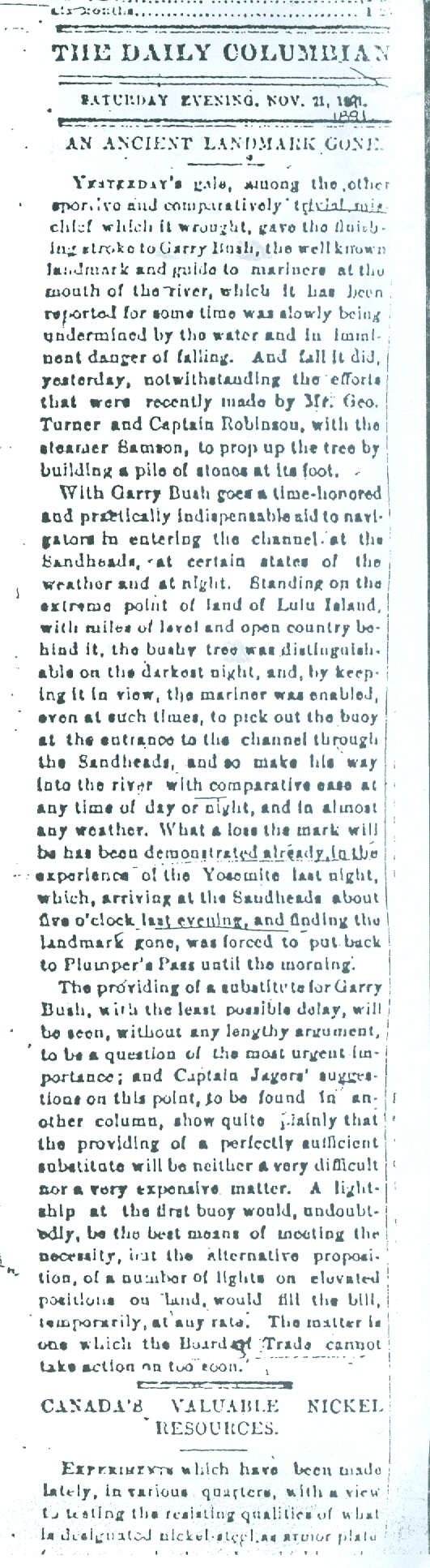
Article from the New Westminster Daily Columbian, November 21, 1891. (City of Richmond Archives Reference Files.)
The Fraser was first charted in 1859 by Captain G.H. Richards, who also had a series of navigation buoys anchored to mark the river channel.
On his chart the tree was featured as a navigational marker and it subsequently appeared in future Admiralty charts and sailing directions for decades to come.
The tree was called by several names, the Leading Tree, the Lone Tree, the Garry Tree and the Garry Bush and was either a spruce, pine or fir, depending on which record is read. Regardless, it was a vital guide in making one’s way into the river, even for experienced local mariners.
Improvements in navigating the river continued, with the availability of river pilots and installation of lightships and lighthouses at the Sand Heads, but the tree continued to be a navigation aid until 1891 when newspaper reports in the May 30, 1891 Daily Columbian raised concerns about the tree’s future, saying that “Mr. Turner (George Turner, formerly of the Royal Engineers) had two mattresses sunk at Garry Bush to try and save it from being carried away. Garry Bush, a well known land mark to mariners, is a tall pine tree with some wild crab apple trees growing about, on the lower end of Lulu Island.”
The article states that in the previous three years 400 to 600 feet of shoreline had been washed away and that the roots of the tree had become undermined. A later article from November 21, 1891, titled “An Ancient Landmark Gone” stated that despite efforts to save the tree, it had been washed away in a gale on the 20th.
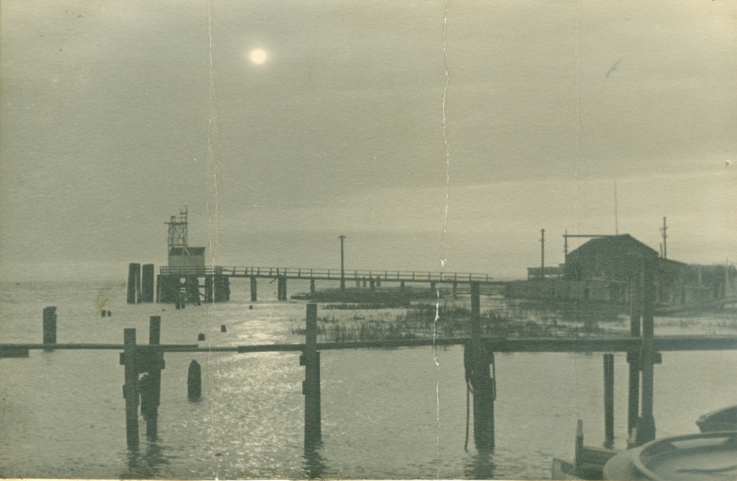
Gambles Observatory at Garry Point in 1909. Built as a tide gauge, a fixed red light was added to it after the tree was washed away. It was visible for six miles. (City of Richmond Archives photo 1978 34 3)
The loss of the tree prompted the authories to install a light at Garry Point, mounted atop Gamble’s Observatory, which had been built as a tide gauge by Provincial Government Public Works Engineer F.C. Gamble, the supervisor of dyking operations in the lower Fraser Valley.
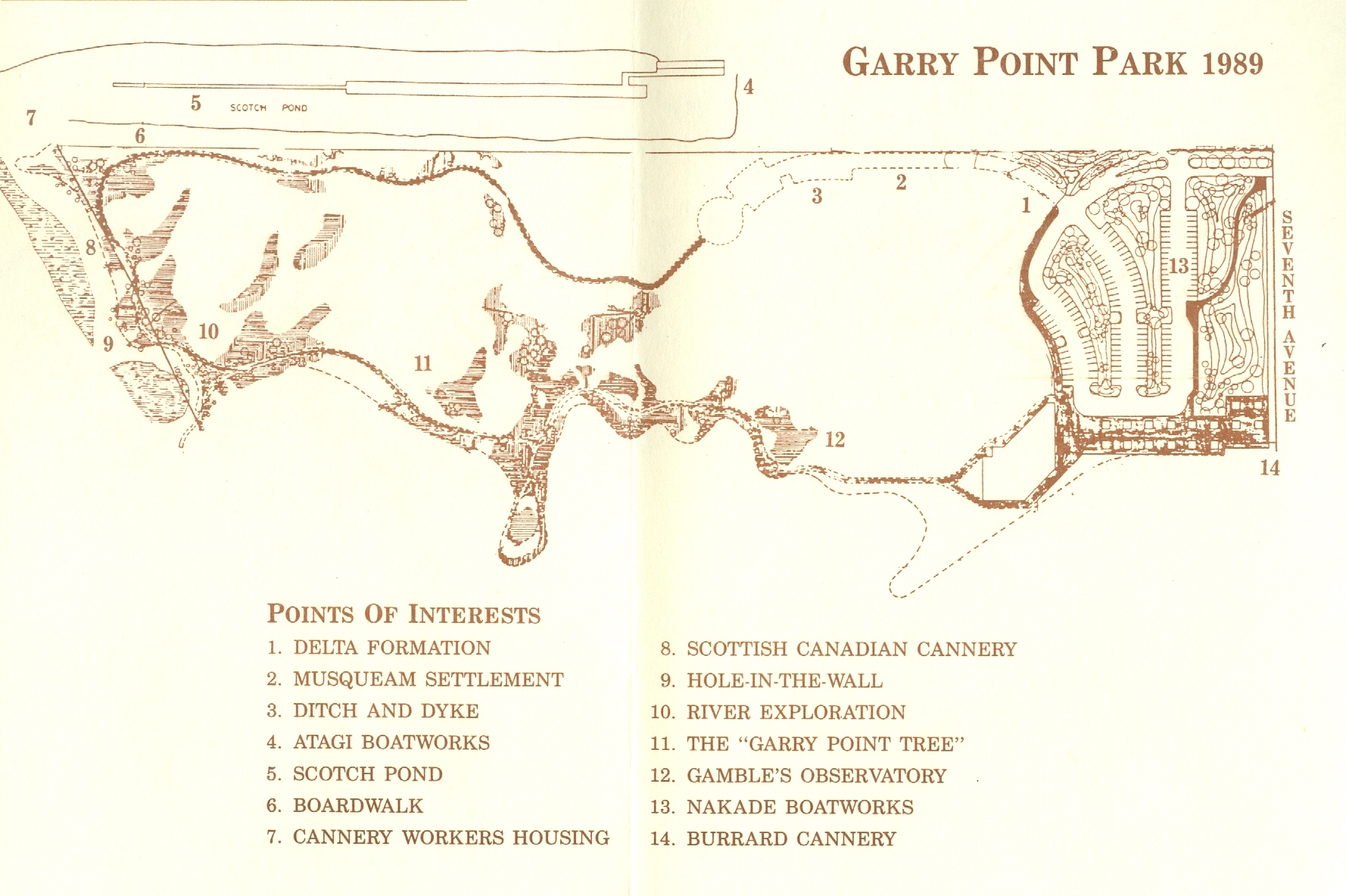
A walking tour map of Garry Point Park from 1989 shows significant locations around the park, including the location of the “Garry Point Tree”, No. 11, and Gamble’s Observatory, No. 12. (City of Richmond Archives Reference Files)
The construction of the Steveston Jetty in 1911 and a program of dredging have stabilized the shifting main channel and newer lights and navigation markers and buoys make the trip up the river much less risky than in the past, but all these modern aids to navigation have a heritage that stems back to a single large tree that grew at Garry Point.


You must be logged in to post a comment.