
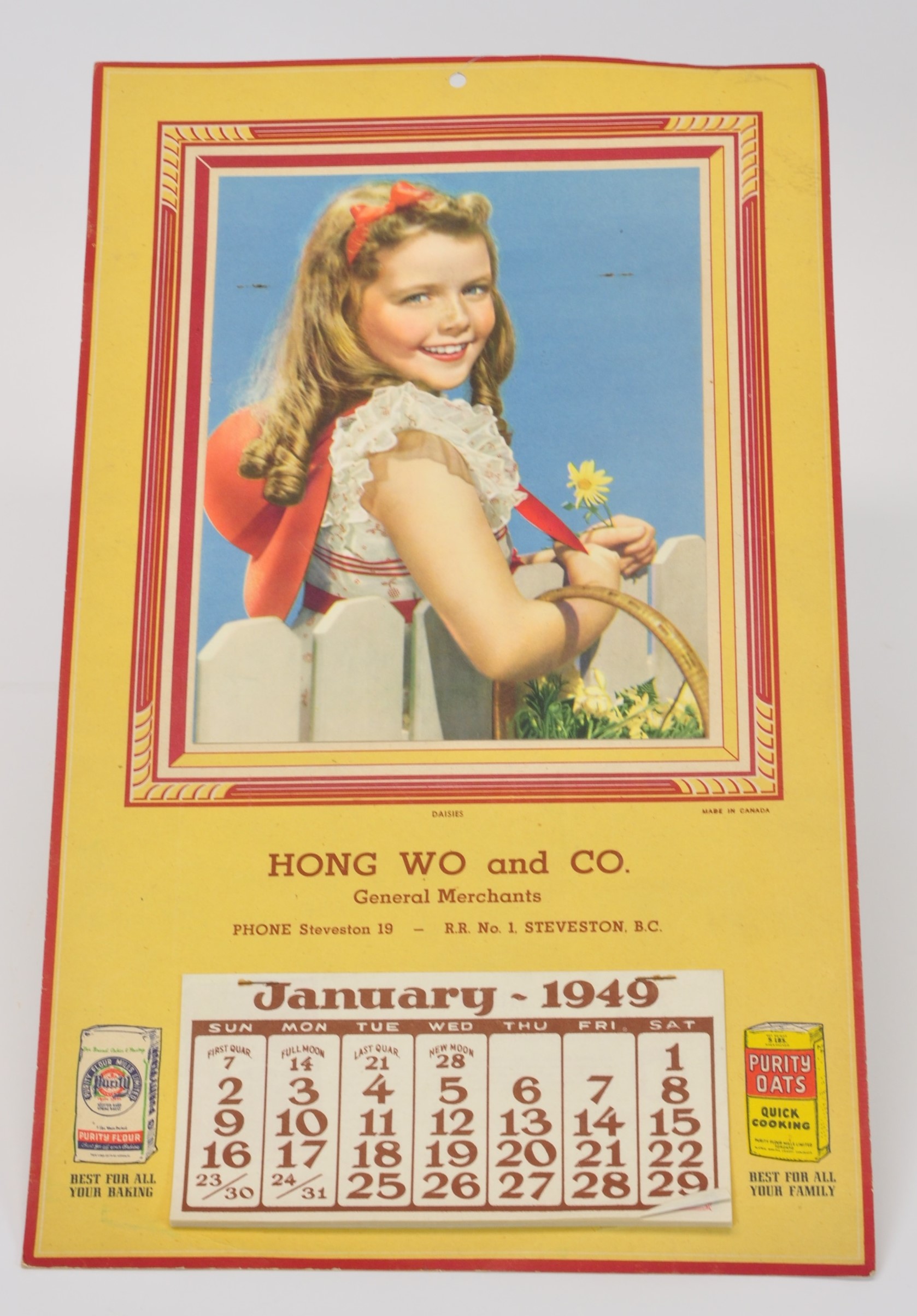
The salmon canning industry in Steveston is well known and documented, with several books written detailing the history of Steveston’s Cannery Row and the more than twenty canneries which were built along the one and one half mile waterfront of the South Arm of the Fraser River to its mouth. There was, however, a lesser known stretch of canneries in Richmond. These canneries along the Middle Arm of the Fraser, while being fewer and farther removed from the boom town of Steveston, provided work and accommodation for people working in the fishing industry. Here are some of their stories.
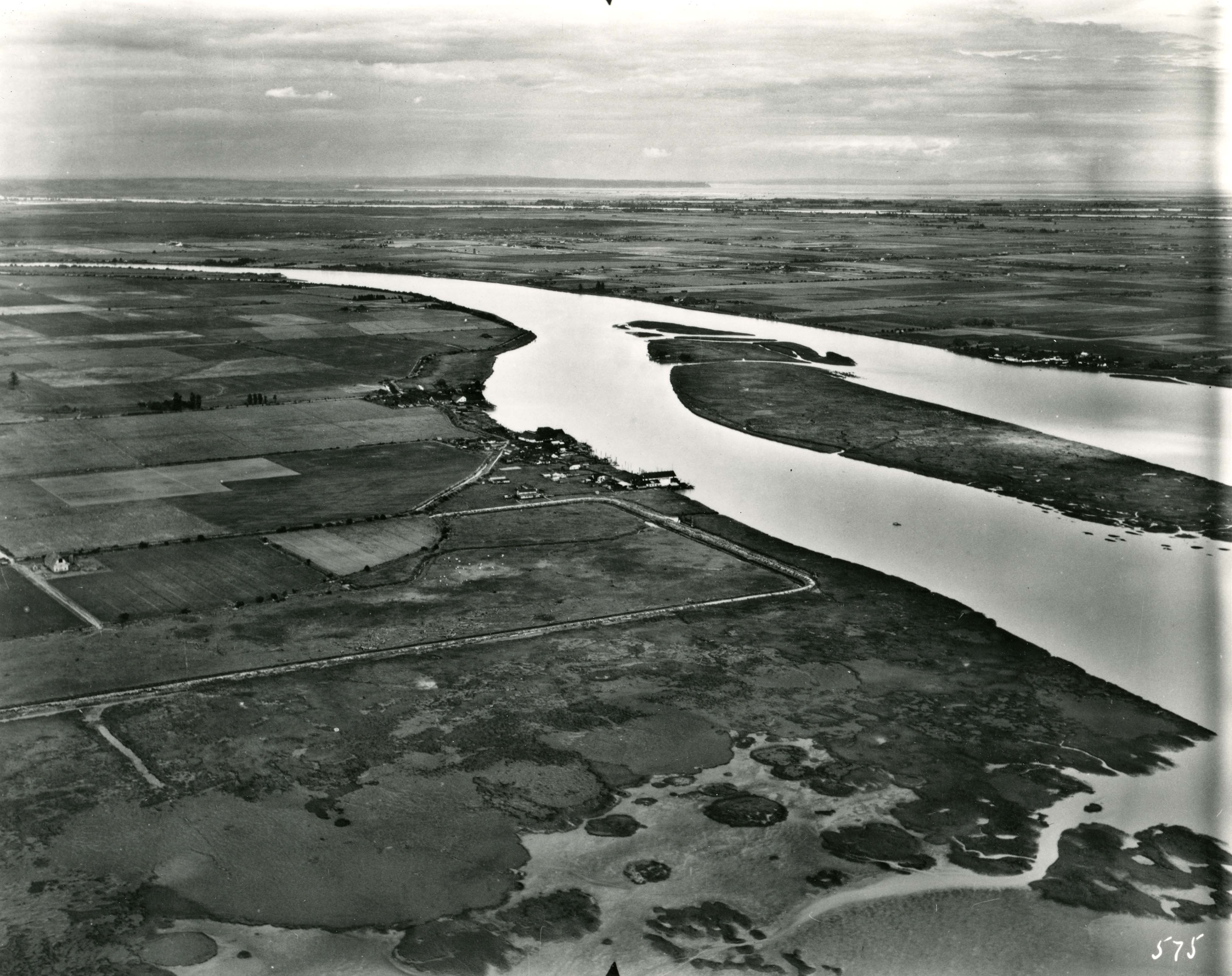
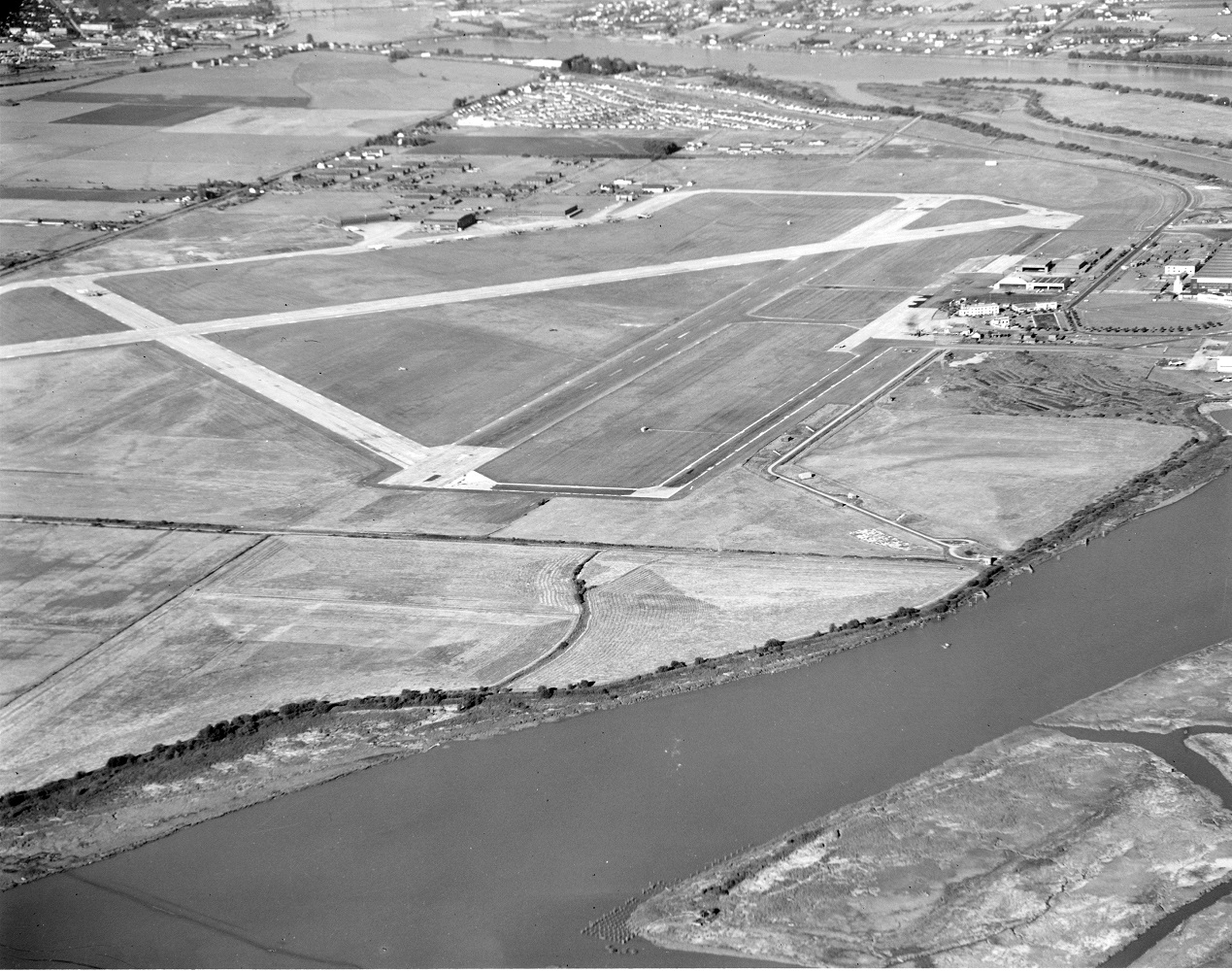
South-west Sea Island
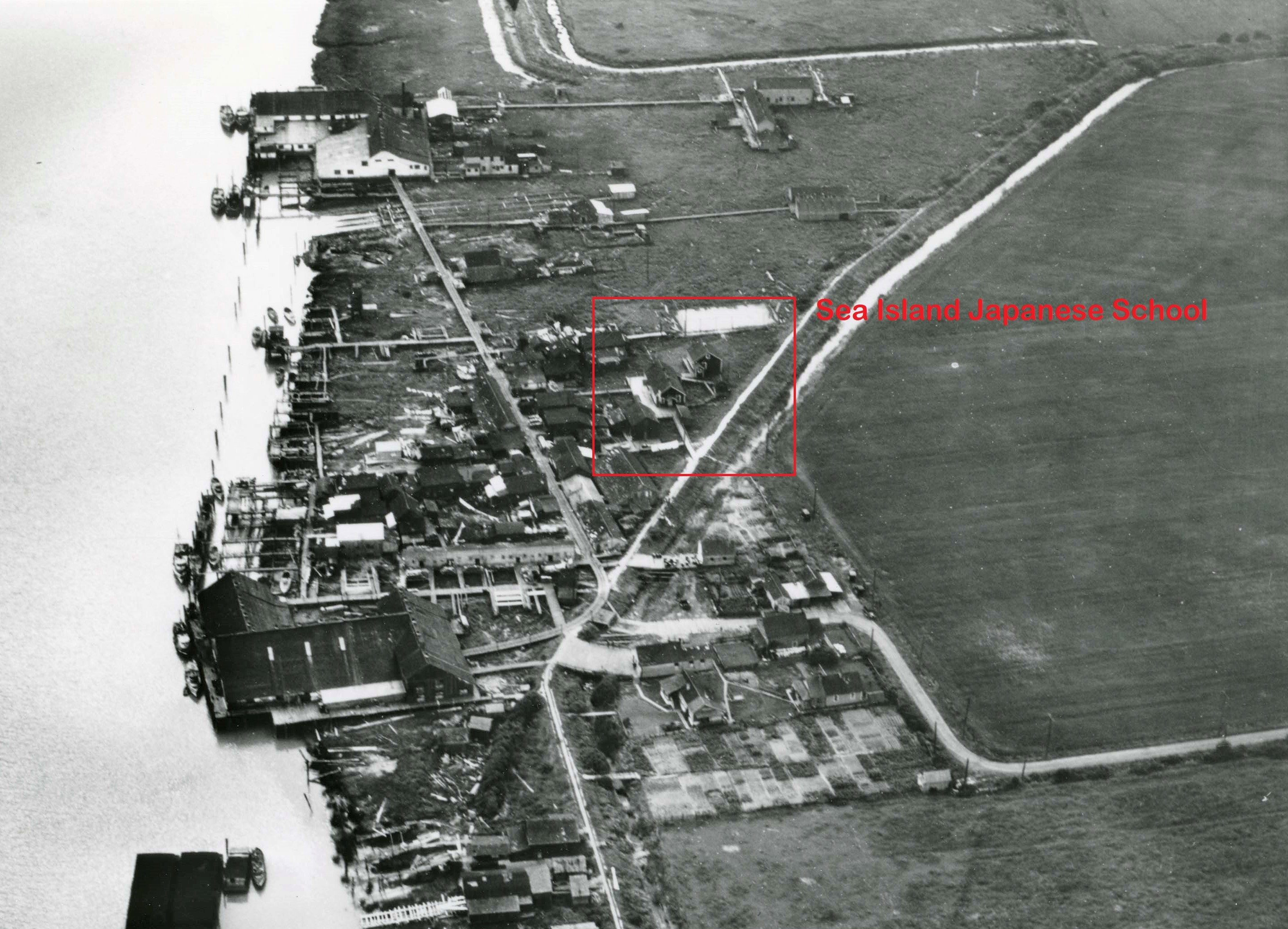
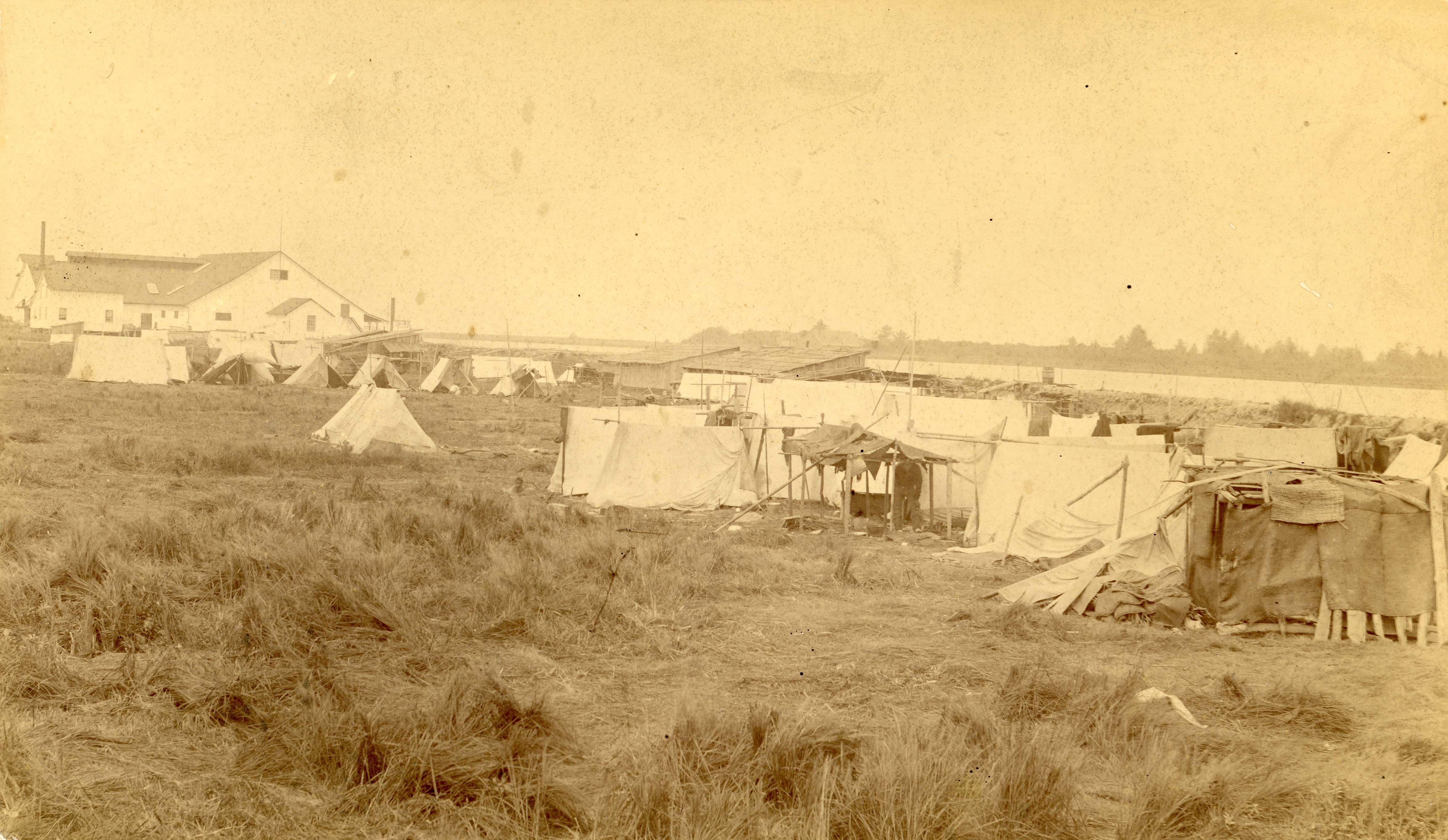
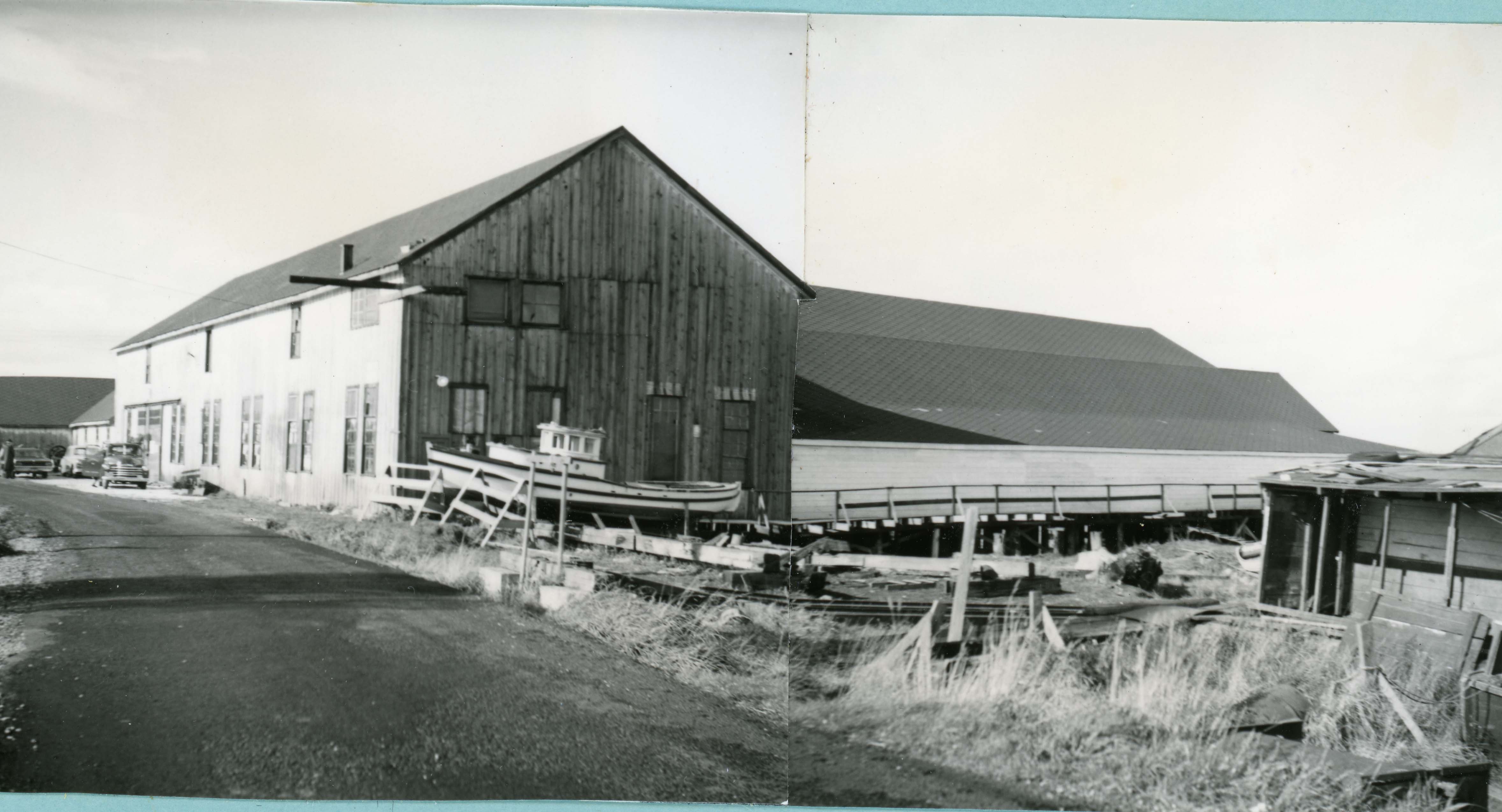
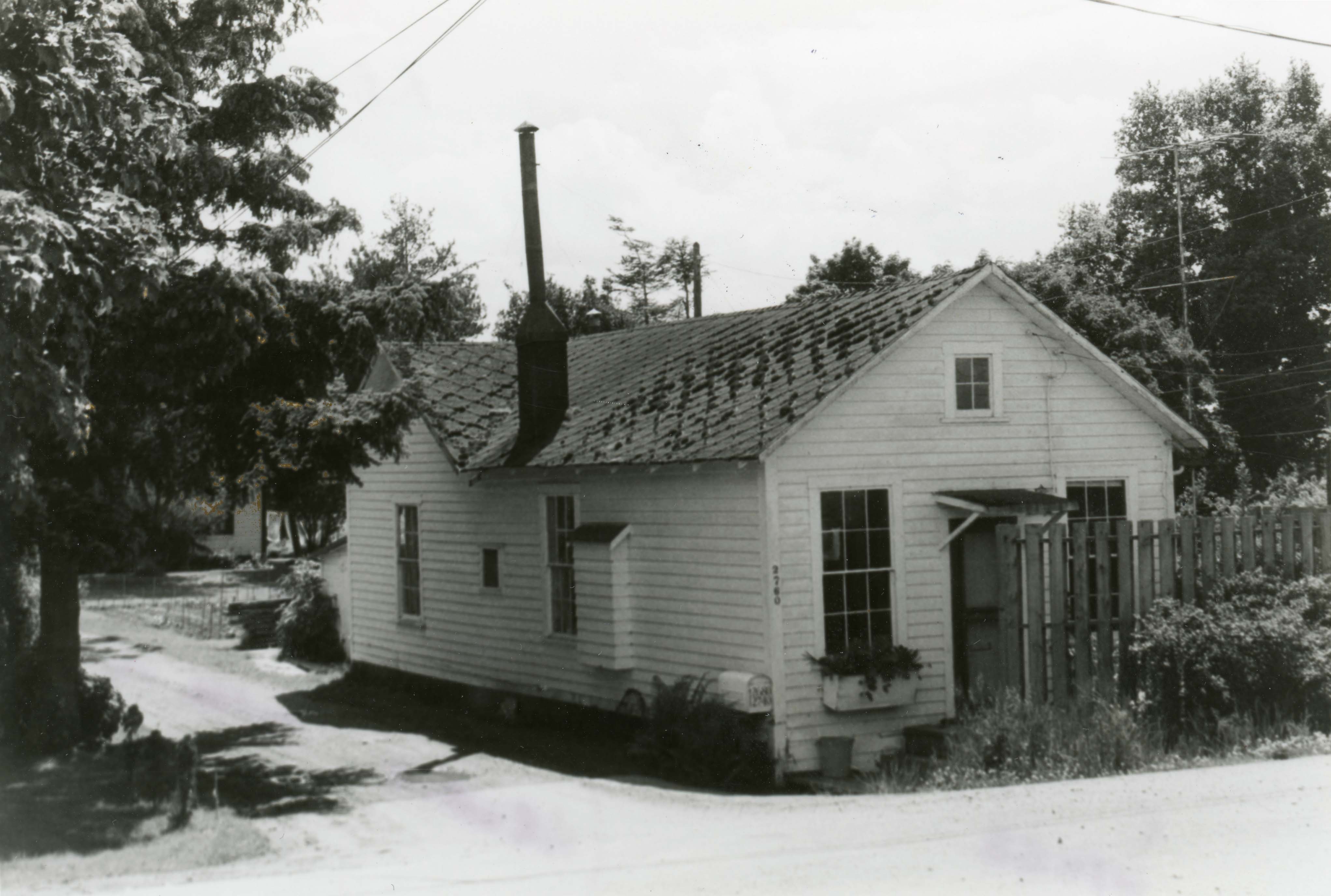
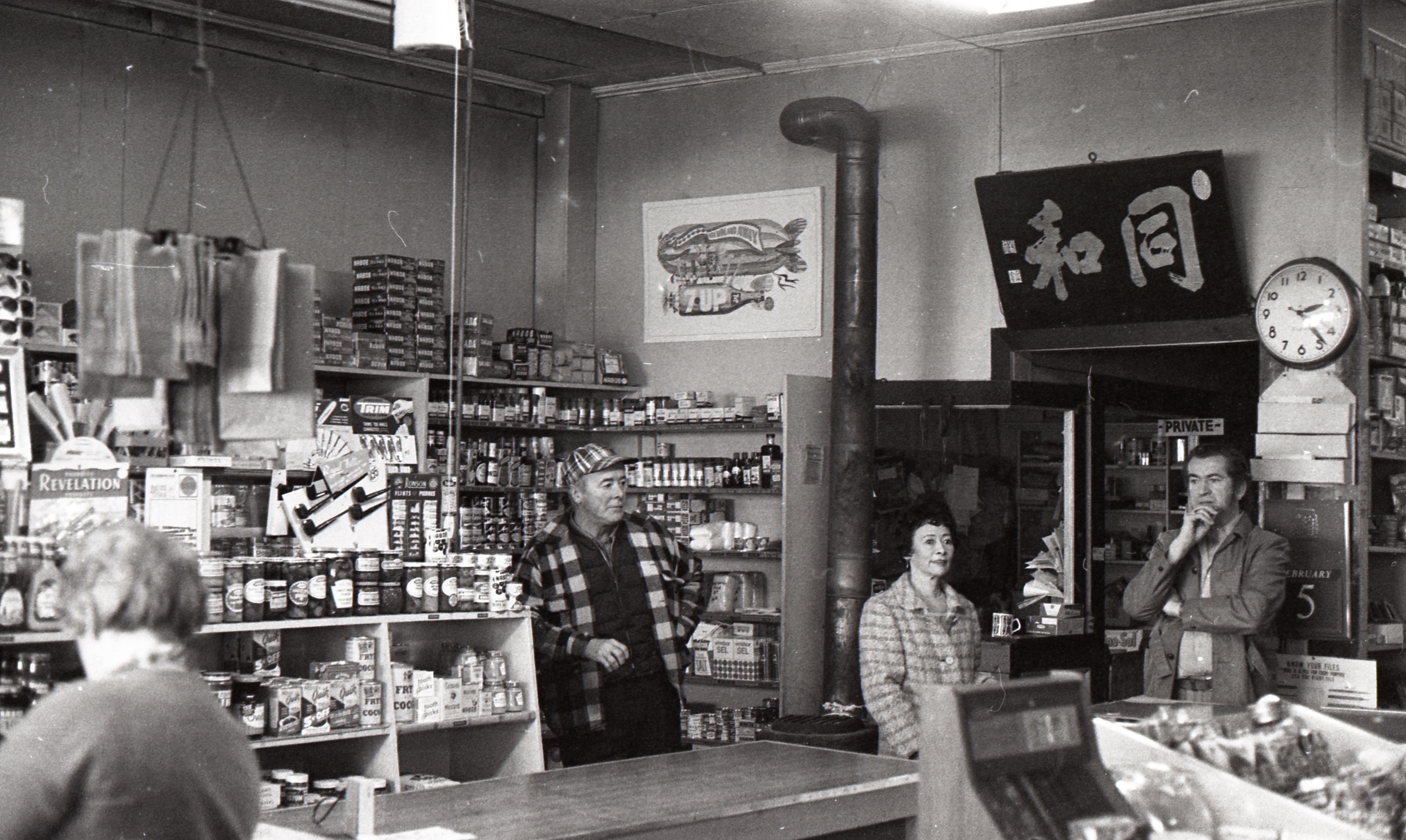
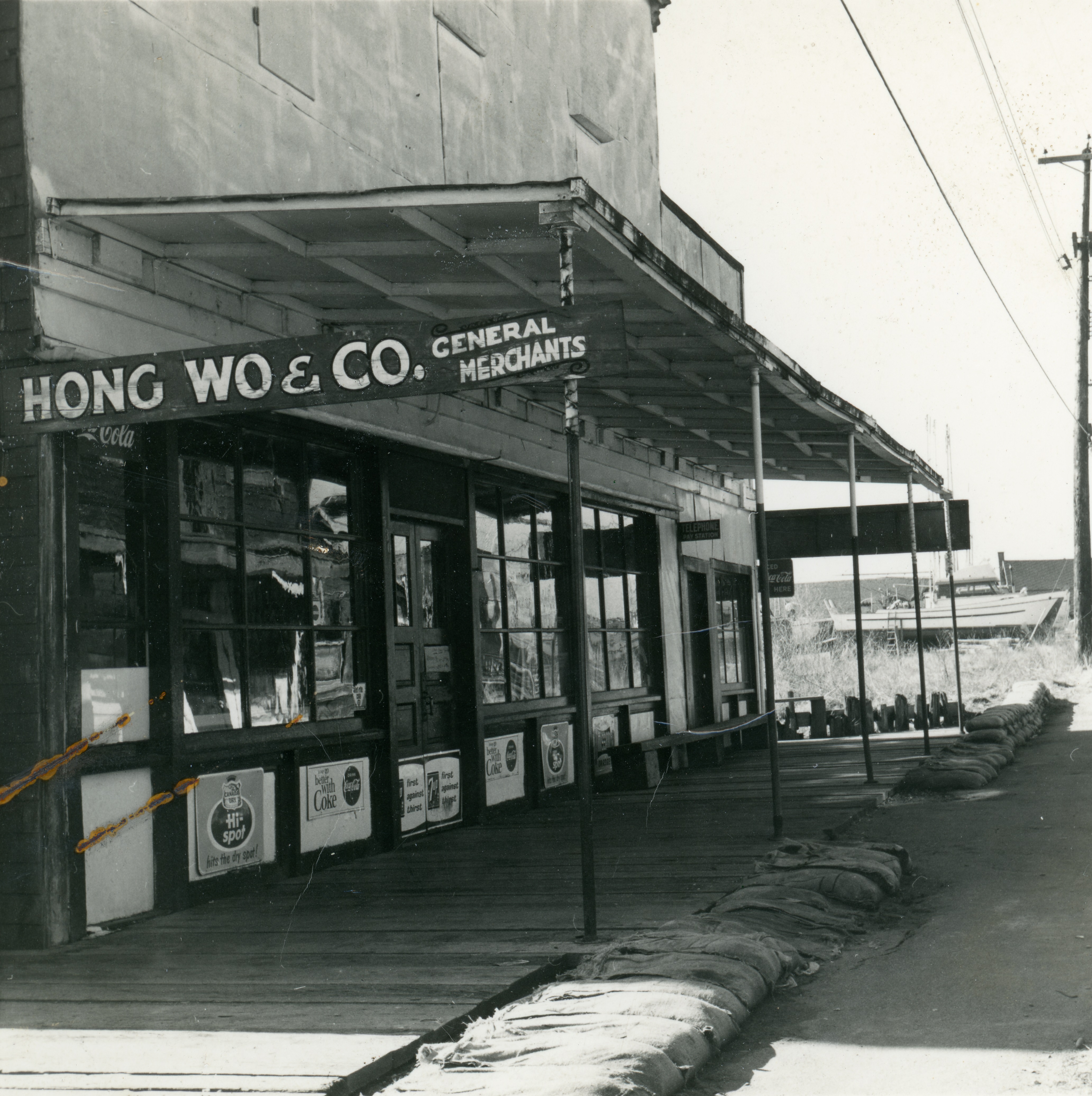
Three canneries stood along the south-west shore of Sea Island, and a fourth just across the channel from them. The Fraser River, Vancouver, Acme and Sea Island Canneries were all built in the 1890s. Company-owned housing for cannery workers, fishermen and their families was built along both sides of the dyke running through the cannery properties. Boarding houses for single migrant workers were provided and often temporary villages, built on the dyke close to the cannery, were established by seasonal Indigenous workers. This group of canneries became home to a large, tight knit community of mostly Japanese Canadian workers and fishermen who settled in the cannery housing and utilized the cannery docks and facilities even after salmon canning stopped in those locations. The Sea Island Japanese School, was established at Vancouver Cannery for the children of workers and resulting in community spirit, sports teams and social groups. Boat builders plied their trade and other industries connected to the fishing industry flourished. The forced relocation of Japanese Canadians in 1942 marked the end of the community and most of the buildings were razed.

Fraser River Cannery
The Fraser River Cannery was located on the south west shore of Sea Island and was the closest of the Middle Arm canneries to the mouth of the river. Built in 1896 or 1897 by McPherson & Hickey, the cannery had a sockeye pack of 3500 cases for 1898, according to a report by the Vancouver Province newspaper. It was sold to the Canadian Canning Company in 1899 and was then subsequently purchased by Gosse-Millerd Packing Company (Vancouver Cannery Limited) in 1914. The facility was equipped with machinery for manufacturing cans and was capable of supplying all five of the company’s plants, located at Sea Island, Rivers Inlet, Bella Bella, Skeena River and the west coast of Vancouver Island. Having been absorbed into Vancouver Cannery Limited, the Fraser River Cannery lost its separate identity, becoming part of the Vancouver Cannery complex.

Vancouver Cannery
The Vancouver Cannery was erected in 1896 by the Canadian Canning Company. It was purchased by Vancouver Cannery Limited in 1914, owned by R.C. Gosse and F. Millerd who had also purchased the Fraser River Cannery just to the west. It was subsequently owned by several incarnations of the Gosse – Millerd partnership until 1928 when it was absorbed into British Columbia Packers. The plant stopped operating as a cannery in 1930, but still existed as a fish camp for the Imperial Plant. The cannery equipment was dismantled in 1935-36.
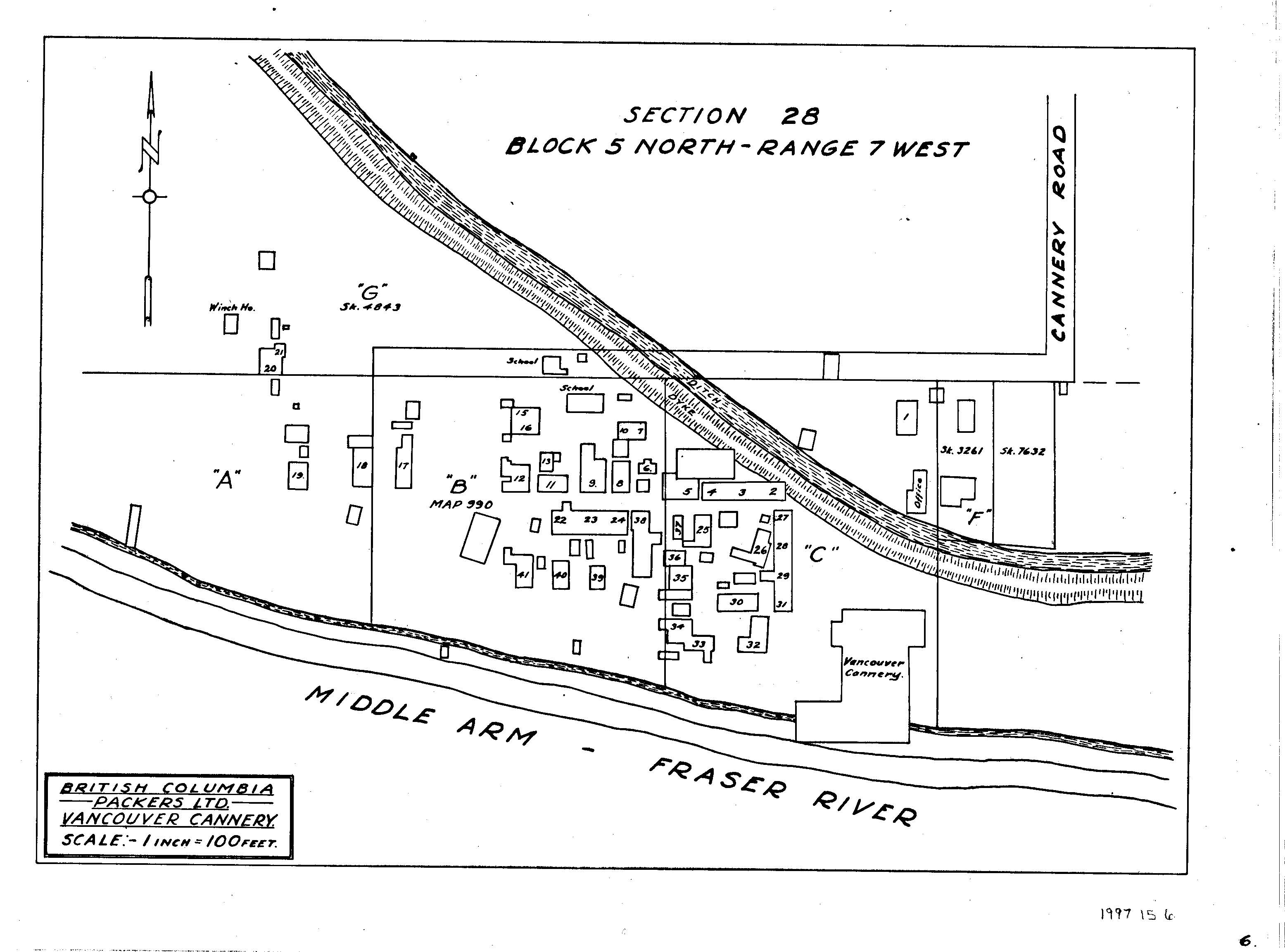

Acme Cannery
The Acme Cannery was erected in 1899 by the Acme Canning Company Limited, owned by Jane R. Cassidy and Allan Cameron. In 1902 it was purchased by the British Columbia Packers Association and subsequently by the British Columbia Fishing and Packing Company Ltd. (1914) and British Columbia Packers Ltd (1928) as the company reorganized. Acme operated as a cannery until 1918 when the machinery was removed from the plant. It operated as a Fraser River Camp for the Vancouver Cannery until 1930 and as a fish camp for the Imperial Cannery afterward. It was also the location of Thomas Goulding’s cork mill, the only commercial supplier of cedar fish net floats on the West Coast. In 1946 it was sold to D. Matheson.

Sea Island Cannery – Bon Accord
Little more than a large sandbar, Swishwash Island was the location of the Sea Island Cannery. Originally built by Alexander Ewen and D.J. Munn in 1890 as the Bon Accord Cannery, its name was changed to avoid confusion with a hatchery of the same name at Port Mann. By all accounts this was a successful cannery, employing 225 workers and held licenses for 18 boats. In its first year of operation it packed 18,225 cases of fish. In 1898 the sockeye pack alone was 8500 cases. The Sea Island Cannery operated profitably for ten years until 1899 when it was severely damaged in a fire. In December 1901 a huge storm and flood caused massive damage to the remaining structures. The property was acquired by BC Packers who abandoned it and sold it off in 1902.
North-west Lulu Island
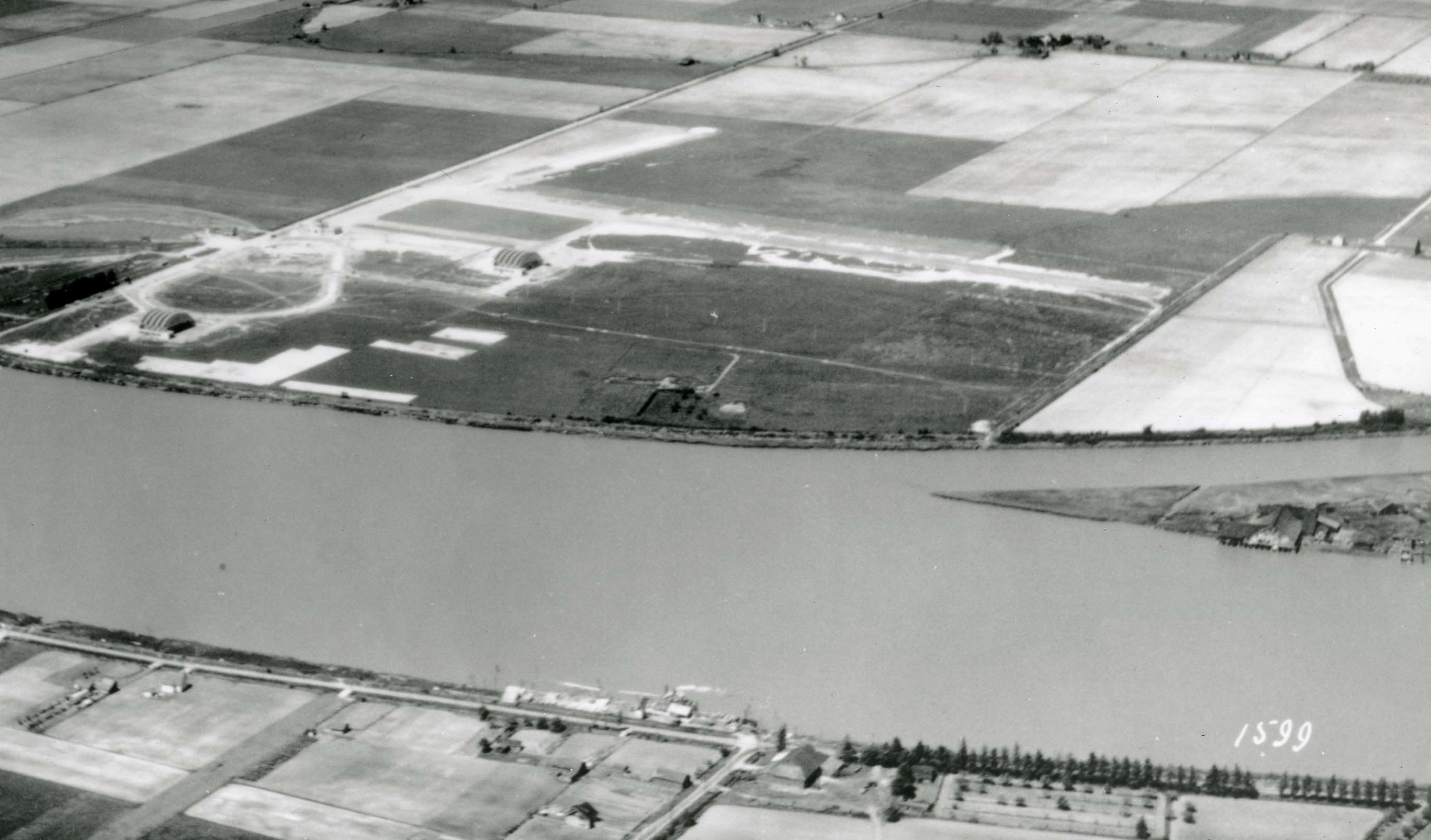
The north-west part of Lulu Island, known as Terra Nova, was home to three other canneries, the Labrador Cannery, the Alliance Cannery and the Terra Nova Cannery. All three of these canneries were subjected to the full force of a gale in December 1901 which caused a great deal of damage and, in one case, the complete destruction of the cannery.
Labrador Cannery
There is little information available about the Labrador Cannery. While listed as located at Terra Nova, its exact location and years of operation are not well documented. One of the smaller operations in Richmond, it reported a total pack of about 10,000 cases for the 1901 season. The Labrador Cannery was reported to have been completely destroyed in the early hours of December 26,1901, when gale force winds and extreme high tides breached the dykes along both sides of the North Arm and flooded large areas of Lulu and Sea Islands. The December 27, 1901 Vancouver Daily Province stated that, “The Labrador cannery at Terra Nova was entirely swept away.” “The buildings were smashed and piled up inside the dyke. Logs four feet thick which dashed against the buildings were also carried inside the dyke and leveled the embankment on the way. Nearly all the cannery boats were smashed and put out where dry land will appear when the tide goes out again.”
Alliance Cannery
Built in 1895 by R. Colquhoun’s Alliance Canning Company, the Alliance Cannery was sold to George Wilson in 1901. This cannery was severely damaged in the 1901 storm as well, although not so badly that it could not be restored. The water level rose enough to cover the floors of the cannery buildings, soaking the cans of salmon stored there but not ruining them. In 1902 the cannery was absorbed into the BC Packers Association, closed in 1903 and became part of the Terra Nova Cannery.
Terra Nova Cannery
The Terra Nova Cannery was built in 1892 by Duncan and John Rowan who formed the Terra Nova Canning Company. They operated the cannery until they sold to the BC Packers Association in 1902. During the December 1901 gale this cannery suffered less damage than the others at Terra Nova but the Japanese boarding house there collapsed trapping several men inside. They were rescued during the height of the storm by other workers and residents of the area with no loss of life. The cannery closed in 1928 but the buildings and docks continued to be used for net storage, moorage and as a fish camp for the Imperial Cannery. The cannery buildings were taken down in 1978.
The Eastern Middle Arm
The final three canneries were spread along the eastern part of the Middle Arm and into the North Arm, each on a different island.
Dinsmore Island Cannery
The Dinsmore Island Cannery was built on Dinsmore Island in 1894 by Richard E. Gosse for the Dinsmore Island Canning Company, run by Michael Brighouse Wilkinson and William McPherson. The Island was named for pioneer John Dinsmore, who farmed the island and was one of the owners of the cannery. The cannery was absorbed into the BC Packers Association in 1902 and operated until 1905, after which it operated every four years during dominant sockeye runs, closing after the 1913 season. The cannery equipment was removed and the property was sold in 1934. Dinsmore Island along with Pheasant Island were absorbed by Sea Island due to infilling with dredging spoils, remembered only in the name of the bridge which connects Gilbert Road to Russ Baker Way.
Provincial Cannery
The Provincial Cannery was built in 1896 on Lulu Island south of the bridge to Sea Island and was operated by the Provincial Packing Company of Norman MacLean, J.W. Sexsmith and R.W. Harris. In 1902 it was absorbed into the BC Packers Association who removed its equipment and sold the property in 1905. In 1906 the location became the home of the Easterbrook Flour mill.

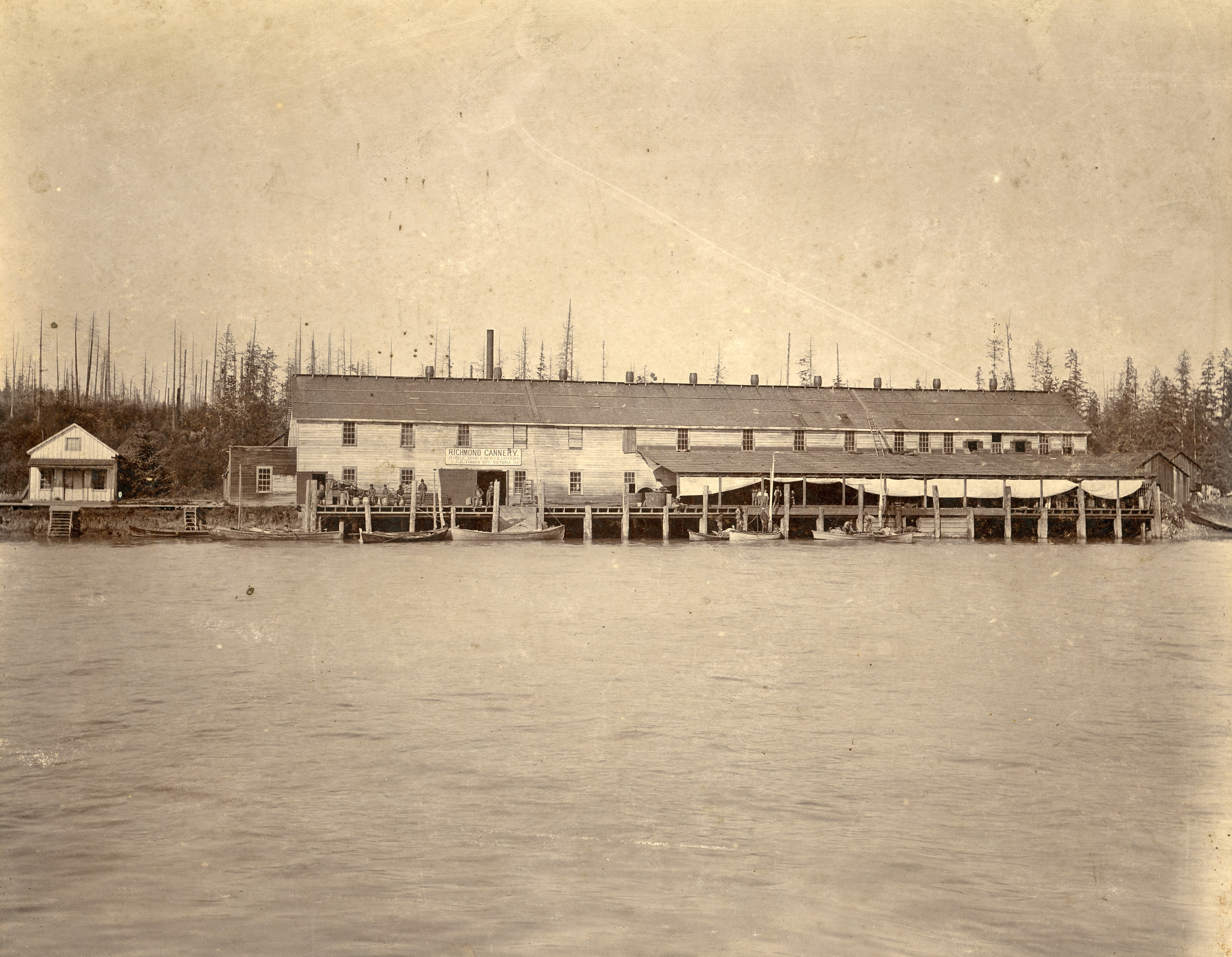
The Richmond Cannery
The last cannery was not technically in the Middle Arm but was in Richmond. The Richmond Cannery was located on Richmond Island, between Sea Island and the Vancouver side of the North Arm. It was built by JH Todd and Sons in 1882. The Richmond Cannery operated from 1882 to 1905 when it was shut down. JH Todd renamed their Beaver Cannery in Steveston Richmond Cannery after the original was closed.
The canning of fish at the Middle Arm canneries did not last as long as the industry in the South Arm. Built during the rush to exploit the seemingly endless supply of fish during the late 19th Century the realities of the limits of the resource and fierce competition for it resulted in the closure of the canning operations at those locations. However, the maintenance of the facilities at Terra Nova and especially at the Vancouver and Acme Canneries resulted in the growth of a vibrant community which has added to the character of Richmond’s history.
For more about the Japanese Canadian community on Sea Island see https://richmondarchives.ca/2015/01/06/japanese-canadians-on-sea-island/
To learn about Thomas Goulding’s cork mill see https://richmondarchives.ca/2024/02/01/keeping-an-industry-afloat-thomas-gouldings-cork-mill/


You must be logged in to post a comment.