
The City of Richmond Archives holds records created by Council, its committees, and municipal departments involved in guiding land use in Richmond from the very earliest town planning discussions to recent zoning bylaws. Before the post World War II growth of suburban development, the local government role in guiding land use was largely carried out through building and subdivision approval. In Richmond, the first subdivision plans approval bylaw was passed in 1908. The Archives holds a variety of early subdivision plans.
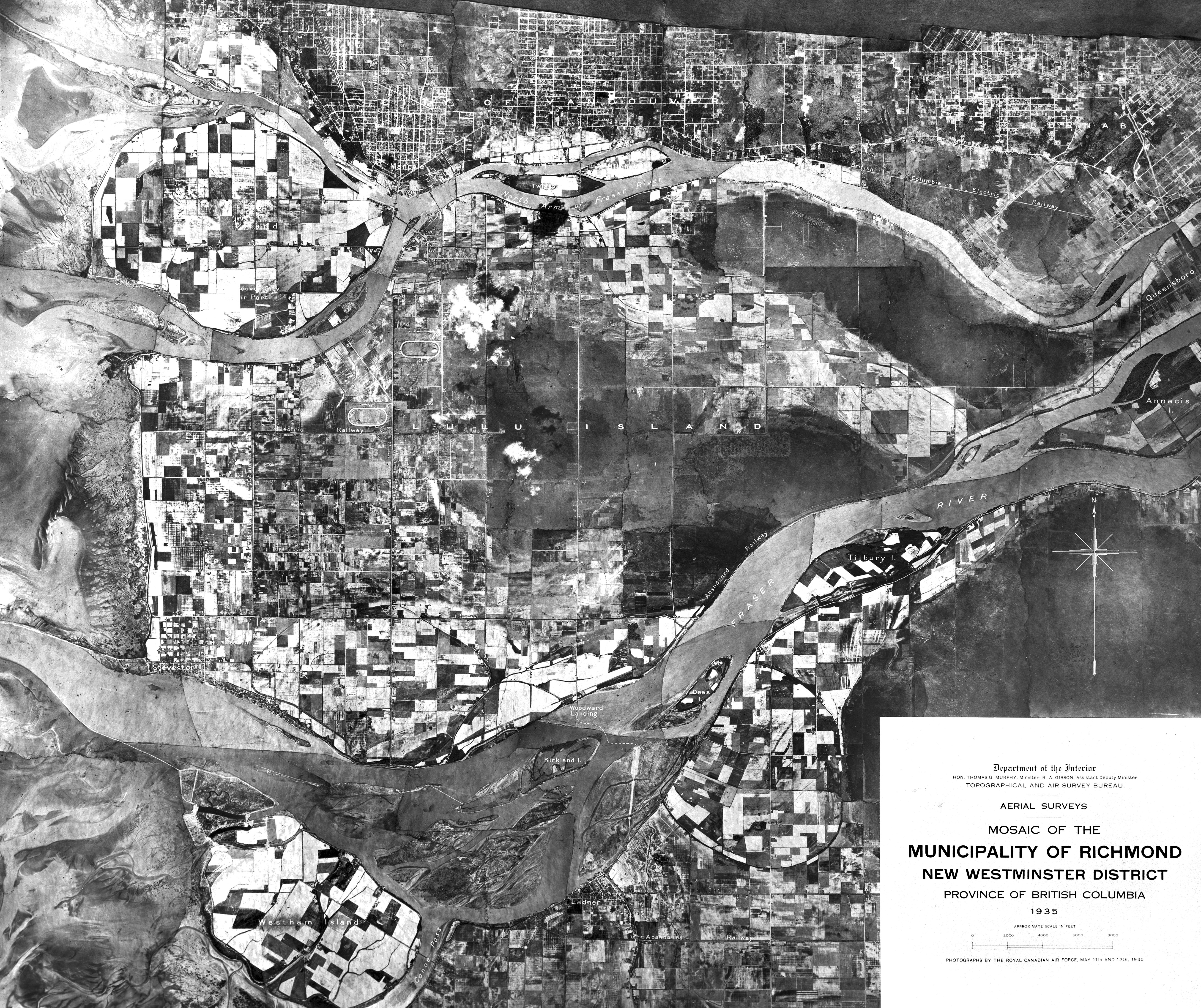
Aerial view of Richmond (population 8,000) in the 1930s, before the establishment of zoning bylaws. City of Richmond Archives Photograph 1985 154 1
After World War II the need for formal planning and building control became more pressing; land was being subdivided and buildings were being constructed at an increasing rate. In 1947, Bylaw 1071 was adopted establishing a Town Planning Commission to advise Council in carrying out the powers and provisions of the provincial “Town Planning Act” (1925).
The Archives holds the original minutes and reports of the Town Planning Commission (1948-1957), and its successor body, the Advisory Planning Commission (1958-1991).

Minutes of first meeting of the Town Planning Commission. City of Richmond Archives MR402, APC1-1
As evidenced in the early meeting minutes, the Town Planning Commission was empowered to issue or deny building permits and to make decisions relating to permissible activities on specific properties. The Commission was assisted in its decision making by the Municipal Engineer and the Municipal Clerk.
With the help of the provincial government’s Regional Planning Division, a comprehensive planning tool was developed in 1949. This was the first zoning bylaw, Bylaw 1134 (1949), for the regulation of land use and building, in 7 types of districts, known as the Town Plan. The bylaw was officially described as: “A bylaw to divide the Corporation of the Township of Richmond into districts and to make regulations in relation thereto, regulating the location, use and height of buildings, size of yards and other open spaces, and the use of land, pursuant to the ‘Town Planning Act’ and the ‘Municipal Act’”.

1949 Zoning Map as Schedule A to Bylaw 1134. City of Richmond Archives Bylaws
Until 1957, when Richmond’s first Town Planner was hired, Council’s oversight of the planning process was carried out through the Town Planning Commission and outside consultants. This mechanism proved inadequate to manage growth. In 1955 consultants presented a report which became the basis for the next zoning bylaw, to replace the 1949 bylaw.

First page of Zoning Bylaw 1430 (1956), with amendment bylaw number annotations in pencil. City of Richmond Archives Bylaws
Zoning Bylaw 1430 (1956) created 11 use classifications. With multiple amendments (over 1000), it served to guide land use control in Richmond until a new Zoning Bylaw was adopted in 1989. The new 1989 bylaw (Bylaw 5300) was established in association with Richmond’s Official Community Plan, first adopted in 1986. Bylaw 5300 was repealed with the adoption of the present Zoning Bylaw 8500 in November, 2009.
The Archives holds extensive municipal government records of planning functions carried out since the creation of the Planning Department, including those relating to community planning and zoning administration.
[Note – this is an updated version of an article first published in the Spring 2012 issue of the Archives News]

You must be logged in to post a comment.