“No Better Than a Duck Pond” – Richmond’s Historic Floods

The City of Richmond is built on islands located on the flood plain of the Fraser River, surrounded by the river and exposed to the Strait of Georgia on the west. With an average elevation of just one metre above the present mean sea level, Richmond faces flooding from extreme storm surges, intense rainfall, high tides and seasonal rises in river flows and levels. It was not until the arrival of non-Indigenous settlers in the Lower Mainland that textual records of floods and the damage they caused to dykes, crops, livestock and structures were made, most often in the newspapers of the day. Early landowners in Richmond began the process of dyking the land, usually their own properties, and building flood boxes to allow drainage at low tide and blocking the ingress of water at high tide. Soon, dyking districts were formed which provided funds for dyking and drainage projects through taxation and by the mid 1930s these were amalgamated under the control of the Richmond Municipality. The improvements made by Richmond over the years, ditches, canals, electric pump stations, box culverts and dyke upgrades, have greatly lessened the impact of floods on the city. This post describes some of the floods that occurred through Richmond’s history and some of the steps taken to reduce their consequences.

Several men watch from what is probably the flood box at the north end of No.2 Road while children appear to swim in the outflow, ca. 1930. The No.2 Road flood box was the first in Richmond, built before incorporation. Flood boxes have a balanced gate that allows water to flow out during low tides but blocks water from flowing back in when the tide is high. City of Richmond Archives photograph 1987 104 38.

November 1871 – An intense storm blowing up the river combined with a high tide and storm surge caused dykes to be washed away in Ladner and flooding to occur. While Richmond, which was not incorporated until 1879, was not mentioned in reports, the storm did cause significant damage to the Sand Heads Light Ship, dismasting it and tearing up parts of its deck. It was towed to New Westminster for repairs.

May to June 1894 – The “Great Flood of 1894” caused extensive flooding and damage all through the Fraser Valley. An extreme spring runoff brought on by a cool summer of 1893 which failed to melt snow in the mountains, a record snowfall through the winter of 1893-94 and rain and a heat wave at the end of May raised river levels to the highest ever recorded, 25.75 feet at the Mission Bridge. Dykes were destroyed, bridges and wharves washed away and farms were inundated destroying crops and drowning cattle and causing substantial loss of human life. In Richmond by June 1st, the flood had scoured out the fill around the pilings on the newly completed North Arm (Fraser Street) Bridge, causing about 200 feet of it to be carried away a few days later. Lulu Island was reported to be seriously flooded due to breaks in the dyke at Scott’s Mill at the Queensborough end of the Island and then over the main dykes at high tide. Damage in Richmond Municipality was estimated to be $2000 to the North Arm Bridge and a further $7000 in crop loss due to the flooding.

Steveston, shown here in 1891, was flooded several times in its early history. Cannery floors were awash in water and the plank roads shown here were floated up and washed away. City of Richmond Archives photograph 1984 17 75.

January 1895 – Six months after the 1894 flood, Lulu Island was again hit by flooding, this time by a combination of high river flows and extreme high tides with a strong west wind. Dykes on Lulu Island were washed away in many places, flooding large areas of farmland. Root crops stored in pits were destroyed along with large quantities of potatoes. Houses and barns were flooded and bridges over ditches and canals were washed away. Sea Island was reported to be under as much as three and a half feet of water. In Steveston water flooded over the floors of canneries and some residents had to leave their houses. Steveston’s plank roads floated and were swept away by the water.

1900 – The first of Richmond dyking districts was formed when landowners petitioned the Provincial Government to allow taxation for the construction of dykes and drainage systems under the authority of the Drainage, Dyking and Development Act. The New Lulu Island Slough Dyking District was responsible for the land encompassing the slough complex from Francis Road south to the river. Before this time landowners dyked their own property with other areas being handled by the Township. Commissioners were elected to administer the district and an engineer was hired to draw up technical plans and assessments of the land.

Headlines in the December 27, 1901 Vancouver Daily Province describe some of the damage to Richmond in the 1901 flood.

December 26-27 1901 – Richmond was hammered by a severe gale directed squarely at the mouth of the Fraser combined with very high tides. This was the most extensive and damaging flood in Richmond since 1894. Several canneries were heavily damaged and one, the Labrador Cannery at Terra Nova, was completely destroyed. Miles of dykes were lost along the North and Middle Arms of the river, fishing boats were swept as far as half a mile into farmer’s fields and smashed up. The Japanese boarding house at Terra Nova collapsed with people trapped inside who were rescued by neighborhood residents. Another boarding house with nine men inside was swept into the river. They managed to get on to the roof of the building where they were rescued by men who braved the storm in two boats. Sea Island and the greater part of Lulu Island were reported to be flooded by two to four feet of water. Steveston was under water and the floors in the Gulf of Georgia cannery were completely covered. Outbuildings at the Colonial Cannery were washed away and the plank roads in Steveston and around Lulu Island floated away.

1905 – The second of the dyking districts was formed. The Lulu Island West Dyking District was formed with responsibility for the area west of No. 3 Road.

November 1913 – The highest tides in ten years combined with a storm surge and high winds caused dykes to give way in many places flooding hundreds of acres of farmland. On Lulu Island, the Bridgeport area was inundated. Water covered roads and fields up to two feet deep, while Bridgeport School was surrounded with about three feet of water. Sea Island was similarly affected with about 500 acres of land flooded after the North Arm dyke was breached at the Cooney property on No.13 (Miller) Road. Damage was fairly light at the north-east corner of Sea Island, although the store and meat market sustained significant damage.

January 1914 – Through January 1914 heavy rains and high tides rendered the municipal drainage systems useless causing high water all along No.20 (Cambie) Road from Bridgeport to No.5 Road. The Bridgeport, Cambie and Alexandra areas were flooded with up to two feet of water. Later in the month, the same conditions, worsened by a gale force wind, washed away 150 feet of the dyke on Sea Island, completely flooding the island. Mitchell island, along with smaller islands in the river were also completely flooded. At a ratepayer’s meeting after the flood, keynote speaker John Tilton stated that “…well dyked and well drained, this island would be a beauty spot of Canada. As it is, it is no better than a duck pond.”

Ditches were excavated along most roads in Richmond to help drain the land and gave rise to the municipality’s nickname of “Ditchmond,” As shown in this photograph, ca. 1920, they could pose a hazard to careless drivers as well. City of Richmond Archives photograph 1978 30 2.

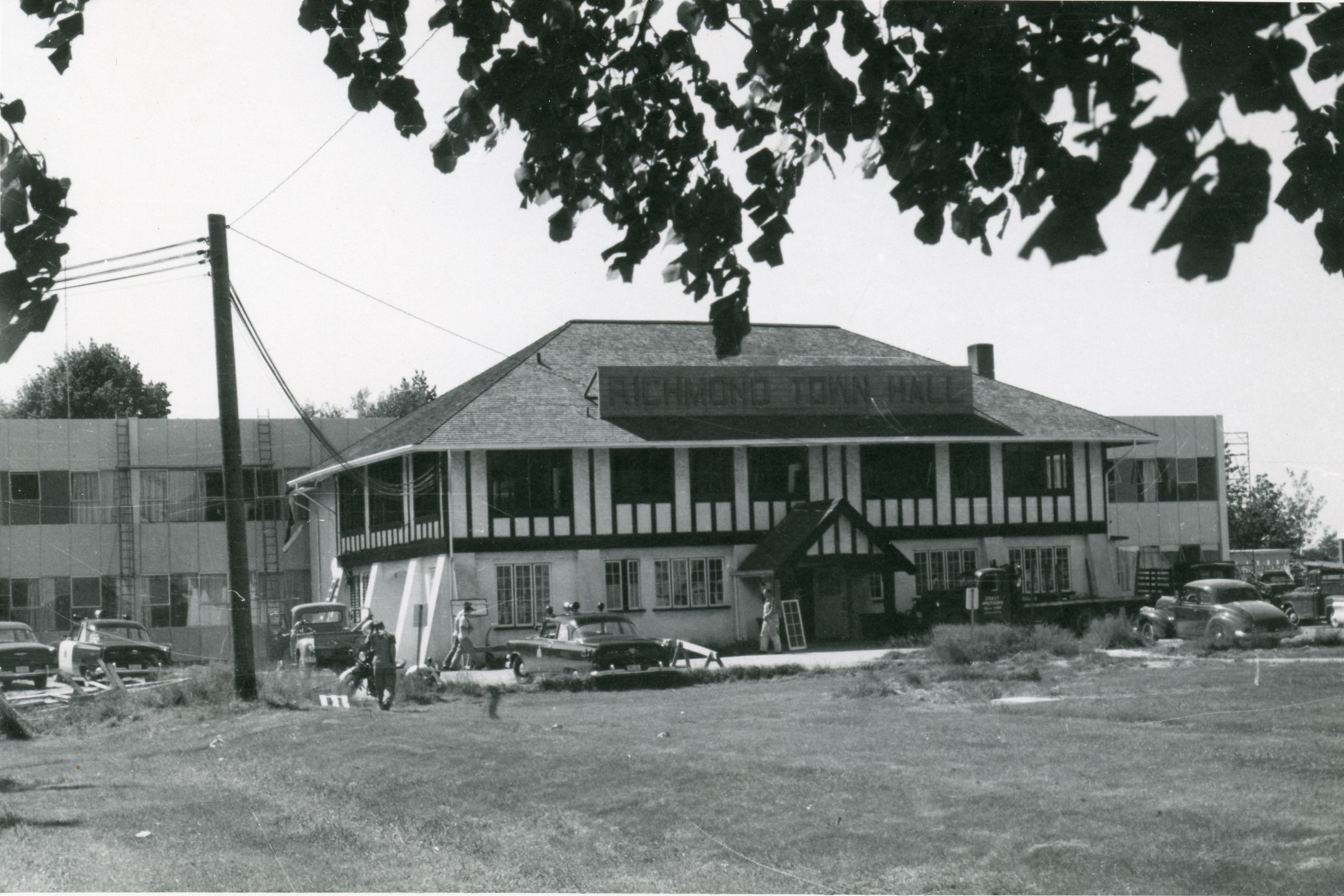
January 1921 – Once again the double hit of heavy rain and high tides caused flooding in Richmond. The flood box on Twigg Island was washed away, resulting in the island being completely inundated every time the tide came in. On Mitchell Island a poorly reconstructed dyke, built after the construction of Union Cedar Mills, allowed tide water to surge over and flood the island. On Lulu Island unfinished dykes on the North Arm and on the South Arm at the London property allowed the water to wash over. Large parts of the Alexandra and Garden City areas were flooded. A public meeting held at Richmond Townhall saw citizens, who had already willingly taxed themselves for dyking and drainage to an amount equal to half the general taxes of the municipality, advocating for the installation of powerful electric pumps to drain the island.

January 1933 – The New Lulu Island Slough Dyking District installed the first electric pump in the dyking and drainage system on the South Arm between No. 3 and No. 4 Roads. The 60 horsepower pump would operate automatically only during the highest tides when the flood boxes become ineffective. The pump was expected to remove 16000 gallons per minute and would drain about 4300 acres of land.

People pose in front of the first electric pump in Richmond’s dyking and drainage system, located between No. 3 and 4 Roads on the South Arm. City of Richmond Archives photograph 1988 17 112.

January 1935 – Heavy snowfall followed by higher than normal temperatures and heavy rain caused flooding in the Fraser River Valley and drainage problems in Richmond. Lulu Island was reported to be a series of small lakes and Lansdowne and Brighouse Racetracks were completely flooded.

Water flows onto Lulu Island through a breach in the dyke in 1953. Tire tracks indicate attempts to block the flow by pushing mud into the break. City of Richmond Archives photograph 1977 1 4.

1936 – The Township of Richmond amalgamated its own works with the other two dyking districts, assuming control of all dyking and drainage activities within its boundaries. The work done on the dyking and drainage system was beginning to have a positive effect on flooding problems in Richmond. While some flooding due to high rainfall was still problematic at times, residents did not seem too concerned about the occasional time when one had to wear gumboots to go into their yards. The Richmond Review boasted in the October 6, 1936 edition, “Richmond the Dryest Place in the Valley.” “Richmond should let the world know that it is about the safest place in time of flood from Winnipeg west. Richmond is so near the sea that excess water can readily escape if given half a chance.” The attention given to improving and upgrading dyking and drainage systems was to continue up to the present day.

February 1945 – “The Great Storm of February 7, 1945” was claimed to have caused the worst flood in ten years. Vancouver newspaper reports said that Burkeville was a chain of lakes with about 25 houses surrounded by water, stranding the residents inside. Acres of Lulu Island were under water. However, the Richmond Review reported, “Flood of Short Duration Here.” The rain which caused ditches to fill and property to flood on Wednesday had all run off by Friday.

1948 – In January high tides and storm surge burst through the dykes on Twigg Island. On Lulu Island a few houses were subject to flooding. Then, in May and June the Fraser Valley was hit by the worst flood since 1894. The 1948 flood was one of the most destructive in BC history, causing widespread damage throughout the Fraser Valley. Richmond, however, got off relatively easily because of the the tremendous organization and mobilization of every available resource led by Reeve (Mayor) R.M. Grauer. With help from the military, volunteer labour from Richmond and other cities in the Lower Mainland and some paid labour, the dykes were monitored 24 hours a day, thousands of sandbags were filled, brush along the dykes was cleared and weak spots in the dykes were shored up. Organizing and supervising the workers on the dykes were Ken Fraser, who took care of Steveston to No.2 Road, Archie Blair, the area between No.2 Road and No. 4 Road, Leslie Gilmore, No. 4 to No.6 Roads, Matthew McNair, No.6 to No.7 Roads, Andy Gilmore, No.7 to No.9 Roads, E. Carncross, No.9 Road to Hamilton, Bob Ransford, Hamilton to the eastern boundary, and Doug and John Savage, the northern boundary to No.8 Road. G. Crosby monitored the Middle Arm dyke on Lulu Island and on Sea Island the Grauers watched the North Arm dyke to Cora Brown, Doug Gilmore, the rest of the North Arm Dyke, Cline Hoggard, the Middle Arm to the Airport and the rest was watched by the Airport Authorities.

Mrs. A. E. Vigar sits on a row of sandbags along the Fraser River in Richmond during the 1948 flood. City of Richmond Archives photograph 1987 30 29.

The logistics involved in the “Battle of the Dykes” were akin to a military operation. Hundreds of workers were mobilized and directed to their stations. Canteens were set up at the various command posts, supplied with coffee, sandwiches, soup, cigarettes, donuts, cases of pop and cookies provided by the Municipality, the Red Cross or donated by Lower Mainland businesses and churches. Drivers were busy delivering supplies to the dykes and the canteens. Businesses and private citizens donated the use of cars, trucks and tractors to the effort. The military provided manpower, vehicles, boats and powerful tugs, able to pull barges of rock and earth against the strong current in the river. To help with communications the BC Forest Service provided two mobile radio units, The BC Telephone Company installed temporary telephones at command posts and BC Electric provided power where necessary. All movement of deep sea vessels was suspended on the river. Towing companies were instructed to use only more powerful tugs, speed limits were imposed to prevent damage to dykes and the size of tows was restricted to single barges and booms with an assisting tug. Bridges were closed to traffic from two hours before until two hours after high tide slack.

A group of students from Richmond High School pose atop a stack of sandbags during the 1948 flood. Male students were excused from classes to help fill sandbags and work at the dykes. City of Richmond Archives photograph 2010 35 5.

To make sure that workers remained focused on the job at hand, the liquor licenses at the Steveston Hotel, the Steveston and Sea Island ANAFs and the Royal Canadian Legion were temporarily suspended. In the event that the worst happened, a train was stationed at New Westminster to assist in evacuating people from Richmond.

A notice published in the June 9, 1948 Richmond Review.

The constant monitoring, shoring up of low spots and reinforcing dykes that began to weep paid off in a minimum of damage in the Municipality. There was only one significant problem reported when a “geyser” erupted on the dyke at the Rice Mill resulting in a breach. About 100 yards of the dyke had collapsed into the river at high tide. Fortunately, as the tide receded the flooding stopped and the gap was filled using the Municipal dragline. Repair work was completed before the tide came back in and flooding didn’t penetrate past the CN Rail line.

A Universal Bren Carrier delivers sandbags to the dyke in this clip from a film taken during the 1948 flood in Richmond. To see the whole video visit https://www.youtube.com/watch?v=pR0czKKsehM .

November/December 1951 – In late November a near hurricane storm system and high tidal surge hit the Lower Mainland. At Richmond, River Road near the Sea Island bridge was under about 6 inches of water. Workers from the Lulu Island Canning Company were set to work packing the dykes with sandbags. In nearby low lying areas houses were surrounded by water up to 10 inches deep. The high tides and strong winds breached a low dyke at the end of No.2 Road in Steveston but the water was held back by a higher inside dyke. The ferry to Ladner was put out of service when a pontoon at the Richmond ferry terminal sank.

Strong winds and high tides wash against the dyke at the end of No.1 Road in Steveston during the November/December 1951 storm. City of Richmond Archives photograph 1977 1 24.

January 1953 – Dirt fill around the new $15000 flood box at Finn Slough washed away resulting in the destruction of the flood box. About 50 yards of the dyke near the foot of No.4 Road washed out “as if cut by a knife.” The location of the break was such that trucks could not be brought in so Councillor Archie Blair used his farm tractor to bring in sandbags and to push mud into the breach and a scow delivered a load of soil. Flooding caused significant damage to the Gilmore farm buildings and the family home. It was discovered that wing dams and modifications made by the Federal Government to the south shore of the river in an attempt to increase the water velocity and make the river “self-dredging,” redirected the flow, causing it to scour the area between Woodward’s Landing and Steveston and undermine the dyke. High seasonal tides then ended up breaching the dyke. The dyke was subsequently repaired and armoured with rock.

The brand new Finn Slough flood box was destroyed when soil around it was washed away in 1953. City of Richmond Archives photograph 1977 1 8.
The Gilmore house is surrounded by water in this image from the 1953 flood. The area around Finn Slough could be problematic during high drainage loads and dyke breaches. City of Richmond Archives photograph 1977 1 10.

November 1954 – Very heavy rainfall overwhelmed the drainage system causing an accumulation of water in Richmond that filled ditches and backed up onto the surface of the land. The No.3 Road pump had lost a top main bearing making the situation worse. The most affected area was in the Grauer subdivision and the rest of the area drained by the No.4 Road canal. Crown Zellerbach helped out by placing nine large pumps at Finn Slough which assisted the municipality’s pumps by drawing an additional 22,000 gallons a minute.

Kids wearing gumboots wade in their yards on Dixon Avenue during the 1954 flooding. City of Richmond Archives photograph 1977 1 118.

November 1955 – Heavy rainfalls caused flooding around the Lower Mainland but, according to reports in the Vancouver Sun, flooding in Richmond was “much less than expected.” While some ditches overflowed onto roads, fields and lawns, the municipality’s canal drainage system speeded up the runoff significantly.

The use of natural drainage channels forms part of the strategy of removing water from Richmond. This aerial view, ca. 1980, shows Woodwards Slough which drains into the South Arm near Finn Slough. A flood box and pump station ensure efficient water removal. Horseshoe Slough and Bath Slough are also part of the drainage system. City of Richmond Archives photograph 1988 123 745.

December 1957, January 1958 – High tides, wind and heavy rain caused water to go over the dykes on Mitchell Island. About 100 homes in Richmond were surrounded by water due to blocked drains in the drainage system.

Drainage canals have been an effective way of moving large amounts of water out of Richmond. This image shows the north end of the Gilbert Road canal and pump station. The canal has since been replaced by a box culvert. City of Richmond Archives photograph 1988 123 689.

December 25-26 1972 – Water from rain melting snow caused flooding around Richmond, and damage at the municipal offices.

February 1976 – An exceptionally high tide caused flooding one foot deep around about fifty homes in the Cambie and River Road area when a temporary rock dam was breached where a new pumping station was being installed on the Middle Arm.

The large open drainage canals have been replaced for the most part by enormous box culverts like this one on Gilbert Road which replaced the canal shown in the previous photograph. City of Richmond Archives photograph 1988 123 445.

December 1979 – Once again, extremely heavy rainfall caused drainage problems around Richmond. The flooding caused sanitary sewers to back up at London Junior Secondary School, flooding the gym and closing the school. Wet cables caused the loss of telephone service to about 1000 customers.

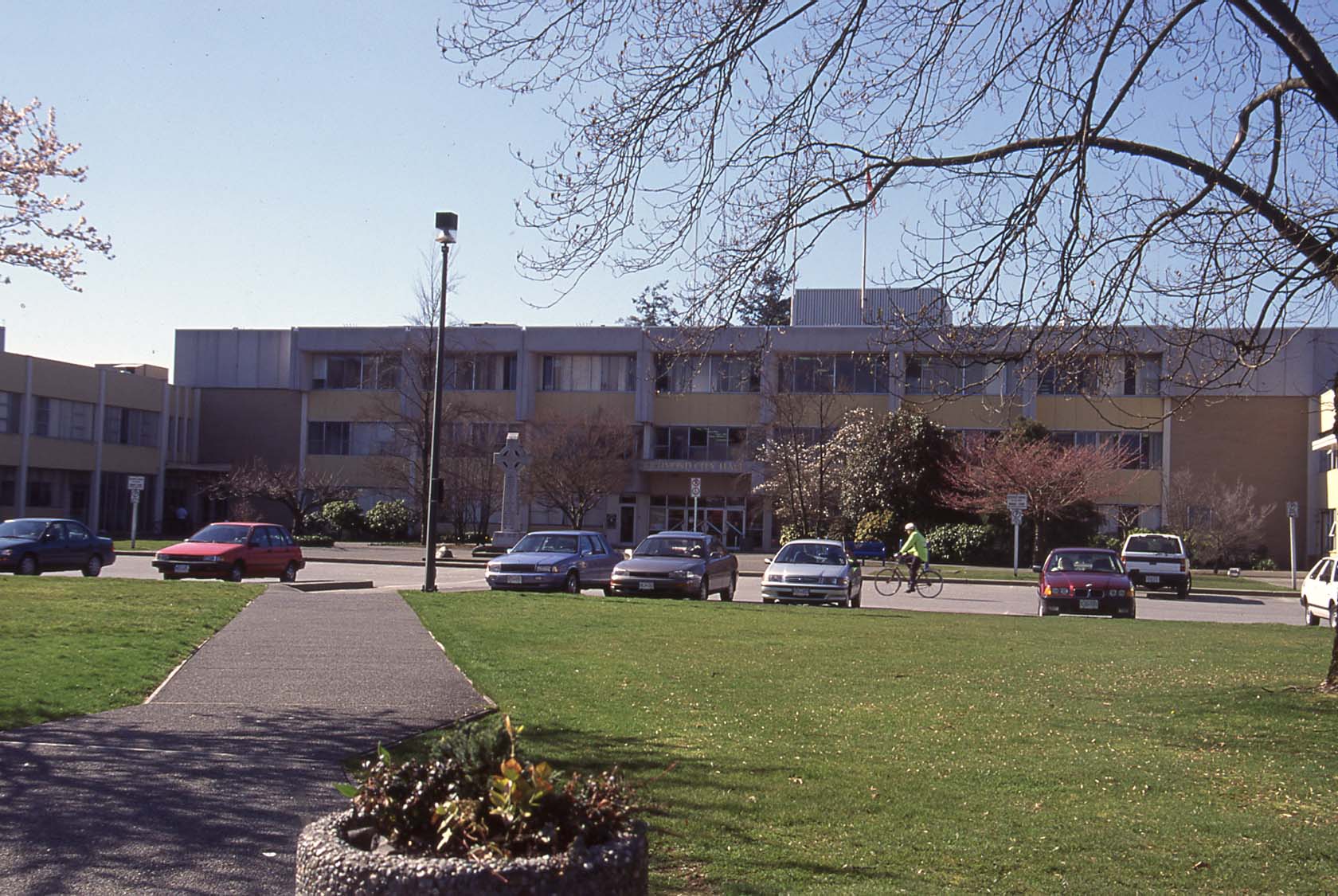
To the present- The improvements made to Richmond’s dyking and drainage system have been continuous since the first hand built dykes in the 1800s. Today, around 49 km of dykes hold back water from the sea and the river. 598 km of drainage piping, 61 km of culverts and 151 km of open watercourses move water out of the city. Thirty-nine pump stations, capable of removing 5.3 million litres of water per minute, are ready to discharge rainwater to the river and ocean. Sensors provide real-time information about river levels, rainfall and the drainage of storm water and analysis of weather patterns, snowpack and predicted runoff warn of potential risks to the city. Regular inspection and maintenance of the whole dyking and drainage system takes place with increased patrols during higher risk periods. Richmond’s dyking and drainage system is designed to withstand a one in 500 year flooding event, something that has a 0.2% chance of occurring in any given year. A case in point is the 2021 atmospheric river event, which broke rainfall records around the Pacific Northwest and caused extensive damage in many places, was handled well by Richmond’s system although localized drainage problems did occur.

Many of Richmond’s upgraded pump stations feature public art displays. This image shows the Shell Road North Drainage Pump Station which was upgraded in 2020. The walls show large maps of Richmond with bridges, roads and highways, as well as the paths of some of the City’s historic slough waterways. City of Richmond Engineering and Public Works: Richmond’s Drainage Pump Stations, July 26, 2024. https://corportal1.richmond.ca/portal/apps/storymaps/stories/c4d06a030aa845c981117f95727a4e26

To the future- To prepare for climate change induced sea level rise and increased rainfall the City’s Engineering and Public Works Department has developed a flood protection strategy to prepare for emergencies. To ensure Richmond and its residents remain safe, the City has one of the most comprehensive flood protection systems in BC. To learn about it, visit the City of Richmond’s website at https://www.richmond.ca/services/water-sewer-flood/dikes.htm

Centres of Government – Richmond’s Town Halls – Part Four

Part Four – The Modern Tower

The City of Richmond was incorporated in 1990 and by then it was already obvious that the 1957 City Hall, even with its additions and improvements, was becoming unsuitable for the rapidly growing city. Staff reports detailed the inadequacy of the office space and the inefficiencies of operation in the existing facility. Council and senior city staff identified issues with the existing building and began studies to determine what was needed to meet the city’s requirements for the foreseeable future.

This image has an empty alt attribute; its file name is OldCityHallstaff.jpg
The third Richmond City Hall had been outgrown by the Municipality it had been designed to serve, even with nearly continuous upgrades and additions. Staff at the hall pose outside before the building was shut down and demolished. City of Richmond photograph.

In 1991 a Task Force was formed to explore the space requirements, cost benefits, and feasibility of the construction of a new City Hall. Many considerations were made regarding the construction of a new building over the modification of the existing one, the suitability of the location, and the design of a potential replacement. Detailed analysis found that the cost of upgrading the existing building would be at least 75% of the cost of a new facility. City owned and privately owned properties were considered as potential sites for a new hall but the location of the existing City Hall with its proximity to the School Board offices, RCMP Station and the new Cultural Centre, Senior’s Centre, Minoru Park, Arenas, and Brighouse Park, all fit in with the concept of a “Civic Centre” at the heart of Richmond’s City Centre. The Task Force also identified the opportunity to create an landmark building for the community.

After demolition of the old hall, site preparation and construction began. The under-building parking is a few feet below the water table and features a pump system to keep it dry. City of Richmond photograph.

By 1996 work on the project had progressed to the point where project management and architectural services, provided by KPMB Architects of Toronto, had been settled on. Mayor and Council formed a building committee and in 1997 city operations were moved from City Hall to another city owned property on Elmbridge Way to allow demolition of the old building to take place  and site preparation and construction of the new one to begin.

A public art project decorated the wall around the construction site on Granville Avenue. Two hundred plywood puzzle pieces were painted by more than 600 residents during the 1998 spring break at Lansdowne Park Mall. City of Richmond photograph.

The new building, unlike its predecessor, returned to the practice of the first two Town Halls, making space available for community events and public use. The award winning design featured four major building components.

Photo Collection 1999 City Hall Construction June 1999 In 1999 construction of the new City Hall was underway. City of Richmond Archives photograph.

The eight storey administrative tower includes the first floor “Front of House” area which clusters representatives from various City Departments in one area to provide one-stop-shopping and improve customer service.

The Administrative Tower, shown here looking south east, rises eight storeys at the corner of No.3 Road and Granville Avenue. City of Richmond photograph.

The circular council chamber over looks the southern terrace water garden which features an island to represent Richmond’s status as an Island City and is landscaped with native plant species.

Looking over the Water Garden toward the Council Chambers in the background. City of Richmond photograph.

The light filled, two storey Meeting House wing houses a variety of open public spaces and multi-purpose rooms and offices and extends to the west of the tower.

_KO19497 The two storey Meeting House features natural light, natural wood finishes, a mix of office and meeting spaces, public areas and a cafe. City of Richmond photograph.

The west terraces and civic square feature an outdoor stage, gardens, public art and access to the administrative tower and the Meeting House from the public parking area.

The West Terraces and Civic Square were an integral part of the O Zone during the 2010 Olympic Winter Games providing a large screen for watching events. Russ Bueker – City of Richmond Archives photograph.

The new Richmond City Hall was one of the first public buildings in the country to adopt the principles of Feng Shui in its design, consulting with a Feng Shui Master in the early planning stages of the project and throughout the construction phase. To quote Richmond Mayor Greg Halsey-Brandt who was in office for the duration of the project, ” Virtually every opening of a new building that I go to will have a Feng Shui master’s input. They do this all the time in the private sector because they are concerned about their customers, and the way I see it, we are no different. If we build a building that makes it uncomfortable for say, 20 per cent of our population, then that is not in the interest of the community we are trying to serve.”

The reconditioned Cenotaph was replaced within feet of where it was originally sited in 1922. City of Richmond photograph.

The building, which cost around $39 Million to build, is designed with the best available technology to withstand earthquakes, provides good public accessibility and an effective, pleasant and safe workplace for employees.

The new City Hall opened for business on May 15, 2000 and several celebratory events were held afterwards. On May 20 an Official Opening Ceremony took place. This was followed by a Charity Gala on May 26, attended by more than 1200 guests. On June 6 the cenotaph, which had been refurbished while in storage during the construction project, was rededicated. It was installed very close to its original location on No.3 Road near the main entrance to the building. On June 12 a Recognition Social was held, attended by more than 1000 residents who had lived in Richmond for 50 years or more.

bphillips_Cityhall Crans 1_3824 During the 2010 Olympic Winter Games the Water Garden at City Hall was filled with cranberries from the local harvest. Brian Phillips – City of Richmond Archives photograph 1_3824.

In the nearly 140 years since the opening of the first Richmond Town Hall, Richmond has grown dramatically, a trend which continues. The first hall served a population of 250 to 300 people at a time when Richmond could still be considered a frontier settlement. By 1919 when the second hall was opened, the population had soared to 3110. In 1957 the third hall was built to provide services for a community of around 26,000 people. The present City Hall was built when the population was around 150,000, a number which is estimated to have swelled to 222,945 today. With the growing service requirements needed to operate our expanding city, space has again become tight at the hall. Some city departments have moved from the main hall to the City Hall Annex, the former Public Safety building vacated by the RCMP in 2011, which has alleviated crowding for, so for the foreseeable future, our fourth City Hall will continue to serve as our Centre of Government.

Back: Part Three – The 1950s Office Building.

https://richmondarchives.ca/2018/08/23/centres-of-government-richmonds-town-halls-part-three/

Centres of Government – Richmond’s Town Halls – Part Three

Part Three – The 1950s Office Building

In January 1955 the Municipal Building Committee recommended to Council that a new, two-storey Municipal Hall be built immediately behind the existing one on the Municipal property at Granville Avenue and No.3 Road. By February the plans had been broadened to include a school administration building and health services offices on the same site and approval to borrow $398,000 was given by Council. The architectural contract was awarded to Allen C. Smith and Associates, the construction contract to Narod Construction, heating and ventilation to Crombie Heating and the electrical contract to Canadian Comstock.

1997 42 3 47 Construction of the new Town Hall takes place behind the old one in this photo. When the building was completed and the old one removed, the Cenotaph was relocated closer to the entrance. City of Richmond Archives photograph 1997 42 3 47.

Construction on the site began with moving the Brighouse Fire hall to the southwest corner of the property, making room for excavation to begin. The building’s construction was of reinforced concrete and throughout the construction, changes and amendments to the plans were made, although one suggestion that a neon sign to identify the hall should be added to the plans was quashed. The location of the new hall allowed work to continue uninterrupted in the old Town Hall while the new building rose behind it.

1985 7 14 Work continues on the new Town Hall while business continues in the old one. City of Richmond Archives photograph 1985 7 14.

By May of 1957 the hall was ready for occupation and municipal departments began to move their operations into the new building.

1988 18 51 Municipal employee Nellie Grecan and her adding machine are moved into the new Town Hall on May 25, 1957. City of Richmond Archives photograph 1988 18 57.

The demolition of the old hall was started, and once complete, landscaping, paving of the parking area and relocation of the cenotaph was completed in time for the grand opening on August 9, 1957.

1985 7 31 Once staff had moved into the new building, the old building was demolished. City of Richmond Archives photograph 1985 7 31.

The opening of the new Municipal Hall was attended by the the Hon. Wesley Black,  Minister of Municipal Affairs, and the Hon. Leslie Peterson, Minister of Education who opened the new School Board offices.

1988 18 38 The crowd on the east plaza of the new Town Hall for the opening ceremonies, August 9, 1957. City of Richmond Archives photograph 1988 18 38.

The new hall departed from its predecessor’s use as community space and community activities moved to community centres, church halls and other buildings. It was an unpretentious office building designed to house the growing bureaucracy required for the rapidly growing town, one which was growing far faster than could have been imagined.

1977 1 146 The new council chambers at the Municipal Hall with Reeve E.R. Parsons in the chair, Municipal Clerk Ted Youngberg seated below him and Councillor R.A. McMath in the foreground, Councillor H.D. Hudson seated on the far left, and Councillor Robert G Ransford at the far right. City of Richmond Archives photograph 1977 1 146.


1977 1 148 Photograph of the general office and municipal employees in the new Richmond Municipal Hall, 1957. City of Richmond Archives photograph 1977 1 148.

By 1961 office space was growing tight in the four-year-old building and debate was taking place on expansion of the hall. In 1964 the decision was made to add a new wing to the building. A contract was awarded to L.D. Boyd construction for $166,900 and the new wing was completed in September 1965. This alleviated the space crisis for a few years but improvements and modernization continued through the rest of the 1960s.

2004 11_Municipal Hall 1960 The front entrance of Richmond Town Hall, ca. 1960. City of Richmond Archives photo 2004 11.

Growth continued and in 1969, with the hall once again bursting at the seams, plans were being debated for further expansion. In 1971 $1,278,000 was borrowed for the construction of a third floor on the existing building and for the construction of a new Public Safety Building. The new building would allow the RCMP to vacate their space in Municipal Hall and move to their own building, freeing up valuable office space. The additional space provided by the third floor and the space cleared by the RCMP only lasted a short time in the rapidly growing municipality.

1992 20 F This photo from 1979 shows the Municipal buildings complex. Municipal Hall, with the third floor and additions at each end is in the foreground. The old Brighouse Firehall is in the space between the Hall and the RCMP Building and the School District Offices. To the right foreground is the Post Office and in the mall parking lot is the Richmond Square Theatres. City of Richmond Archives photograph 1992 20 F.

By January 1978 an architect had been commissioned to produce a report on the state of the council chambers and offices and how to increase the efficiency of the use of space in the hall. This report led to changes in the Health Department, a new Personnel Department and an addition to the north end of the building in 1979.

2008 39 6 705 Richmond City Hall, ca. 1992. City of Richmond Archives photograph 2008 39 6 705.

In 1990 the Corporation of the Township of Richmond was reincorporated as the City of Richmond. Over the preceding decade Richmond’s growth had continued and accelerated with increasing immigration. Richmond’s old Town Hall’s days were numbered, the city once again outgrowing it’s office space.

Back: Part Two – The Tudor Manor.

https://richmondarchives.ca/2018/03/08/centres-of-government-richmonds-town-halls-part-two/

Next: Part Four – The Modern Tower.

https://richmondarchives.ca/2019/01/09/centres-of-government-richmonds-town-halls-part-four/


A Walk Down No. 3 Road in 1958

In 1974,  the Assessment Authority Act was passed in the BC Legislature allowing the formation of the BC Assessment Authority, an organization which operates independently from municipal or provincial governments to assess property values for taxation purposes. Before this the Corporation of the Township of Richmond had its own tax assessors who created assessment rolls to establish property values in the Municipality. In 1958, an assessor took his camera out to document the commercial buildings along No. 3 Road, mostly between its intersection with Westminster Highway and with Granville Avenue, and left us with a fascinating time warp back to the late 1950s in a location that has seen some of the greatest change in Richmond, although bits of it still survive. Lets take a stroll along No. 3 Road in 1958.

a 1988 18 7

The intersection of No. 3 Road and Westminster Highway looking north west. City of Richmond Archives photograph 1988 18 7.

Starting our walk at the intersection of No. 3 Road and Westminster Highway, we look toward the north west corner and the new, modern supermarket of Canada Safeway and its parking lot. This intersection, one of the busiest in Richmond then and now, was one of the first to have a traffic signal.

b 1988 18 8

On the north east corner of the intersection was the Lansdowne Service Shell station. City of Richmond Archives photograph 1988 18 8.

Across No. 3 Road from Safeway is Lansdowne Service, a Shell gas and service station. If you drive north along No. 3 Road, there were only trees between the station and Lansdowne Park Racetrack.

c 1988 18 9

Directly across Westminster Highway from Safeway was the Super-Valu Store. City of Richmond Archives photograph 1988 18 9.

On the south west corner of the intersection, directly across the street from Safeway is its main competition, Super-Valu. Their signs compete for attention on this corner.

d 1988 18 10

Turning around and looking south up No. 3 Road you can see the Ford dealership of Steveston Motors and the strip of commercial building an bit farther down. City of Richmond Archives photograph 1988 18 10.

Standing in front of Super-Valu and looking south along No. 3 Road you can see some of the commercial buildings on the west side of the street. Steveston Motors Ford dealership was just south of the Super-Valu store. Across the opening to their car lot is a strip of storefronts.

e1988 18 11

Looking south along No. 3 Road from the east side of the street. City of Richmond Archives photograph 1988 18 11.

If you cross No. 3 Road to the east side and look south you get a good view of Super-Valu, Steveston Motors and the row of commercial buildings. Let’s walk along the sidewalk a bit….

f 1988 18 6

Looking north toward Westminster Highway from the east side of No. 3 Road. City of Richmond Archives photograph 1988 18 6.

… and look north to see the businesses on the west side of the street, Safeway, Super-Valu and Steveston Motors. Judging by the banners and flags they’re really trying to sell those Edsels.

g 1988 18 35

Looking east along Westminster Highway from No. 3 Road. City of Richmond Archives photograph 1988 18 35.

If we head back down to the intersection we can look east along Westminster Highway and see a couple of businesses just around the corner, Lulu Billiards and Jerry Pickard Motors Austin Sales and Service.

h 1988 18 34

Lulu Island Motors on the coner of No. 3 Road and Westminster Highway. City of Richmond Archives photograph 1988 18 34.

Right on the corner of Westminster Highway and No. 3 Road is Lulu Island Motors, a Standard Oil (Chevron) station where you can get gas, a tune-up and new tires.

i 1988 18 33

Looking farther south the next building houses a number of businesses. City of Richmond Archives photograph 1988 18 33.

Next to Lulu Island Motors is a commercial building with a number of businesses. The Richmond Review Newspaper is through the first door at 604 No. 3 Road. Next door is the popular Rooster Cafe. Beside the cafe is the Farmerette Grocery Store and at the end is Marpole Cleaners. Upstairs are some lawyer’s and doctor’s offices and some apartments.

j 1988 18 32

The neon sign at the Rooster Cafe. City of Richmond Archives photograph 1988 18 32.

Looking up, the neon sign at the Rooster Cafe is Richmond’s finest.

k 1988 18 31

The Lulu Theatre. City of Richmond Archives photograph 1988 18 31.

Across a driveway, the next building is the Lulu Theatre, showing Hollywood’s latest movies.

l 1988 18 4

Looking north down No. 3 Road toward Westminster Highway. City of Richmond Archives photograph 1988 18 4.

Turning around and looking north down the west side of the street you can see the buildings housing The Canadian Bank of Commerce, Kleven’s 5-10-15 Cent Store, Pemberton Jewelers, Lansdowne Hardware (selling Bapco Paints), McCue Drugs, the Island Colour Bar (selling Canada Paints) and Richmond Tailors.

m 1988 18 5

Looking south west toward 621 No. 3 Road. City of Richmond Archives photograph 1988 18 5.

Turning and looking south west, next door to the bank is the Delta Esso Service Station. In the background are the buildings at Cunningham Lumber Co.

n 1988 18 30

Back on the east side of the street is Lang’s Nurseries. City of Richmond Archives photograph 1988 18 30.

Looking back to the east side of the street we find a long-time family owned Richmond business, Lang’s Nurseries. The propery is filled with trees, shrubs, plants, topsoil and anything else one needs for landscaping or gardening.

o 1988 18 3

Looking north west. City of Richmond Archives photograph 1988 18 3.

Back across the street is the Cunningham Lumber Co. (selling Glidden Paint) and the offices of J.M. Wells Construction Ltd.

p 1988 18 29

Looking north east toward the Bank of Montreal. City of Richmond Archives photograph 1988 18 29.

Back on the east side of the street again is the Bank of Montreal at the west end of the Hyland Park Shopping Centre. In the background, a ferris wheel from Royal Canadian Shows is set up in the empty lot between Lang’s Nurseries and Hyland Park.

q 1988 18 28

Looking south along No. 3 Road. City of Richmond Archives photograph 1988 18 28.

Turning south, we can see the sign for the Hyland Park Shopping Centre with a list of the businesses there. The Shop-Easy Grocery Store and its parking lot are just past the sign. Fastened to the telephone pole is a poster for Royal Canadian Shows at Brighouse  May 22 to 24.

r 1988 18 27

Looking north on No. 3 Road. City of Richmond Archives photograph 1988 18 27.

After walking along the street, crossing Cook Road and looking back, we can see the Hyland Park and Shop-Easy signs in the distance. Realtors Insurance and Home Builders Lumber (selling Monamel paint) are to the right.

s 1988 18 26

Simpsons-Sears Catalog Store. City of Richmond Archives photograph 1988 18 26.

Between Home Builders Lumber and this building is a large, mostly empty lot. This commercial building houses four businesses. Loreta Beauty Salon is in the ground floor left, Simpsons-Sears Catalog Store is on the ground floor right, P.A. Wolanski Accountant is upstairs on the left and the Marpole-Richmond Accordion College is upstairs on the right.

t 1988 18 24

The east side of No. 3 Road. City of Richmond Archives photograph 1988 18 24.

Next door is the Brighouse Branch of the Royal Bank of Canada and a Masonic Lodge, and next door to that is the Brighouse Bola-Drome bowling alley and cafe. A group of young guys with slicked back DA haircuts loiter outside and the advertising sign requests “Players Please!”

u 1988 18 25

Looking east to the corner of Park Road and No. 3 Road. City of Richmond Archives photograph 1988 18 25.

Crossing the intersection of Park and No. 3 Roads we come to Richmond Motors, a BA service station. Behind the station on Park Road is the office of  Richmond Cabs (Call CR-8-8444).

v 1988 18 23

Looking east toward 680 No. 3 Road. City of Richmond Archives photograph 1988 18 23.

Next to Richmond Motors the building at 680 No. 3 Road houses two businesses. Brighouse Hardware (selling Martin-Senour Paint) and Gordon’s Rexall Drugs.

w 1988 18 22

Looking east toward 682 No. 3 Road. City of Richmond Archives photograph 1988 18 22.

Beside the drug store, 682 No. 3 Road has four more retail outlets. Starting at the north end is Harris’ Bakery, Scoular’s Shoe Store, the Island Meat Market (Percy and Bob Eeles, proprietors) and Ivan’s Men’s Wear.

x 1988 18 21

Looking east toward 684 No. 3 Road. City of Richmond Archives photograph 1988 18 21.

Four more businesses occupy 684 No. 3 Road. Brighouse Television sells TVs, radios and appliances as well as doing service and TV antenna installations. Next door, Burrows Cleaners provides laundry service, including pick-up and delivery.  Dawn Marie Style Shop offers the latest fashions for ladies and they can go next door to shop for shoes to go with their new dress at Skuse’s Shoes. The small building next door at 686 No. 3 Road (Behind the big Cadillac) is Dr. Booth’s Dentist Office and Dr. Talmey’s and Dr. Varley’s doctor’s office.

y 1988 18 20

Looking east toward 688 No. 3 Road. City of Richmond Archives photograph 1988 18 20.

Just south of the doctor’s offices is a large two-storey commercial building  at the corner of Anderson Road and No. 3 Road. The first space is occupied by Richmond Realty with its clock sign and marquee which asks, “What Recession?”. Next to it is the Sea-View Bakery. Beside the bakery, a door leads to stairs to the second floor where Dr. Kita has his dental office, Dr. Fagen has his medical practice and where chartered accountant Donald Ross, and lawyers A.A. McDonald and F.R. Spry have their offices. At street level, the south corner of the building houses Porter’s Brighouse Pharmacy.

z 1988 18 19

Looking south east toward 690 No. 3 Road. City of Richmond Archives photograph 1988 18 19.

Across Anderson Road is an old wood framed commercial building holding the storefront of  Grayshon & Morgan Electrical Contracting and Plumbing Services. Next door is the Brighouse Beauty Shop, open Friday ’til 9:00 PM.

zz 1988 18 18

Looking east across toward 692 No. 3 Road. City of Richmond Archives photograph 1988 18 18.

Next to the beauty parlour at 692 No. 3 Road is Grassie Jewellers and next to that is a Richmond favorite, the Brighouse Cafe, offering “Good Food” in their Cafe and Dining Room. Next door is Island Glass who deal in “Glass of all kinds, for every purpose”, Lyall Grath, proprietor.

zzz 1988 18 17

Looking east toward 694 No. 3 Road. City of Richmond Archives photograph 1988 18 17.

At 694 No. 3 Road we find Richmond Home Furniture, a large furniture store offering trade-ins and good deals on all kinds of furniture and flooring. Next door is a two in one business, Naimark’s Dry Goods sells “Ladies and Kiddies Wear” and in the same store, Naimark’s Dry Cleaning cleans them.

zzzz 1988 18 16

Looking east toward 696 No. 3 Road. City of Richmond Archives photograph 1988 18 16.

The last building before Granville Avenue is the location of Richmond Hardware and the Brighouse Grocery – Red & White Store. The hardware store sells Bapco Paint, it seems like a lot of  places sell paint on No. 3 Road. The grocery store was a longtime business in Richmond, run by the Meyer Family. Upstairs, two apartments enjoy a balcony overlooking the street. Just across the street from this location is the Richmond Town Hall and just around the corner behind the store is Brighouse Station of the recently closed BC Electric Railway Interurban Tram.

zzzzz 1988 18 15

Looking east toward 700 No. 3 Road. City of Richmond Archives photograph 1988 18 15.

We’ll finish our walk down No. 3 Road by looking across Granville Avenue and No. 3 Road at the Parkview Service Garage. Brighouse Park is to the west of it and to the south is mostly houses. No. 3 Road between Westminster Highway and Granville offered most of the services anyone might need during the 1950s all contained within a few blocks. We’re fortunate that an unknown tax assessor decided to document this area and leave us with this detailed example of a point in time of Richmond’s development.

Centres of Government – Richmond’s Town Halls – Part One

Part 1 – The First Town Hall

On November 10, 1879, when Letters Patent were issued to incorporate the Corporation of the Township of Richmond at the request of 25 early settlers, the first order of business was to hold an election and form a council to run the fledgling municipality.  The election was held at the home of Hugh Boyd and Alexander Kilgour and, as required in the Letters Patent, a “Warden” and seven Councillors were elected. Hugh Boyd was the first Warden of Richmond, a title later replaced by Reeve and then Mayor.

Hugh Boyd

Hugh Boyd, the first Warden of the Corporation of the township of Richmond. The first Council meetings were held in the dining room of his house on Sea Island. City of Richmond Archives,  Oil Painting by T. B. Walker, 1911.

Council meetings were held in the dining room of the Boyd house on Sea Island until a better venue could be provided. In October 1880, Council approved the purchase of a five-acre field from Sam Brighouse. The property was located on the Middle Arm of the Fraser River near the present day intersection of River Road and Cambie Road. Land not occupied by the Municipal buildings was to be rented out to a farmer to produce crops. The contract for building the new hall was awarded to James Turnbull who built it for $434. The building was completed on January 4, 1881 and a few weeks later the outhouse and woodshed were also finished.

The first function to take place at the brand new hall was a party to celebrate its completion. Guests were transported from New Westminster to the party on the steamboat Adelaide, there being too few men and even fewer women in Richmond at the time to make a proper observance.

1984 17 77

A group of school children play baseball outside of the first Richmond Town Hall which also served as an early school. In this photo, ca. 1888, are William Garratt, Leo Carscallen, Peter Carscallen, James Sexsmith, Mr. McKinney, Jack Smith, George Sexsmith, William Mellis, Frances Sexsmith, Anna Sexsmith, Pearl Robinson, Kate Smith, Grace Sweet, Mae Vermilyea and Anna Noble. City of Richmond Archives photograph 1984 17 77.

The purchase of  property in that location was made based on an important fact about Richmond in those days. There was no infrastucture, –  no roads, minimal dyking done by private landowners and few trails. The location of the hall on the Middle Arm made arrival by boat convenient for many. In order to attend council meetings Councillor Walter Lee, who lived on the South Arm, would travel to Steveston by boat and then hike to the hall along the Crabapple Ridge. Travel overland was impossible in many areas due to the bog and gum boots were recommended even in the “dry” spots. Most Councillors carried slippers with them so they would have footwear during council meetings.

The new hall and the property it was built on became a centre of cultural activity for the community. Before long members of the Richmond Agricultural Society built an Agricultural Hall on the Municipal land near the Town Hall and many agricultural fairs were held there, starting in 1894. The Steveston Brass Band held concerts at the Town Hall, fraternal organizations booked the space to hold their meetings and it became a polling station for elections. Church services were held there and in 1881 permission was granted to the North Arm School Board to use the Hall as a school. Fourteen boys and twelve girls attended classes there with Miss Sweet as their teacher.

1984 17 78

Richmond residents enter the gates to attend the agricultural fair, ca. 1910. The board at the gate shows the fees, Admittance – 25 cents, Children – 10 cents, Horse and Buggy (with driver) – 50 cents. Lunch was available on the grounds for 25 cents. On the right in this photo is the Agricultural/Community Hall and on the left is the Richmond Methodist Church, now Minoru Chapel. City of Richmond Archives photograph 1984 17 78.

In 1891 a new schoolhouse was built by the North Arm School District and the Methodist Church was built nearby, freeing the Town Hall from those duties. In 1905 the hall got its first telephone and in 1911 the heat from the wood stove was supplemented with the addition of an oil stove. By 1912 Council started discussing the need for a new hall in a location more suited to the Municipality, which by now had built many roads and was serviced by the BC Electric Railway’s Interurban Tram.

1977 9 18

Horses and buggies and a crowd of people fill Richmond’s Municipal lands for an agricultural fair, ca. 1907. This image looks toward the present intersection of Cambie Road and River Road and shows the Town Hall (L), Agricultural Hall (M) and Richmond Methodist Church (R). The building in front of the church is the present location of the Richmond Rod and Gun Club. City of Richmond Archives photograph 1977 9 18.

The need for a new hall became more imperative in January 1913 when two auditors were going over documents in the hall. One of them, Mr. J.H. Lancaster, threw some gasoline into the wood stove thinking it was coal oil. The ensuing explosion caused the Town Hall to go up in flames. Mr. Lancaster was seriously burned and passed away some time later. The other auditor, Mr. J. Glanville  received less serious burns. Quick work by Reverend M. Wright and other bystanders resulted in most of the town’s records being saved.

First Minutes right side colour

The first Council Minutes for the Corporation of Richmond were saved from the disastrous fire that destroyed the Town Hall and appear to be scorched around the edges. City of Richmond Archives photograph.

The loss of Richmond’s Town Hall meant that a new venue needed to be found for council meetings. The Mayor and Council used Bridgeport School as a temporary location until a new hall could be built in a more suitable location. The start of World War One dictated that the school would continue to be Richmond’s centre of government until 1919.

1978 1 18

Bridgeport School hosted Municipal Council meetings after the original Town Hall was burned in 1913. Shown here ca. 1940, the council met there until 1919.

Next: Part Two – The Move to Brighouse.

https://richmondarchives.ca/2018/03/08/centres-of-government-richmonds-town-halls-part-two/