Richmond’s Early Chinese Canadian Settlers: LAM Ching Ling and CHEW Gore

Clarence Sihoe 5 November 2025

Introduction

In late 2017, after almost fifteen years of research, I completed a book that explored the history of my mother’s family in Canada. Driven by curiosity and passion in equal measure, the work enabled all in our extended family to better understand our roots in this land and strengthen the bonds that keep us closely connected. It was satisfying to finally get the project done.

My maternal grandfather, YEE Clun, left his home village in Hoi-Ping (Kaiping) county, Kwangtung (Guangdong) province, China, and arrived in Victoria in September 1902. He paid the head tax of $100 to enter the country. Working first as a labourer, he eventually earned status as a merchant, owning and operating a number of restaurants and cafes and an import-export business in small towns and cities across Saskatchewan. This enabled him to bring my grandmother, ARNG Woon Goke, to Regina in late 1919, exempt from the head tax. There they raised a family of six children until their return to China in 1932. They reunited in Regina in 1941 and finally settled in Vancouver in the fall of 1947.

My journey to uncover these details led me down a countless number of trails: some productive, others complete dead ends. I arranged many conversations with my mother, aunts and uncle; organized a small part of our collection of family photographs; visited libraries and archives in B.C. and Saskatchewan; read dozens of articles and newspaper stories on the internet; and requested and received documents from various provincial and federal government agencies. Of great value early on were the materials held by the Vancouver Public Library Chinese Canadian Genealogy section. The records held by Library Archives Canada were also very useful, particularly the Immigrants from China database, and they continue to be an important resource for family historians and professional genealogists alike.

The year 2023 was recognized as an important date by many members of the Chinese Canadian community, for it marked the one hundredth anniversary of the passing of the Chinese Immigration Act of 1923. This federal legislation, commonly known as the Chinese Exclusion Act, more or less ended immigration of the Chinese people to Canada. There were few exceptions to this legal form of discrimination. For a quarter century until its repeal in 1947, this unjust and cruel law kept thousands of men living and working in Canada apart from their wives and children who remained in China. Some of these so called “bachelors” never reunited with their families, and they died alone in a country that may have welcomed them at first but then denied them a chance to fully participate or contribute towards the growth of this society. The Paper Trail to the 1923 Chinese Exclusion Act, an exhibit curated by Catherine Clement, explored this dark period in our history and was featured at the Chinese Canadian Museum, located in Vancouver’s Chinatown, for eighteen months that began on 1 July 2023. A digital archive of the documents displayed at the exhibition is held at UBC Library, Rare Books and Special Collections. https://rbscarchives.library.ubc.ca/paper-trail-collection

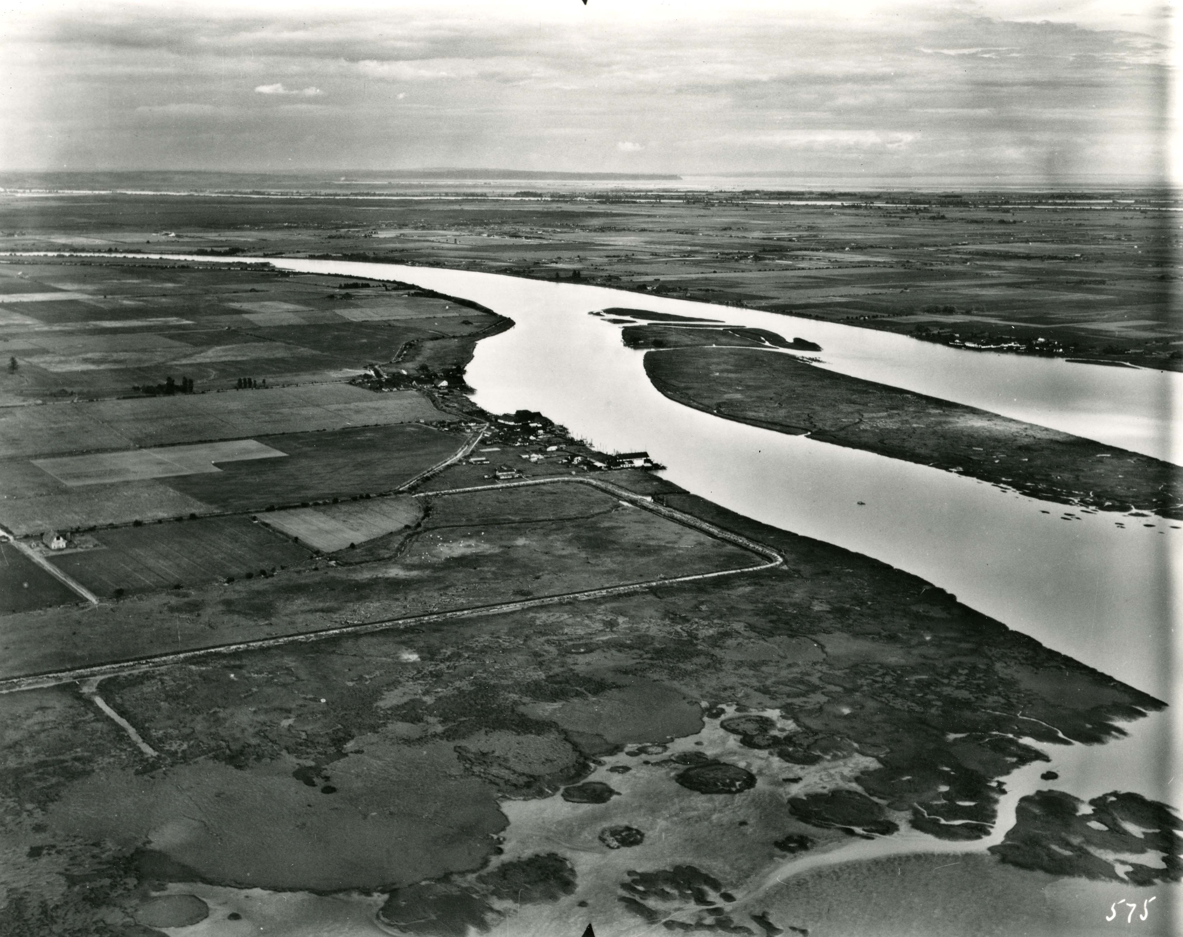
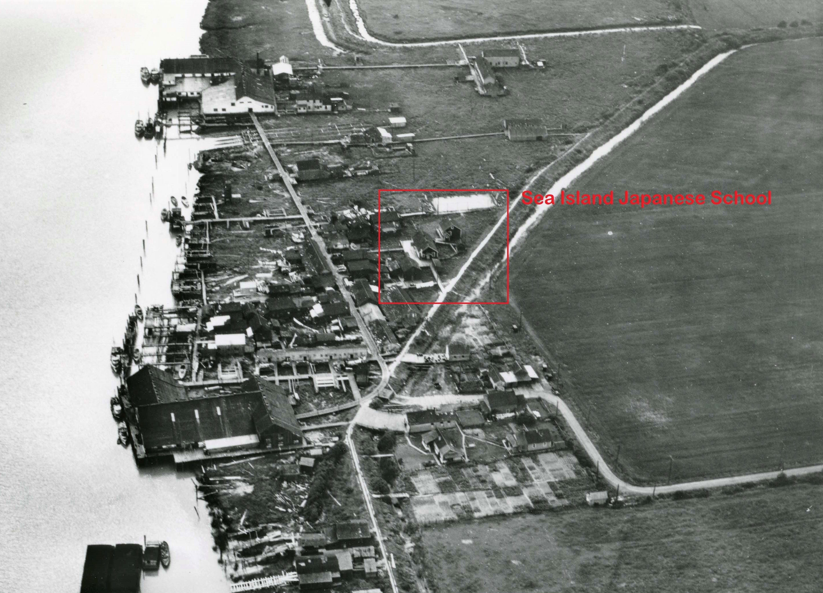
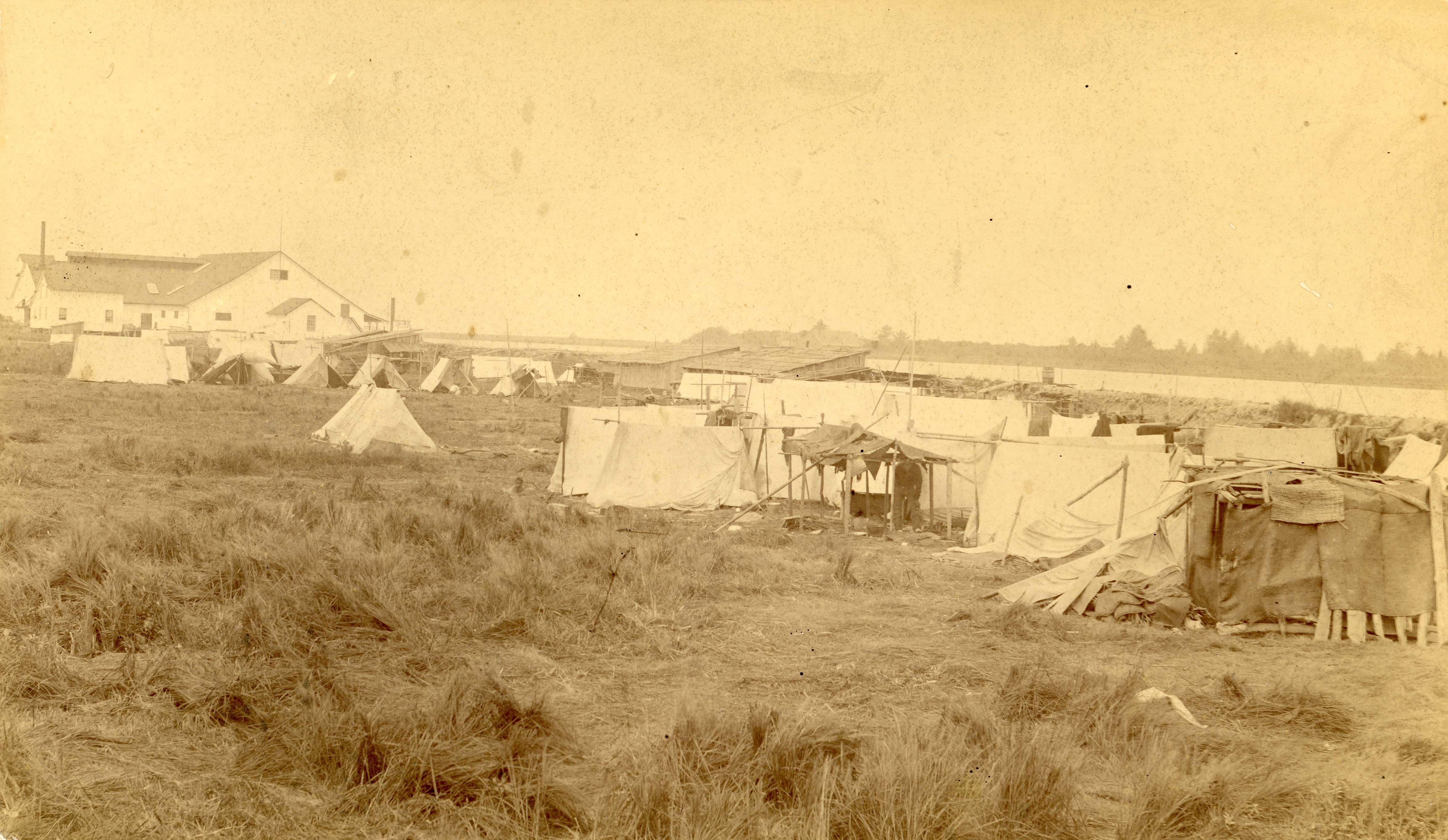
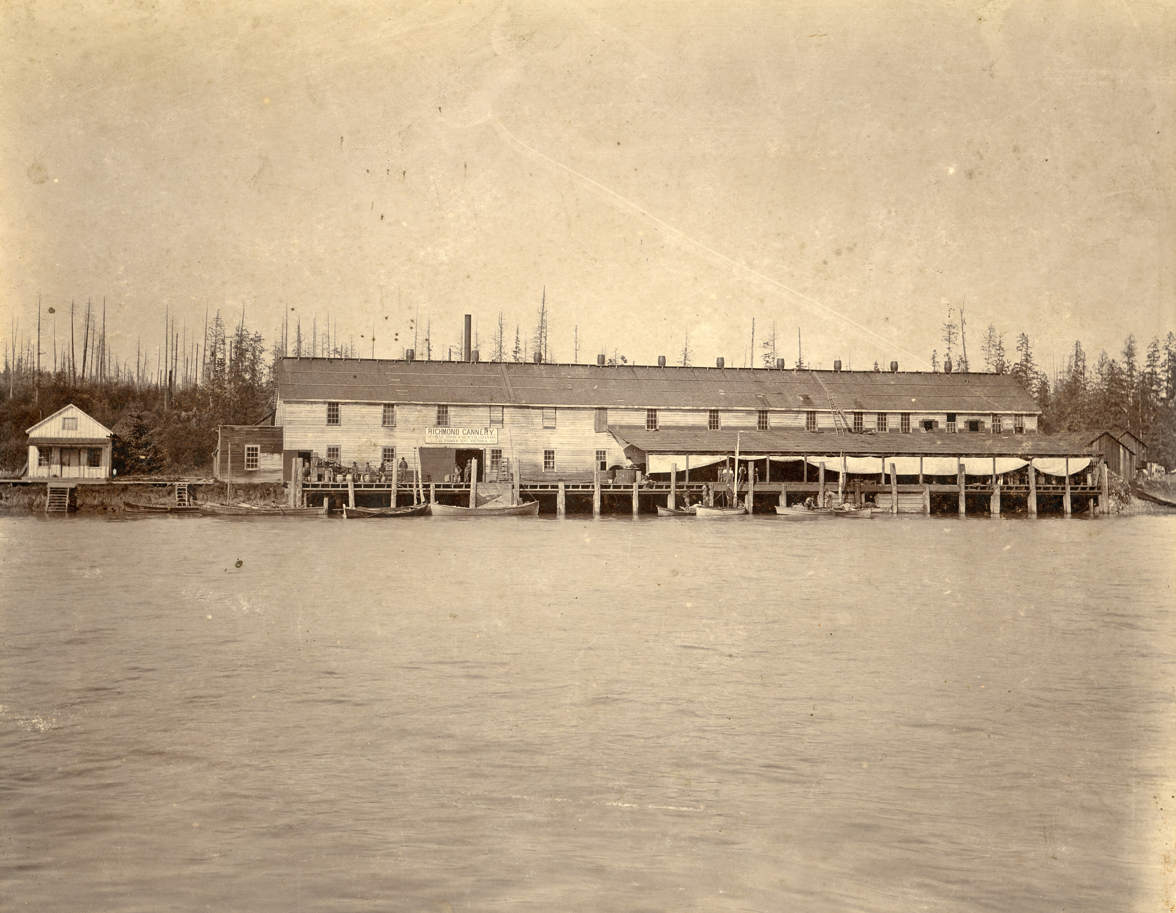
These historical facts have led me to think more about Richmond. I worked within its local government for almost three decades and I’ve resided here since 1991. My aunt, uncle, and cousins lived near the corner of No. 1 Road and Francis Road in the 1960s, but recently I began to wonder about the Chinese people who settled here over a century ago. Who was present when the Exclusion Act came into force in Richmond? The stories of the Chinese fish cannery workers and farm labourers have been documented, mostly single men who worked these seasonal jobs, and then perhaps retreated to Vancouver’s Chinatown during the wintertime. But what of the families who may have lived here? How many men and women were fortunate enough to stay together, earn a living, and raise a family on Lulu and Sea Islands? 

My research these days focuses on discovering the identities of these people, and I begin with LAM Ching Ling, proprietor of the Hong Wo Store in Steveston. His career as a general merchant, farmer, and labour contractor is well known, and has been highlighted in an informative and interesting post from May 2023, researched and written by John Campbell, Social Media Coordinator with the Friends of the Richmond Archives. https://richmondarchives.ca/2023/05/11/peace-together-ling-lam-and-the-hong-wo-store/  

To start my search, I visited the City of Richmond Archives last fall. Knowledgeable staff there pointed me towards an impressive number of municipal and community records available for consultation. These included Council minutes, voters’ lists, and directories. Most important was A Thematic Guide to the Early Records of Chinese Canadians in Richmond, prepared for the Archives by Claudia Chan in August 2011. It is an excellent summary of all the records pertaining to early Chinese Canadians held by the Archives at that time. Reading this led me to the biography files of some of the early Chinese pioneers of Richmond, LAM Ching Ling among them.

His connection to the fishing and farming industries was well documented, but more personal details about his life with family and community were scant. Using the array of genealogical resources now available, my goal is to begin adding extra layers of details to his biography, so that we may better come to know this important figure in the story of our City. I see this as the first in a series of similar stories about the other Chinese Canadian pioneer families of Richmond.


LAM4 Zoeng1 Ling6 (in Jyutping Cantonese romanization); LIN Zhang Ling (in Pinyin Mandarin romanization); LAM Ching Ling.

LAM Ching Ling was born on 1 August 1873 in Sun Wui county, Kwangtung (Guangdong) province, China.  Sun Wui is also known as SunWoy and as XinHui in Pinyin. The village where he is from has been written as Goo Chung, Goo Dung and Kwo Jung in various Canadian government documents.

Ling LAM (City of Richmond Archives Accession 2013 52.)

He arrived in Vancouver, B.C. in March 1890 aboard the vessel S.S. Abyssinia, and registered with the authorities on 7 March 1890. Prior to departure from Hong Kong, he had paid the $50 head tax to enter Canada.

His name was recorded in the General Register of Chinese Immigration as JUNG Ah Tuen and his entry is given the Ottawa serial number 6242, in row seventeen about two-thirds down the page.

The Register recorded various details about each individual; name, port, place and date of registration; number and date of issue of any certificates received; amount of head tax paid; sex; age; city or village, district, province of birth in China and last place of domicile; occupation; and the port and date of arrival and name of vessel on which the immigrant arrived.

LAM Ching Ling or JUNG Ah Tuen as he was then called, was listed as a “Canneryboy” and it’s notable that his height of five feet one inch was recorded and various facial markings such as moles and scars were listed under column nineteen, Physical Marks or Peculiarities. The Canadian government went to great lengths to identify and keep track of all these immigrant to the country.

General Register of Chinese Immigration page for LAM Ching Ling, serial no. 6242, http://central.bac-lac.gc.ca/.redirect?app=immfrochi&id=6242&lang=eng

During his lifetime in Canada, LAM Ching Ling was known by various names. These included JUNG Ah Tuan, JUNG Ah Leun, LAM Ling, LEM Ling, CHUNG Chong, LIM Chong Ling, Hong Woo LAM and Hong Wo LAM. He is listed as LAM Duck Hew on some documents issued to his children.

He was commonly referred to as LAM Ching Lam, which may be spelled in Jyutping as LAM4 Zoeing1 Ling6. (The numbers refer to the Cantonese language tones.) The Chinese characters for this name are shown on his Chinese Immigration C.I.9 travel certificate issued in 1927, and are read from left to right.

C.I.9 travel permit issued to JUNG Ah Luen in 1927 https://heritage.canadiana.ca/view/oocihm.lac_reel_t16601/382

On his grave marker at Mountain View Cemetery in Vancouver, his name written in Chinese characters can be spelled in Jyutping as LAM4 Dak1 Diu6. This may be his name taken after marriage. LAM is the first character of the column, Dak Diu are the third and fourth. The second character, Gong, is an honorific used to respectfully refer to the deceased male.

Grave marker of LAM Ching Ling, Mountain View Cemetery, Vancouver, B.C. C.Sihoe photograph, 2025.

 ZIU6, Zhao, Chew, Chiu, Chu, Jew

CHEW Gore was born on 9 April 1875, in Sun Wui (Sun Woy, Xinhui) county, Kwangtung (Guangdong) province, China. Some documents list her birth village as Sue Kai; others list it as Kwo Jung, the same village where her husband was born.

Photograph from LAM Chew See’s C.I.44 document issued in 1924. https://recherche-collection-search.bac-lac.gc.ca/eng/home/record?idnumber=254727&app=immfrochi&ecopy=t-16183-00109

She departed from Hong Kong aboard the vessel Empress of Japan and arrived at Vancouver in June 1899.  She was registered under her birth name JEW Gow.

General Register of Chinese Immigration page for JEW Gow, serial no. 30707. http://central.bac-lac.gc.ca/.redirect?app=immfrochi&id=30712&lang=eng

She had travelled to Canada with her husband, LAM Ching Ling, recorded this time in the General Register as LEM Ling, and their seven months old daughter, LEM Kim Fon. LAM Ching Ling had returned to China sometime in the late 1890s.

He was now classified as a merchant and head tax payments for himself and daughter LEM Kim Gon were later refunded. It would be expected that JEW Gow, being a merchant’s wife, would have been exempted from the head tax payment as well, but she was classified as a housewife upon entry and pays the $50 fee.

After marriage JEW Gow would often be referred to as LAM Chew Shee, meaning “a woman born of the CHEW clan and married to a LAM”. 

LAM Ching Ling and LAM Chew Shee had six children:

The eldest child and first daughter was Kim Fon, also known as Fanny. She was born in 1898, in China. She died in 1918.

The next five children were all born in Canada. Names are shown in English, Jyutping, and Pinyin romanization.

Mary (LAM4 Ping4 Ngoi3, LIN Pingxi) born, 31 October 1900, died 1990;

George (LAM4 Fuk1 Tin4, LIN Futian) born, 20 March 1904, died 1970;

John (LAM4 Fuk1 Coeng4, LIN Fuxiang) born in 1908, died 1922;

Jessie born on 24 October 1910, died in 1995; and

Dorathea (LAM4 Cai4 Mei5, LIN Qimei, ) born on 9 September 1916, died in 1947.

Mary LAM was born in Steveston. A doctor was present at her birth. LAM Duck Heu is named as her father and it is recorded that she is the second child born to CHEW Shee. Their address is given as 1452 East 11th Avenue in Vancouver.

Birth Registration certificate for Mary LAM. https://search-collections.royalbcmuseum.bc.ca/Image/Genealogy/f722893d-be21-43ab-bfc8-3248a82fad44 

An entry for the LAM Ching Ling family has been recorded in each Census of Canada for the years 1901, 1911, 1921, and 1931. (The microfilm records of these documents are often of poor quality, making the deciphering of the census taker’s handwriting difficult. Sometimes the handwriting itself is almost illegible. The names given are taken from the Ancestry.ca website, and often represent their researcher’s “best guess”.)

In the 1901 Census of Canada, LAM Ching Ling is listed as LING Lim, 28, living and working in Richmond, B.C. as a General Merchant. Named, as well, are his wife, Gem Ling, 26, and two daughters: Com Fung Lung, 2, and Ping Wye Ling, 1., lines 39-42. http://central.bac-lac.gc.ca/.redirect?app=census&id=33558608&lang=eng

In the 1911 Census of Canada, he is listed as HONGWO, Isac, 37, and residing at 9 Broadway E. in Vancouver. His family includes wife Laren, 35, and five children: daughters Mung, 12, Mary, 10, and Bessie, 8 months; and sons George, 7, and Charot, 2., lines 22-28.  http://central.bac-lac.gc.ca/.redirect?app=census&id=6818361&lang=eng 

Entry for the LAM Family in the 1911 Census of Canada.

In the 1921 Census of Canada, he is listed LING Lenn, 48, and residing at 605 Broadway E. in Vancouver. His spouse is Chee Ling, 46, and their five children are George, 17, John 13, Mary, 20, Jessie, 10, and Dora, 5., lines 44-50.  http://central.baclac.gc.ca/.redirect?app=census&id=66466013&lang=eng 

In the 1931 Census of Canada, he is listed as LAM Hongwo, 57, and living at 1452 East 11th Avenue in Vancouver. He is classified as a merchant working in a general store. Family members include wife Stell, 55, and four children: Mary, 28, Jessie, 20, George, 26, and Dora, 15., lines 42-47.  http://central.bac-lac.gc.ca/.redirect?app=census&id=85837223&lang=eng  

On 28 June 1924, in Vancouver, LAM Ching Ling, and his family, registered as per Section 18 of the Chinese Immigration (Exclusion) Act of 1923. Every person of Chinese descent or origin (i.e. immigrant or native-born) was required to register his or her presence with a government official. These were often local police officers or postmasters.  LAM Ching Ling was issued C.I.44 certificate number 52656. Note that he is referred to as CHUNG Chong.

http://central.bac-lac.gc.ca/.redirect?app=immfrochi&id=254954&lang=eng 

On this document, his family is listed as: wife LIM Chew Shee, 1 son LIM Fook Ten (George), 3 daughters LIM Ping Oy (Mary), LIM Chu Yen (Jessie), and LIM Tie Mee (Dora).  Daughter Fanny (Kim Fon) had passed away in 1918, and second son John in 1922.

http://central.bac-lac.gc.ca/.redirect?app=immfrochi&id=254727&lang=eng 

http://central.bac-lac.gc.ca/.redirect?app=immfrochi&id=254662&lang=eng 

http://central.bac-lac.gc.ca/.redirect?app=immfrochi&id=254664&lang=eng

http://central.bac-lac.gc.ca/.redirect?app=immfrochi&id=254658&lang=eng

http://central.bac-lac.gc.ca/.redirect?app=immfrochi&id=254660&lang=eng

The Canadian government implemented an expansive system of paperwork to record, track, monitor and control the movements of the Chinese people travelling to, from and within Canada. Upon arrival and after registration, a new immigrant would receive their head tax certificate, known as the C.I.5 or C.I.30 if exempted from payment, which served as the primary means of identification. If lost or destroyed, a C.I.28 was issued as a replacement.

JEW Gow’s C.I.5 certificate is replaced by C.I.28 certificate no. 12219, on 1 December 1924, although it had been endorsed as early as 28 June 1924. 

Page from the C.I.28 Register for JEW Gow, no. 12219. https://heritage.canadiana.ca/view/oocihm.lac_reel_t3486/710

On 13 June 1925, LAM Ching Ling’s C.I.5 certificate, is either lost or damaged, and is replaced by C.I.28 certificate no. 12350.

Page from the C.I. 28 Register for LAM Ching Ling, no. 12350. https://heritage.canadiana.ca/view/oocihm.lac_reel_t3486/711

During this time, any Chinese person wishing to leave Canada temporarily had to apply for a special travel document known as a C.I.9 certificate. On 7 July 1927, the LAM family received theirs for an intended trip to Seattle, Washington by CPR Local rail. On LAM Ching Ling’s C.I.9 no. 59670, his proper name is given as JUNG Ah Luen. https://heritage.canadiana.ca/view/oocihm.lac_reel_t16601/382

Note the lack of a signature on CHEW Gore’s document. https://heritage.canadiana.ca/view/oocihm.lac_reel_t16601/383

In the 1931 Census of Canada, LAM Ching Ling and his family are listed at 1452 East 11th Avenue, District 235 Vancouver Burrard, sub-district no. 52, Vancouver City, p.9. He is named as LAM Hongwo. Occupations are listed for each family member: LAM Hong Wo – merchant; his wife Shee – homemaker; Mary – teacher; Jessie – stenographer; George – laborer; and Dora – student.

LAM Ching Lam died on 20 August 1939. His obituary appeared in the Vancouver Daily Province, 21 August 1939. page 13.

The funeral procession was noted in the Vancouver Sun, 24 August 1939, page 12.

Services for LAM Ching Ling were described in the Vancouver Daily Province, 24 August 1939, page 24. Note the mention of a brother living in Steveston.

LAM Ching Ling is interred at Mountain View Cemetery in Vancouver and is recorded as CHUNG Ling Lam in its database. https://covapp.vancouver.ca/BurialIndex/PersonDetail.aspx?PersonId=d1c14bed-1f6c-420e-a290-2c63fbdcbc7e

LAM Chew Shee died on 20 February 1947.  Place of burial is Mountain View Cemetery, Vancouver, B.C. Her obituary appeared in the Vancouver Daily Province, 22 February 1947.

Most members of the LAM family are interred or commemorated at Mountain View Cemetery, in Vancouver, B.C. Photographs were taken on 22 March 2025.

Translation of the Chinese characters is approximately as follows. 

On the left side, four characters: Woman of the CHEW clan who entered the LAM household.

On the left side column: The grave of Mrs. LAM Dak Diu.

On the right side column: The grave of Mr. LAM Dak Diu

Frank Shong is the husband of Mary Mah.

Conclusion

The City of Richmond Archives has a significant number of records from the Hong Wo Store. These records, currently being cleaned by a conservator, will be accessible to researchers, possibly by the end of 2025. A preliminary review of some of these documents, as well as others, leads me to believe that LAM Ching Ling’s brother was involved in the store’s operation. That idea, the achievements of some of the children of LAM Ching Ling and CHEW Gore, and the stories of Richmond’s other pioneer Chinese Canadian families, will all be the subjects of posts in the future.

Symbols of the City – Richmond’s Visual Identity

A city or municipality needs to define itself with a symbol of its identity, a connection to its history and a visual representation of its stature and image. Coats of Arms, official seals, flags, and logos all function to promote a positive public image to residents, visitors, and potential investors, as well as serve to authenticate documents and official correspondence. Here is a brief history and explanation of Richmond’s symbols.

The Official Seal

On November 10, 1897, Lulu and Sea Islands became the Corporation of Richmond by Letters Patent under the Public Seal of the Province of British Columbia. One of the orders of business during the first year of Richmond’s incorporation was the adoption of an official seal. Used to authenticate legal documents and be a credible indication of the validity of municipal documents, Richmond’s first official seal was adopted at the Council meeting of Saturday June 19, 1880. The entry in the minutes reads, “Moved by Councillor Smith seconded by Councillor Kilgour that the seal impressed on the margin be adopted as the seal of the Corporation of Richmond … Carried”. In the left margin of the page beside the entry, a blob of red sealing wax is impressed with an indistinct shape.

The first Seal of the Corporation of Richmond, adopted June 19, 1880 as shown in this photo from the Council minutes. City of Richmond Archives photograph.

The first seal was not in use for very long. It was quickly replaced by the more modern embossed seal using a design which has symbolized Richmond up to today, the Cornucopia (Horn of Plenty). The design was suggested by Richmond’s first Warden (Reeve, Mayor) Hugh Boyd and was adopted at the July 5, 1880 council meeting. It shows the cornucopia in the centre, encircled by the words “Municipality of Richmond B.C.” In the words of early Richmond historian Thomas Kidd, it was “considered a very appropriate symbol at that time and it is to be hoped that the prosperity of these islands will always justify it remaining so.”

The embossed Corporate Seal of the Municipality of Richmond is shown here in the minutes from the July 5, 1880 Council meeting. The entry says, “Moved by Councillor Kilgour seconded by Councillor Steves that the new seal impressed on the margin be adopted as the Corporate Seal of Richmond in lieu of the one adopted on the 19th of June… Carried.” City of Richmond Archives photograph.
A colourful version of Richmond’s seal. City of Richmond Archives photograph.

The cornucopia has been a constant symbol of Richmond’s identity, the image changing slightly over the years and the text changing from “Municipality of Richmond B.C.” to “The Corporation of the Township of Richmond B.C.” to “Corporation of Richmond” with “Incorporated 1879” placed inside the circle. In 1979 in celebration of Richmond’s 100th Anniversary a new emblem of the Corporation was unveiled, still bearing the image of the cornucopia but incorporating registered symbols of heraldry.

The Coat of Arms

In August 1978 the Richmond’s Municipal Council adopted a resolution to petition the College of Arms in London, England to grant the Municipality a Coat of Arms and Badge as part of the celebrations around the Municipality’s centennial on November 10, 1979. After consultation with Mr. Robert D. Watt, Chief Curator of the Vancouver Centennial Museum and a Director of the Heraldry Society of Canada, a letter was sent to the York Herald of Arms, Dr. Conrad Swan, PhD., M.A., requesting that the Municipality be granted a Coat of Arms and badge. Some preliminary design ideas were provided which were considered, modified slightly to conform with the requirements of the Kings of Arms and approved. Once the design was approved the process of producing Letters Patent of Armorial Bearings was undertaken over several months. The Letters Patent were presented to the Corporation of the Township of Richmond by Lieutenant Governor Henry Bell-Irving, representing the Crown and assisted by Dr. Conrad Swan, York Herald of Arms at a ceremony on November 10, 1979, the centennial of the incorporation of Richmond.

The Letters Patent granting the Coat of Arms to Richmond and bearing the seals of the Kings of Arms. The text opens with the salutation, “TO ALL AND SINGULAR to whom these Presents shall come Alexander Colin Cole, Esquire Commander of the Royal Victorian Order upon whom has been conferred the Territorial Decoration, Garter Principal King of Arms, Sir Anthony Richard Wagner, Knight Commander of the Most Honourable Order of the Bath, Knight Commander of the Royal Victoria Order, Clarenceux King of Arms and Walter John George Verco, Esquire, Commander of the Royal Victoria Order, Norroy and Ulster King of Arms Send Greetings! ” City of Richmond Archives photograph.

Heraldry harks back to the 12th century when the markings were used to identify the warriors on the battlefield, much like the colours and logos on the uniforms of modern sports teams. A Coat of Arms is made up of several elements:

The Coat of Arms of Richmond. City of Richmond photograph.

Colours – The predominant colours in Richmond’s Coat of Arms are Blue and Gold.

The Shield The shield is gold with a wavy blue bar, known as the pale, symbolizing the Fraser River and featuring three leaping salmon, representing the most common species in the waters around Richmond and its links to the fishing industry. From the Letters Patent: “Or on a Pale wavy Azure three leaping Salmon proper”.

The Helmet and Mantling Above the shield sits a helmet mantled in blue and gold.

The Crest and Wreath – Atop the helmet is the wreath of gold and blue supporting a circlet of red maple leaves, representing Canada, and white dogwood flowers for British Columbia. The Crest is a dove rising with an olive twig in its beak, relating to the story of Noah and land rising from the waters as the islands of Richmond have. From the Letters Patent: “And for the rest Upon a Helm with a Wreath Or and Azure Rising from a Circlet of Maple Leaves Gules and Dogwood Flowers alternatively a Dove volant in its beak a sprig of Olive proper”.

The Supporters On either side of the shield are two supporters, both representing the Goddess Fortuna, the bearer of prosperity. Each supporter holds a cornucopia, representing the fruitfulness of the land. The supporter to the right of the shield wears a red ribbon embroidered with white roses. The red and white represents Canada while the white roses represent the first Richmond in Yorkshire which has white roses in its coat of arms. From the Letters Patent: “Supporters following that is to say: – On the Lecter side a female figure proper crined or vested Argent supporting with the exterior hand a Cornucopia at the mouth its tail over her shoulder proper On the sinister side a like figure above her shoulders a Riband Gules thereon Roses Argent barbed and seeded proper and supporting with the exterior hand a Cornucopia by its tail also proper its mouth to the ground”.

The Compartment – The area upon which the shield and supporters stand is known as the compartment and shows green foliage and stems of blueberries, a common local crop, and once again representing the fertility of the land. From the Letters Patent: “the Compartment comprising a grassy mount with sprigs of Blueberry fructed growing therefrom all proper”.

The Motto – Below the compartment is a banner with the Motto, “Child of the Fraser.” The Motto comes from the first line of the poem “Lulu Island” by early Richmond settler and historian Thomas Kidd. The first verse of the poem reads, “Child of the Fraser River and the Sea, / Fair Lulu Island where I built my home, / Though I had seen fair lands ere I saw thee, / I came and saw and said, ‘No more I’ll Roam.'”

The Badge

Richmond’s Badge. City of Richmond photo.

Included with the granting of a Coat of Arms is a Badge. Richmond’s Badge shows an anchor, signifying the sea and a connection to the fishing industry, and a strawberry vine and blossoms, signifying the fruitfulness of the land. The strawberry blossom also connects to the Coat of Arms of the Frasers, which also carry the strawberry blossom and gives a link to the Fraser River. From the Letters Patent: “And We do further grant and assign the following Device or Badge that is to say:  An Anchor Azure charged in base with a Strawberry Flower proper from the ring reflexed towards the sinister fluke and behind the Anchor’s stock a branch of Strawberry flowered and leaves proper”.

The Flag

On July 22, 1985, Municipal Council directed staff to prepare a report on the design of a civic flag. The civic flag was designed by Municipal employees Rod Lynde with assistance from Frank Sciberras and was officially introduced to the public at the opening of Brighouse Park on April 12, 1986 by Mayor Gil Blair.

The civic flag of Richmond. City of Richmond Archives photograph.

The flag is blue and gold, Richmond’s accepted colours. The shield in the centre of the flag is from the Coat of Arms, gold with a wavy pale bar in blue and three salmon. The gold background and blue borders of the flag represents Richmond’s fertile lands surrounded by the waters of the Fraser River.

The Heron Logo

Richmond’s most familiar symbol today is based on the bird commonly seen fishing in the shallows around our city. The stylized heron logo is simple, yet iconic and was first used by Tourism Richmond in the 1990s. This first logo featured the words “Richmond – Island City, by Nature” with the heron’s head rising from the “N” in Richmond.

This Tourism Richmond Visitor Guide cover image using the stylized heron logo was published in 1995. City of Richmond image.

The heron logo and slogan was adopted a in 1998 by Richmond’s Year 2000 Committee. In 2000 the City also adopted the heron logo, but in 2002 changed the slogan to “Better in Every Way” as part of a promotional campaign to attract investment to the city.

The “Better in Every Way” tagline on the Heron logo lasted only for a few years.
City of Richmond image.

In 2008, with the 2010 Winter Olympics on the horizon, the City adopted a new consolidated visual identity and logo for itself and its partners, one which would reflect the past but fit in with the changes occurring with the Olympic era. The new logo was also a stylized heron, but facing to the right and in colours consistent with the Olympic palette, although the design’s colour is easily changed for other uses. The design of the heron demonstrates the elements of flow, flight, and fusion – concepts used in the design of Richmond’s Olympic Oval. The “Better in Every Way” logo was dropped and a new tagline, “Soar Beyond” was suggested. The design was accepted by the committee but the new tagline was rejected and the tried and true “Island City, by Nature” was preserved to be used when a slogan was found to be desirable.

The new heron logo was adopted in 2008 and appears in colours consistent with those of the 2010 Olympics. City of Richmond image.
The heron logo in basic black identifies vehicles and equipment in the City’s fleet. City of Richmond photograph.

The City’s corporate symbols have changed over its history but it retains an image from its earliest past with the cornucopia in the Coat of Arms, still used in official documents, and an image from more recent times, the stylized heron seen widely around the city on signs, buildings, and City vehicles. The future may bring new designs to represent our city but the images shown in this post will always remain as a part of Richmond’s visual identity.

“No Better Than a Duck Pond” – Richmond’s Historic Floods

The City of Richmond is built on islands located on the flood plain of the Fraser River, surrounded by the river and exposed to the Strait of Georgia on the west. With an average elevation of just one metre above the present mean sea level, Richmond faces flooding from extreme storm surges, intense rainfall, high tides and seasonal rises in river flows and levels. It was not until the arrival of non-Indigenous settlers in the Lower Mainland that textual records of floods and the damage they caused to dykes, crops, livestock and structures were made, most often in the newspapers of the day. Early landowners in Richmond began the process of dyking the land, usually their own properties, and building flood boxes to allow drainage at low tide and blocking the ingress of water at high tide. Soon, dyking districts were formed which provided funds for dyking and drainage projects through taxation and by the mid 1930s these were amalgamated under the control of the Richmond Municipality. The improvements made by Richmond over the years, ditches, canals, electric pump stations, box culverts and dyke upgrades, have greatly lessened the impact of floods on the city. This post describes some of the floods that occurred through Richmond’s history and some of the steps taken to reduce their consequences.

Several men watch from what is probably the flood box at the north end of No.2 Road while children appear to swim in the outflow, ca. 1930. The No.2 Road flood box was the first in Richmond, built before incorporation. Flood boxes have a balanced gate that allows water to flow out during low tides but blocks water from flowing back in when the tide is high. City of Richmond Archives photograph 1987 104 38.

November 1871 – An intense storm blowing up the river combined with a high tide and storm surge caused dykes to be washed away in Ladner and flooding to occur. While Richmond, which was not incorporated until 1879, was not mentioned in reports, the storm did cause significant damage to the Sand Heads Light Ship, dismasting it and tearing up parts of its deck. It was towed to New Westminster for repairs.

May to June 1894 – The “Great Flood of 1894” caused extensive flooding and damage all through the Fraser Valley. An extreme spring runoff brought on by a cool summer of 1893 which failed to melt snow in the mountains, a record snowfall through the winter of 1893-94 and rain and a heat wave at the end of May raised river levels to the highest ever recorded, 25.75 feet at the Mission Bridge. Dykes were destroyed, bridges and wharves washed away and farms were inundated destroying crops and drowning cattle and causing substantial loss of human life. In Richmond by June 1st, the flood had scoured out the fill around the pilings on the newly completed North Arm (Fraser Street) Bridge, causing about 200 feet of it to be carried away a few days later. Lulu Island was reported to be seriously flooded due to breaks in the dyke at Scott’s Mill at the Queensborough end of the Island and then over the main dykes at high tide. Damage in Richmond Municipality was estimated to be $2000 to the North Arm Bridge and a further $7000 in crop loss due to the flooding.

Steveston, shown here in 1891, was flooded several times in its early history. Cannery floors were awash in water and the plank roads shown here were floated up and washed away. City of Richmond Archives photograph 1984 17 75.

January 1895 – Six months after the 1894 flood, Lulu Island was again hit by flooding, this time by a combination of high river flows and extreme high tides with a strong west wind. Dykes on Lulu Island were washed away in many places, flooding large areas of farmland. Root crops stored in pits were destroyed along with large quantities of potatoes. Houses and barns were flooded and bridges over ditches and canals were washed away. Sea Island was reported to be under as much as three and a half feet of water. In Steveston water flooded over the floors of canneries and some residents had to leave their houses. Steveston’s plank roads floated and were swept away by the water.

1900 – The first of Richmond dyking districts was formed when landowners petitioned the Provincial Government to allow taxation for the construction of dykes and drainage systems under the authority of the Drainage, Dyking and Development Act. The New Lulu Island Slough Dyking District was responsible for the land encompassing the slough complex from Francis Road south to the river. Before this time landowners dyked their own property with other areas being handled by the Township. Commissioners were elected to administer the district and an engineer was hired to draw up technical plans and assessments of the land.

Headlines in the December 27, 1901 Vancouver Daily Province describe some of the damage to Richmond in the 1901 flood.

December 26-27 1901 – Richmond was hammered by a severe gale directed squarely at the mouth of the Fraser combined with very high tides. This was the most extensive and damaging flood in Richmond since 1894. Several canneries were heavily damaged and one, the Labrador Cannery at Terra Nova, was completely destroyed. Miles of dykes were lost along the North and Middle Arms of the river, fishing boats were swept as far as half a mile into farmer’s fields and smashed up. The Japanese boarding house at Terra Nova collapsed with people trapped inside who were rescued by neighborhood residents. Another boarding house with nine men inside was swept into the river. They managed to get on to the roof of the building where they were rescued by men who braved the storm in two boats. Sea Island and the greater part of Lulu Island were reported to be flooded by two to four feet of water. Steveston was under water and the floors in the Gulf of Georgia cannery were completely covered. Outbuildings at the Colonial Cannery were washed away and the plank roads in Steveston and around Lulu Island floated away.

1905 – The second of the dyking districts was formed. The Lulu Island West Dyking District was formed with responsibility for the area west of No. 3 Road.

November 1913 – The highest tides in ten years combined with a storm surge and high winds caused dykes to give way in many places flooding hundreds of acres of farmland. On Lulu Island, the Bridgeport area was inundated. Water covered roads and fields up to two feet deep, while Bridgeport School was surrounded with about three feet of water. Sea Island was similarly affected with about 500 acres of land flooded after the North Arm dyke was breached at the Cooney property on No.13 (Miller) Road. Damage was fairly light at the north-east corner of Sea Island, although the store and meat market sustained significant damage.

January 1914 – Through January 1914 heavy rains and high tides rendered the municipal drainage systems useless causing high water all along No.20 (Cambie) Road from Bridgeport to No.5 Road. The Bridgeport, Cambie and Alexandra areas were flooded with up to two feet of water. Later in the month, the same conditions, worsened by a gale force wind, washed away 150 feet of the dyke on Sea Island, completely flooding the island. Mitchell island, along with smaller islands in the river were also completely flooded. At a ratepayer’s meeting after the flood, keynote speaker John Tilton stated that “…well dyked and well drained, this island would be a beauty spot of Canada. As it is, it is no better than a duck pond.”

Ditches were excavated along most roads in Richmond to help drain the land and gave rise to the municipality’s nickname of “Ditchmond,” As shown in this photograph, ca. 1920, they could pose a hazard to careless drivers as well. City of Richmond Archives photograph 1978 30 2.

January 1921 – Once again the double hit of heavy rain and high tides caused flooding in Richmond. The flood box on Twigg Island was washed away, resulting in the island being completely inundated every time the tide came in. On Mitchell Island a poorly reconstructed dyke, built after the construction of Union Cedar Mills, allowed tide water to surge over and flood the island. On Lulu Island unfinished dykes on the North Arm and on the South Arm at the London property allowed the water to wash over. Large parts of the Alexandra and Garden City areas were flooded. A public meeting held at Richmond Townhall saw citizens, who had already willingly taxed themselves for dyking and drainage to an amount equal to half the general taxes of the municipality, advocating for the installation of powerful electric pumps to drain the island.

January 1933 – The New Lulu Island Slough Dyking District installed the first electric pump in the dyking and drainage system on the South Arm between No. 3 and No. 4 Roads. The 60 horsepower pump would operate automatically only during the highest tides when the flood boxes become ineffective. The pump was expected to remove 16000 gallons per minute and would drain about 4300 acres of land.

People pose in front of the first electric pump in Richmond’s dyking and drainage system, located between No. 3 and 4 Roads on the South Arm. City of Richmond Archives photograph 1988 17 112.

January 1935 – Heavy snowfall followed by higher than normal temperatures and heavy rain caused flooding in the Fraser River Valley and drainage problems in Richmond. Lulu Island was reported to be a series of small lakes and Lansdowne and Brighouse Racetracks were completely flooded.

Water flows onto Lulu Island through a breach in the dyke in 1953. Tire tracks indicate attempts to block the flow by pushing mud into the break. City of Richmond Archives photograph 1977 1 4.

1936 – The Township of Richmond amalgamated its own works with the other two dyking districts, assuming control of all dyking and drainage activities within its boundaries. The work done on the dyking and drainage system was beginning to have a positive effect on flooding problems in Richmond. While some flooding due to high rainfall was still problematic at times, residents did not seem too concerned about the occasional time when one had to wear gumboots to go into their yards. The Richmond Review boasted in the October 6, 1936 edition, “Richmond the Dryest Place in the Valley.” “Richmond should let the world know that it is about the safest place in time of flood from Winnipeg west. Richmond is so near the sea that excess water can readily escape if given half a chance.” The attention given to improving and upgrading dyking and drainage systems was to continue up to the present day.

February 1945 – “The Great Storm of February 7, 1945” was claimed to have caused the worst flood in ten years. Vancouver newspaper reports said that Burkeville was a chain of lakes with about 25 houses surrounded by water, stranding the residents inside. Acres of Lulu Island were under water. However, the Richmond Review reported, “Flood of Short Duration Here.” The rain which caused ditches to fill and property to flood on Wednesday had all run off by Friday.

1948 – In January high tides and storm surge burst through the dykes on Twigg Island. On Lulu Island a few houses were subject to flooding. Then, in May and June the Fraser Valley was hit by the worst flood since 1894. The 1948 flood was one of the most destructive in BC history, causing widespread damage throughout the Fraser Valley. Richmond, however, got off relatively easily because of the the tremendous organization and mobilization of every available resource led by Reeve (Mayor) R.M. Grauer. With help from the military, volunteer labour from Richmond and other cities in the Lower Mainland and some paid labour, the dykes were monitored 24 hours a day, thousands of sandbags were filled, brush along the dykes was cleared and weak spots in the dykes were shored up. Organizing and supervising the workers on the dykes were Ken Fraser, who took care of Steveston to No.2 Road, Archie Blair, the area between No.2 Road and No. 4 Road, Leslie Gilmore, No. 4 to No.6 Roads, Matthew McNair, No.6 to No.7 Roads, Andy Gilmore, No.7 to No.9 Roads, E. Carncross, No.9 Road to Hamilton, Bob Ransford, Hamilton to the eastern boundary, and Doug and John Savage, the northern boundary to No.8 Road. G. Crosby monitored the Middle Arm dyke on Lulu Island and on Sea Island the Grauers watched the North Arm dyke to Cora Brown, Doug Gilmore, the rest of the North Arm Dyke, Cline Hoggard, the Middle Arm to the Airport and the rest was watched by the Airport Authorities.

Mrs. A. E. Vigar sits on a row of sandbags along the Fraser River in Richmond during the 1948 flood. City of Richmond Archives photograph 1987 30 29.

The logistics involved in the “Battle of the Dykes” were akin to a military operation. Hundreds of workers were mobilized and directed to their stations. Canteens were set up at the various command posts, supplied with coffee, sandwiches, soup, cigarettes, donuts, cases of pop and cookies provided by the Municipality, the Red Cross or donated by Lower Mainland businesses and churches. Drivers were busy delivering supplies to the dykes and the canteens. Businesses and private citizens donated the use of cars, trucks and tractors to the effort. The military provided manpower, vehicles, boats and powerful tugs, able to pull barges of rock and earth against the strong current in the river. To help with communications the BC Forest Service provided two mobile radio units, The BC Telephone Company installed temporary telephones at command posts and BC Electric provided power where necessary. All movement of deep sea vessels was suspended on the river. Towing companies were instructed to use only more powerful tugs, speed limits were imposed to prevent damage to dykes and the size of tows was restricted to single barges and booms with an assisting tug. Bridges were closed to traffic from two hours before until two hours after high tide slack.

A group of students from Richmond High School pose atop a stack of sandbags during the 1948 flood. Male students were excused from classes to help fill sandbags and work at the dykes. City of Richmond Archives photograph 2010 35 5.

To make sure that workers remained focused on the job at hand, the liquor licenses at the Steveston Hotel, the Steveston and Sea Island ANAFs and the Royal Canadian Legion were temporarily suspended. In the event that the worst happened, a train was stationed at New Westminster to assist in evacuating people from Richmond.

A notice published in the June 9, 1948 Richmond Review.

The constant monitoring, shoring up of low spots and reinforcing dykes that began to weep paid off in a minimum of damage in the Municipality. There was only one significant problem reported when a “geyser” erupted on the dyke at the Rice Mill resulting in a breach. About 100 yards of the dyke had collapsed into the river at high tide. Fortunately, as the tide receded the flooding stopped and the gap was filled using the Municipal dragline. Repair work was completed before the tide came back in and flooding didn’t penetrate past the CN Rail line.

A Universal Bren Carrier delivers sandbags to the dyke in this clip from a film taken during the 1948 flood in Richmond. To see the whole video visit https://www.youtube.com/watch?v=pR0czKKsehM .

November/December 1951 – In late November a near hurricane storm system and high tidal surge hit the Lower Mainland. At Richmond, River Road near the Sea Island bridge was under about 6 inches of water. Workers from the Lulu Island Canning Company were set to work packing the dykes with sandbags. In nearby low lying areas houses were surrounded by water up to 10 inches deep. The high tides and strong winds breached a low dyke at the end of No.2 Road in Steveston but the water was held back by a higher inside dyke. The ferry to Ladner was put out of service when a pontoon at the Richmond ferry terminal sank.

Strong winds and high tides wash against the dyke at the end of No.1 Road in Steveston during the November/December 1951 storm. City of Richmond Archives photograph 1977 1 24.

January 1953 – Dirt fill around the new $15000 flood box at Finn Slough washed away resulting in the destruction of the flood box. About 50 yards of the dyke near the foot of No.4 Road washed out “as if cut by a knife.” The location of the break was such that trucks could not be brought in so Councillor Archie Blair used his farm tractor to bring in sandbags and to push mud into the breach and a scow delivered a load of soil. Flooding caused significant damage to the Gilmore farm buildings and the family home. It was discovered that wing dams and modifications made by the Federal Government to the south shore of the river in an attempt to increase the water velocity and make the river “self-dredging,” redirected the flow, causing it to scour the area between Woodward’s Landing and Steveston and undermine the dyke. High seasonal tides then ended up breaching the dyke. The dyke was subsequently repaired and armoured with rock.

The brand new Finn Slough flood box was destroyed when soil around it was washed away in 1953. City of Richmond Archives photograph 1977 1 8.
The Gilmore house is surrounded by water in this image from the 1953 flood. The area around Finn Slough could be problematic during high drainage loads and dyke breaches. City of Richmond Archives photograph 1977 1 10.

November 1954 – Very heavy rainfall overwhelmed the drainage system causing an accumulation of water in Richmond that filled ditches and backed up onto the surface of the land. The No.3 Road pump had lost a top main bearing making the situation worse. The most affected area was in the Grauer subdivision and the rest of the area drained by the No.4 Road canal. Crown Zellerbach helped out by placing nine large pumps at Finn Slough which assisted the municipality’s pumps by drawing an additional 22,000 gallons a minute.

Kids wearing gumboots wade in their yards on Dixon Avenue during the 1954 flooding. City of Richmond Archives photograph 1977 1 118.

November 1955 – Heavy rainfalls caused flooding around the Lower Mainland but, according to reports in the Vancouver Sun, flooding in Richmond was “much less than expected.” While some ditches overflowed onto roads, fields and lawns, the municipality’s canal drainage system speeded up the runoff significantly.

The use of natural drainage channels forms part of the strategy of removing water from Richmond. This aerial view, ca. 1980, shows Woodwards Slough which drains into the South Arm near Finn Slough. A flood box and pump station ensure efficient water removal. Horseshoe Slough and Bath Slough are also part of the drainage system. City of Richmond Archives photograph 1988 123 745.

December 1957, January 1958 – High tides, wind and heavy rain caused water to go over the dykes on Mitchell Island. About 100 homes in Richmond were surrounded by water due to blocked drains in the drainage system.

Drainage canals have been an effective way of moving large amounts of water out of Richmond. This image shows the north end of the Gilbert Road canal and pump station. The canal has since been replaced by a box culvert. City of Richmond Archives photograph 1988 123 689.

December 25-26 1972 – Water from rain melting snow caused flooding around Richmond, and damage at the municipal offices.

February 1976 – An exceptionally high tide caused flooding one foot deep around about fifty homes in the Cambie and River Road area when a temporary rock dam was breached where a new pumping station was being installed on the Middle Arm.

The large open drainage canals have been replaced for the most part by enormous box culverts like this one on Gilbert Road which replaced the canal shown in the previous photograph. City of Richmond Archives photograph 1988 123 445.

December 1979 – Once again, extremely heavy rainfall caused drainage problems around Richmond. The flooding caused sanitary sewers to back up at London Junior Secondary School, flooding the gym and closing the school. Wet cables caused the loss of telephone service to about 1000 customers.

To the present- The improvements made to Richmond’s dyking and drainage system have been continuous since the first hand built dykes in the 1800s. Today, around 49 km of dykes hold back water from the sea and the river. 598 km of drainage piping, 61 km of culverts and 151 km of open watercourses move water out of the city. Thirty-nine pump stations, capable of removing 5.3 million litres of water per minute, are ready to discharge rainwater to the river and ocean. Sensors provide real-time information about river levels, rainfall and the drainage of storm water and analysis of weather patterns, snowpack and predicted runoff warn of potential risks to the city. Regular inspection and maintenance of the whole dyking and drainage system takes place with increased patrols during higher risk periods. Richmond’s dyking and drainage system is designed to withstand a one in 500 year flooding event, something that has a 0.2% chance of occurring in any given year. A case in point is the 2021 atmospheric river event, which broke rainfall records around the Pacific Northwest and caused extensive damage in many places, was handled well by Richmond’s system although localized drainage problems did occur.

Many of Richmond’s upgraded pump stations feature public art displays. This image shows the Shell Road North Drainage Pump Station which was upgraded in 2020. The walls show large maps of Richmond with bridges, roads and highways, as well as the paths of some of the City’s historic slough waterways. City of Richmond Engineering and Public Works: Richmond’s Drainage Pump Stations, July 26, 2024. https://corportal1.richmond.ca/portal/apps/storymaps/stories/c4d06a030aa845c981117f95727a4e26

To the future- To prepare for climate change induced sea level rise and increased rainfall the City’s Engineering and Public Works Department has developed a flood protection strategy to prepare for emergencies. To ensure Richmond and its residents remain safe, the City has one of the most comprehensive flood protection systems in BC. To learn about it, visit the City of Richmond’s website at https://www.richmond.ca/services/water-sewer-flood/dikes.htm

Cannery Row – The Middle Arm Canneries

The salmon canning industry in Steveston is well known and documented, with several books written detailing the history of Steveston’s Cannery Row and the more than twenty canneries which were built along the one and one half mile waterfront of the South Arm of the Fraser River to its mouth. There was, however, a lesser known stretch of canneries in Richmond. These canneries along the Middle Arm of the Fraser, while being fewer and farther removed from the boom town of Steveston, provided work and accommodation for people working in the fishing industry. Here are some of their stories.

This aerial view of the Middle Arm of the Fraser River (ca. 1929) shows the south-west shore of Sea Island and, looking closely, six of the Middle Arm Canneries. On the Sea Island shore the Fraser River, Vancouver and Acme Canneries are visible. On Swishwash Island where a channel cuts through, the pilings and a building from the Sea Island Cannery can be seen. Across the river on Lulu Island is the Terra Nova Cannery and away in the distance on the tip of Dinsmore Island the roofline of the Dinsmore Cannery can just be made out. City of Richmond Archives photograph 1985 166 5.

South-west Sea Island

Three canneries stood along the south-west shore of Sea Island, and a fourth just across the channel from them. The Fraser River, Vancouver, Acme and Sea Island Canneries were all built in the 1890s. Company-owned housing for cannery workers, fishermen and their families was built along both sides of the dyke running through the cannery properties. Boarding houses for single migrant workers were provided and often temporary villages, built on the dyke close to the cannery, were established by seasonal Indigenous workers. This group of canneries became home to a large, tight knit community of mostly Japanese Canadian workers and fishermen who settled in the cannery housing and utilized the cannery docks and facilities even after salmon canning stopped in those locations. The Sea Island Japanese School, was established at Vancouver Cannery for the children of workers and resulting in community spirit, sports teams and social groups. Boat builders plied their trade and other industries connected to the fishing industry flourished. The forced relocation of Japanese Canadians in 1942 marked the end of the community and most of the buildings were razed.

Three canneries were built along the south-west shore of Sea Island, the Fraser River Cannery (bottom), the Vancouver Cannery (Middle) and the Acme Cannery (Top) (ca. 1930). The Fraser River and Vancouver Canneries were purchased by Vancouver Cannery Limited in 1914 and became known simply as the Vancouver Cannery. These canneries were all connected by a wooden boardwalk allowing easy access to all the buildings and dwellings in the community. City of Richmond Archives photograph 1985 166 10.

Fraser River Cannery

The Fraser River Cannery was located on the south west shore of Sea Island and was the closest of the Middle Arm canneries to the mouth of the river. Built in 1896 or 1897 by McPherson & Hickey, the cannery had a sockeye pack of 3500 cases for 1898, according to a report by the Vancouver Province newspaper. It was sold to the Canadian Canning Company in 1899 and was then subsequently purchased by Gosse-Millerd Packing Company (Vancouver Cannery Limited) in 1914. The facility was equipped with machinery for manufacturing cans and was capable of supplying all five of the company’s plants, located at Sea Island, Rivers Inlet, Bella Bella, Skeena River and the west coast of Vancouver Island. Having been absorbed into Vancouver Cannery Limited, the Fraser River Cannery lost its separate identity, becoming part of the Vancouver Cannery complex.

The former Fraser River Cannery in 1912, just before being absorbed into the Vancouver Cannery. The can making machinery inside could supply all five of the Gosse-Millerd Plants. Note the barrels along the roof used for fire protection. City of Richmond Archives photograph 1988 37 6

Vancouver Cannery

The Vancouver cannery complex is shown here, ca. 1930, showing the former Fraser River Cannery (top left), the Vancouver Cannery (bottom left) and cannery buildings and houses. The Sea Island Japanese School is shown outlined in red. City of Richmond Archives cropped photograph 1985 166 11.

The Vancouver Cannery was erected in 1896 by the Canadian Canning Company. It was purchased by Vancouver Cannery Limited in 1914, owned by R.C. Gosse and F. Millerd who had also purchased the Fraser River Cannery just to the west. It was subsequently owned by several incarnations of the Gosse – Millerd partnership until 1928 when it was absorbed into British Columbia Packers. The plant stopped operating as a cannery in 1930, but still existed as a fish camp for the Imperial Plant. The cannery equipment was dismantled in 1935-36.

This map from the 1936 Waterworks Atlas shows the locations of buildings at the Vancouver Cannery site, including the Sea Island Japanese School. City of Richmond Archives 1997 15 6.
Class picture of Division 2, Sea Island Japanese School in 1929. City of Richmond Archives photograph 1985 39 65.

Acme Cannery

The Acme Cannery was erected in 1899 by the Acme Canning Company Limited, owned by Jane R. Cassidy and Allan Cameron. In 1902 it was purchased by the British Columbia Packers Association and subsequently by the British Columbia Fishing and Packing Company Ltd. (1914) and British Columbia Packers Ltd (1928) as the company reorganized. Acme operated as a cannery until 1918 when the machinery was removed from the plant. It operated as a Fraser River Camp for the Vancouver Cannery until 1930 and as a fish camp for the Imperial Cannery afterward. It was also the location of Thomas Goulding’s cork mill, the only commercial supplier of cedar fish net floats on the West Coast. In 1946 it was sold to D. Matheson.

This 1936 image from the Waterworks Atlas shows the layout of buildings at the Acme Cannery. City of Richmond Archives 1997 15 7.

Sea Island Cannery – Bon Accord

The Sea Island Cannery on Swishwash Island is shown here, ca. 1900. A temporary camp of tents and shacks for workers is set up on the low lying island. City of Richmond Archives photograph 1993 3 1.

Little more than a large sandbar, Swishwash Island was the location of the Sea Island Cannery. Originally built by Alexander Ewen and D.J. Munn in 1890 as the Bon Accord Cannery, its name was changed to avoid confusion with a hatchery of the same name at Port Mann. By all accounts this was a successful cannery, employing 225 workers and held licenses for 18 boats. In its first year of operation it packed 18,225 cases of fish. In 1898 the sockeye pack alone was 8500 cases. The Sea Island Cannery operated profitably for ten years until 1899 when it was severely damaged in a fire. In December 1901 a huge storm and flood caused massive damage to the remaining structures. The property was acquired by BC Packers who abandoned it and sold it off in 1902.

This aerial photograph, ca. 1950, gives a view of the Vancouver Airport, R.C.A.F. base and Burkeville. Pilings from the old Sea Island Cannery are visible on Swishwash Island in the foreground. City of Richmond Archives photograph 1997 5 9.

North-west Lulu Island

The north-west part of Lulu Island, known as Terra Nova, was home to three other canneries, the Labrador Cannery, the Alliance Cannery and the Terra Nova Cannery. All three of these canneries were subjected to the full force of a gale in December 1901 which caused a great deal of damage and, in one case, the complete destruction of the cannery.

Labrador Cannery

There is little information available about the Labrador Cannery. While listed as located at Terra Nova, its exact location and years of operation are not well documented. One of the smaller operations in Richmond, it reported a total pack of about 10,000 cases for the 1901 season. The Labrador Cannery was reported to have been completely destroyed in the early hours of December 26,1901, when gale force winds and extreme high tides breached the dykes along both sides of the North Arm and flooded large areas of Lulu and Sea Islands. The December 27, 1901 Vancouver Daily Province stated that, “The Labrador cannery at Terra Nova was entirely swept away.” “The buildings were smashed and piled up inside the dyke. Logs four feet thick which dashed against the buildings were also carried inside the dyke and leveled the embankment on the way. Nearly all the cannery boats were smashed and put out where dry land will appear when the tide goes out again.”

Alliance Cannery

Built in 1895 by R. Colquhoun’s Alliance Canning Company, the Alliance Cannery was sold to George Wilson in 1901. This cannery was severely damaged in the 1901 storm as well, although not so badly that it could not be restored. The water level rose enough to cover the floors of the cannery buildings, soaking the cans of salmon stored there but not ruining them. In 1902 the cannery was absorbed into the BC Packers Association, closed in 1903 and became part of the Terra Nova Cannery.

This photo from 1962 shows some of the buildings of the Terra Nova cannery from the dyke. City of Richmond Archives photograph 1985 4 840.

Terra Nova Cannery

The Terra Nova Cannery was built in 1892 by Duncan and John Rowan who formed the Terra Nova Canning Company. They operated the cannery until they sold to the BC Packers Association in 1902. During the December 1901 gale this cannery suffered less damage than the others at Terra Nova but the Japanese boarding house there collapsed trapping several men inside. They were rescued during the height of the storm by other workers and residents of the area with no loss of life. The cannery closed in 1928 but the buildings and docks continued to be used for net storage, moorage and as a fish camp for the Imperial Cannery. The cannery buildings were taken down in 1978.

This building was built in 1912 and served as a residence and as a store for the Terra Nova Cannery. It is the last remaining building associated with the cannery. The building is included in the City of Richmond’s Heritage Inventory. City of Richmond Archives photograph 1978 37 66

The Eastern Middle Arm

The final three canneries were spread along the eastern part of the Middle Arm and into the North Arm, each on a different island.

Dinsmore Island Cannery

This 1931 aerial view shows the Vancouver Airport on Sea Island under construction and the Dinsmore Island Cannery on Dinsmore Island. City of Richmond Archives photograph 1985 166 18 (cropped)

The Dinsmore Island Cannery was built on Dinsmore Island in 1894 by Richard E. Gosse for the Dinsmore Island Canning Company, run by Michael Brighouse Wilkinson and William McPherson. The Island was named for pioneer John Dinsmore, who farmed the island and was one of the owners of the cannery. The cannery was absorbed into the BC Packers Association in 1902 and operated until 1905, after which it operated every four years during dominant sockeye runs, closing after the 1913 season. The cannery equipment was removed and the property was sold in 1934. Dinsmore Island along with Pheasant Island were absorbed by Sea Island due to infilling with dredging spoils, remembered only in the name of the bridge which connects Gilbert Road to Russ Baker Way.

Provincial Cannery

The Provincial Cannery was built in 1896 on Lulu Island south of the bridge to Sea Island and was operated by the Provincial Packing Company of Norman MacLean, J.W. Sexsmith and R.W. Harris. In 1902 it was absorbed into the BC Packers Association who removed its equipment and sold the property in 1905. In 1906 the location became the home of the Easterbrook Flour mill.

The Provincial Cannery is shown here ca. 1896. City of Richmond Archives photograph 2004 40 4.

The Richmond Cannery

The last cannery was not technically in the Middle Arm but was in Richmond. The Richmond Cannery was located on Richmond Island, between Sea Island and the Vancouver side of the North Arm. It was built by JH Todd and Sons in 1882. The Richmond Cannery operated from 1882 to 1905 when it was shut down. JH Todd renamed their Beaver Cannery in Steveston Richmond Cannery after the original was closed.

The Richmond Cannery on Richmond Island is shown here, ca. 1900. City of Richmond Archives photograph 1986 57 3.

The canning of fish at the Middle Arm canneries did not last as long as the industry in the South Arm. Built during the rush to exploit the seemingly endless supply of fish during the late 19th Century the realities of the limits of the resource and fierce competition for it resulted in the closure of the canning operations at those locations. However, the maintenance of the facilities at Terra Nova and especially at the Vancouver and Acme Canneries resulted in the growth of a vibrant community which has added to the character of Richmond’s history.

For more about the Japanese Canadian community on Sea Island see https://richmondarchives.ca/2015/01/06/japanese-canadians-on-sea-island/

To learn about Thomas Goulding’s cork mill see https://richmondarchives.ca/2024/02/01/keeping-an-industry-afloat-thomas-gouldings-cork-mill/

A Tree Grows in Richmond

“I think that I shall never see, A poem as lovely as a tree.”

Joyce Kilmer’s 1913 poem, “Trees” describes the way that many people feel about trees. Valued for the natural cooling effect of the shade they provide, their addition of oxygen to the environment and the general improvement to the quality of an urban landscape, most people prefer the presence of trees in spite of the mess made by falling leaves, damage from falling branches and trunks, damage to infrastructure by root systems and getting in the way of development.

Native and Introduced Species

Richmond’s native tree species are adapted to a high water table and peat and silt loam soil. The most common native species in Richmond before non-Indigenous settlement were Shore Pine, Sitka Spruce, Pacific Crabapple, Willow, Black Cottonwood and Black Hawthorn. These trees, many little more than shrubs, lined the shores of Lulu and Sea Islands, shaded the paths of sloughs and grew in groves in areas of prairie grasslands. An ancient beach berm along the west side of Lulu Island, once lined with native crabapple trees, is followed today by the Crabapple Ridge bike route. A large conifer at Garry point, most likely a spruce, was used as a navigation marker, guiding ships and boats into the channel at the mouth of the Fraser River until it was washed away in the flood of 1891.

Native shrubs and trees line the path of this slough just west of the London Farm house in 1977. City of Richmond Archives photograph 1984 4 21.

Trees native to Richmond are not generally long-lived, 100 to 300 years at most, and often die before maturity due to bog fires, diseases and other reasons. Native tree species, important to the natural history of Richmond, are protected by the acquisition of land by the City and by the declaration of environmentally sensitive areas, the emphasis being the preservation of forested areas and allowing natural regeneration rather than the protection of individual trees.

This map shows the types of vegetation existing in Richmond and the rest of the Fraser Lowlands between 1858 and 1880. City of Richmond Archives Map 1987 76 8.

Around 1860, non-Indigenous settlers began arriving in present day Richmond. Wanting farmland, they cleared native vegetation and dyked and drained the land. They also planted non-native trees which provided shade and shelter for livestock, protected crops from wind and produced fruit and nuts. Non-native trees planted by settlers or later residents of Richmond, depending on their age, size, species, setting, landmark, ecological value, aesthetics, and condition are often be considered to be heritage trees or trees of significance.

Protecting Trees

Early in 1987, with an eye towards preservation, the City sponsored a Tree Contest to make use of citizen’s local knowledge of possibly significant trees. Ads in the Richmond Review invited people to submit an entry form with a photograph and location of trees in Richmond which they thought might win in one of four categories, oldest tree, tallest tree, rarest tree and most interesting tree. A $100 prize was awarded for the winner in each category. About 100 entries and photographs of trees from all over town were submitted during the month-long contest which was judged by the City’s Environmental Control Officer and a professional Forester.

This ad and entry form appeared in the May 1, 1987 edition of the Richmond Review,

Winner of the oldest tree was a Giant Sequoia on No.4 Road which was 104 years old at the time. Honorable Mention went to another Sequoia at Cambie and No.4 Road which was 95 years old. The tallest tree winner was a Douglas Fir at Chatham and First Ave. which was 114 feet tall, Honorable Mention was a Hemlock on Garden City Road at 103 feet.

Winner of the tallest tree category was this Douglas Fir located on Chatham Street just east of First Avenue, submitted by the residents of the Lions Manor in Steveston. City of Richmond Archives Accession 1987 60.

Rarest tree was an Ontario Sugar Maple on Sexsmith Road, planted in 1910 by a member of the Sexsmith Family. Honorable Mention in that category was a Fig Tree on Glenacres Drive. The prize for the Most Interesting Tree was won by a Chinese Dawn Redwood on Alexandra Road. The Honorable Mention went to a Pear Tree near General Currie School with four varieties of fruit grafted to it.

This Weeping Willow tree under the Arthur Laing Bridge was planted by the Grauer Family to commemorate the birth of a child and was considered a tree of significance. Grauer’s Store can be seen in the background. City of Richmond Archives photograph 1997 42 1 440.

A few years later the City hired a Landscape Architect to create Richmond’s first professionally prepared list of Heritage Trees. The Consultant identified 127 significant trees or groves of trees, a list that was enhanced by the collection of historical data by other consultants and a citizen’s advisory committee. All of this groundwork was intended to lead to a way to preserve trees of significance, a challenging prospect considering the subjective nature of determining exactly what criteria identifies a Heritage tree. Attempts at protecting specific trees with bylaws or by heritage designation proved to be impractical and today those protections have been superseded by Tree Protection Bylaw 8057 which offers much broader protection to all trees 20cm or greater diameter as measured 1.4 m above the ground. Even with this bylaw it has to be recognized that at some point in a tree’s life they can get old, diseased, get costly and difficult to maintain and become hazardous and need to be removed. There is also a limit to what a city can do to with respect to tree preservation on private property.

A Richmond Tree

As an example of a tree of significance, let’s focus on one that has been in the public eye since it was planted around 1920. After the end of World War One the former Minoru Racetrack reopened as Brighouse Park Racetrack.

Race fans crowd the rail in front of the clubhouse to watch the Parade to the Post at Brighouse Park Racetrack, ca. 1924. At the centre of the photograph, the young American Elm grows. City of Richmond Archives photograph 2001 9 30.

Michael Wilkinson Brighouse purchased the racetrack property and made several changes, improving and enlarging the grandstands, clubhouse and grounds and planting a number of trees. Quite a few of those trees are still standing but one in particular stands out, planted on its own rather than in a group and in an area that has been photographed many times over the years.

This aerial image taken in 1951 shows the now defunct Brighouse Park Racetrack and Richmond Town Hall. The grandstand has been removed but the clubhouse is still there and the Elm tree, much larger and full of foliage, still stands beside the track. City of Richmond Archives photograph 1984 17 5.

This tree, an American Elm (Ulmus americana), has stayed rooted in the same spot for about 100 years, while the City has changed around it. Once a small trackside shade tree it has seen the demise of horse racing in Richmond, had a road built past it separating it from some of its fellow racetrack trees, shaded the back of the Richmond Twin Theatres, the Richmond Centre parkade and now is dwarfed by high-rise buildings behind it.

Workmen lay foundations for the Richmond Twin Theatres under the boughs of the American Elm in this January, 1968 Richmond Review picture. Other trees from the racetrack grow in the background. City of Richmond Archives, Richmond Review, Frank Dawson photograph.

The American Elm tree is located on City property and can be more easily maintained and protected by the City than trees located on private property. Many trees considered to be of heritage value have been lost to disease, out growing their locations, age or safety but many have also been saved through the work of private citizens and City staff.

Looking west toward the Minoru Cultural Centre ca. 1995. The American Elm stands close to the Richmond Centre Parkade. City of Richmond Archives photograph 2008 39 1 184.
The American Elm today with new buildings rising behind. John Campbell photograph.

Hopefully this tree and others like it will be preserved so that future generations can appreciate their beauty as well as their significance to the heritage of our City. As Joyce Kilmer closed his poem,

“Poems are made by fools like me, But only God can make a tree”