In 2023, Jeanne Ryan (nee Harada) donated her family’s records to the City of Richmond Archives. The Harada family’s story is one that is shared by many Japanese Canadians who lived in Richmond, both before and after the forced internment of the Second World War. They have deep roots in Richmond, dating back to 1908 when Eikichi Harada emigrated from Japan.
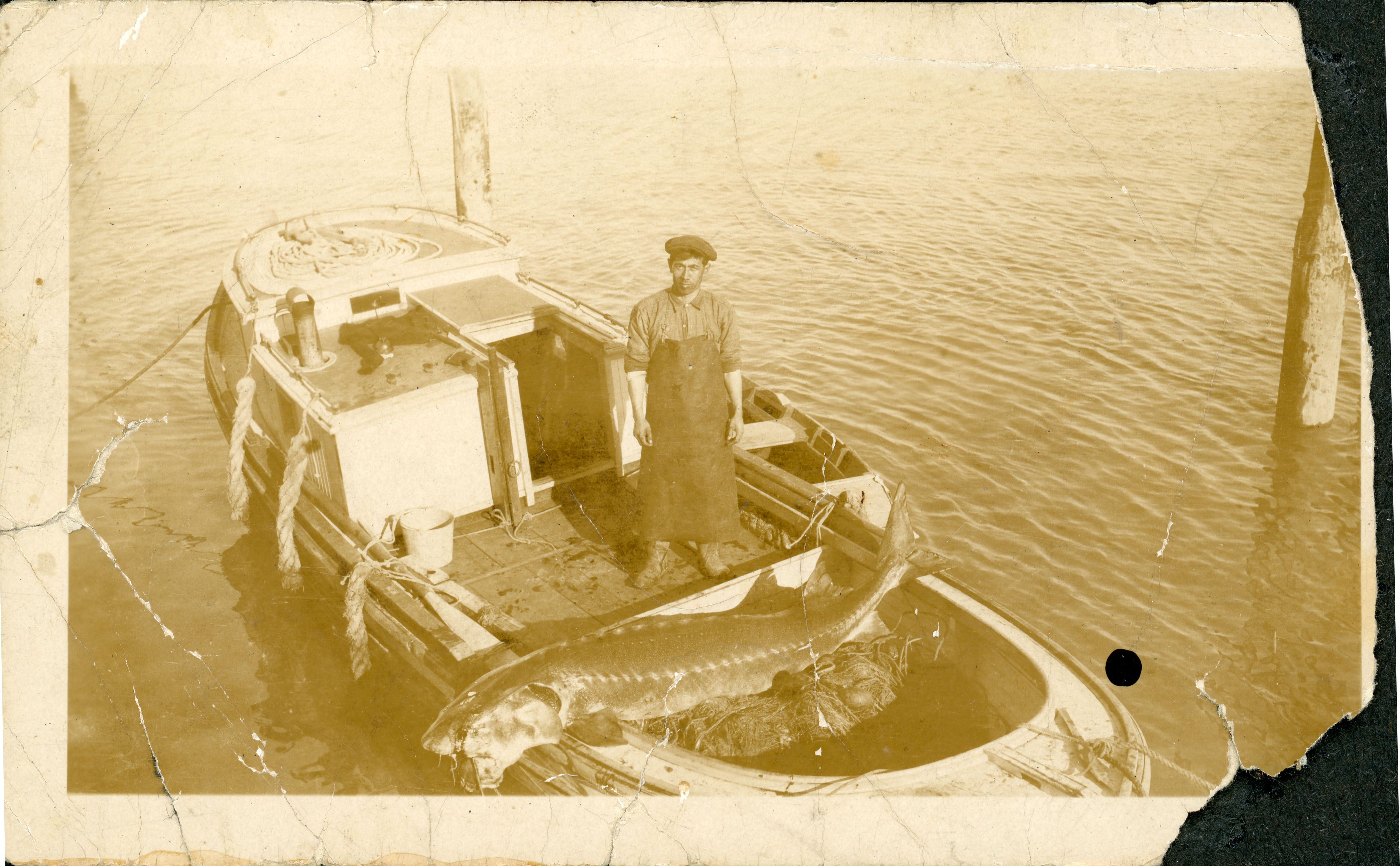
Eikichi Harada with a sturgeon, 1930 Fraser River. City of Richmond Archives photograph 2023 13 1 26.
The family’s records consist of 2000 photographs which have been scanned from 13 photograph albums and date from around 1900 to 1977. They depict several generations of the Harada and Kamitakahara families and their relatives and friends as they moved between Japan and the British Columbia coast, internment in the B.C. interior, displacement to southern Alberta and their return to Richmond once restrictions were lifted in 1949. The albums feature themes of growing up, gatherings, weddings, celebrations and new family members.
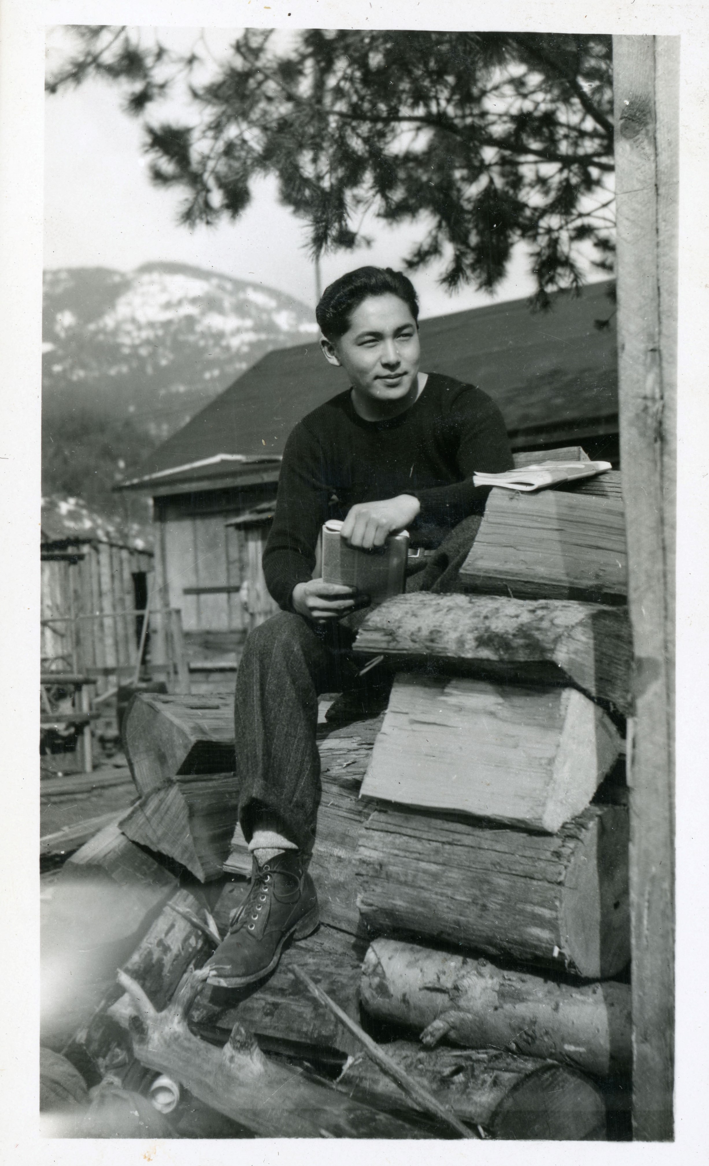
George Kamitakahara reading, Between 1942 and 1946, Slocan City internment camp. City of Richmond Archives photograph 2023 13 1 113.
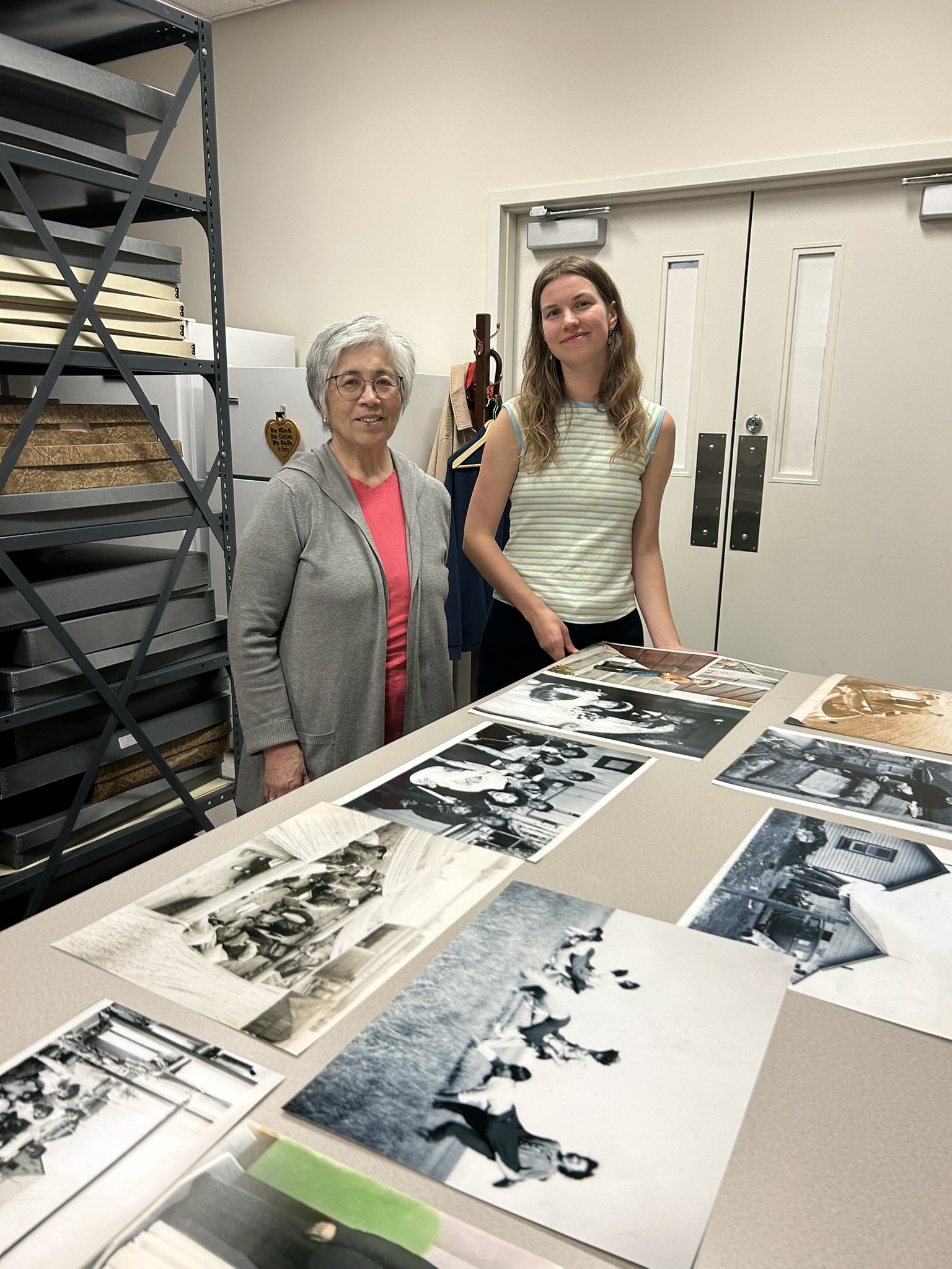
In 2024, Anouska Kirby was hired as an Archives intern. Anouska’s work involved genealogical research and consulting with Harada family members and friends to identify people, places and events and meticulously describing each of the 2000 images according to archival descriptive standards.
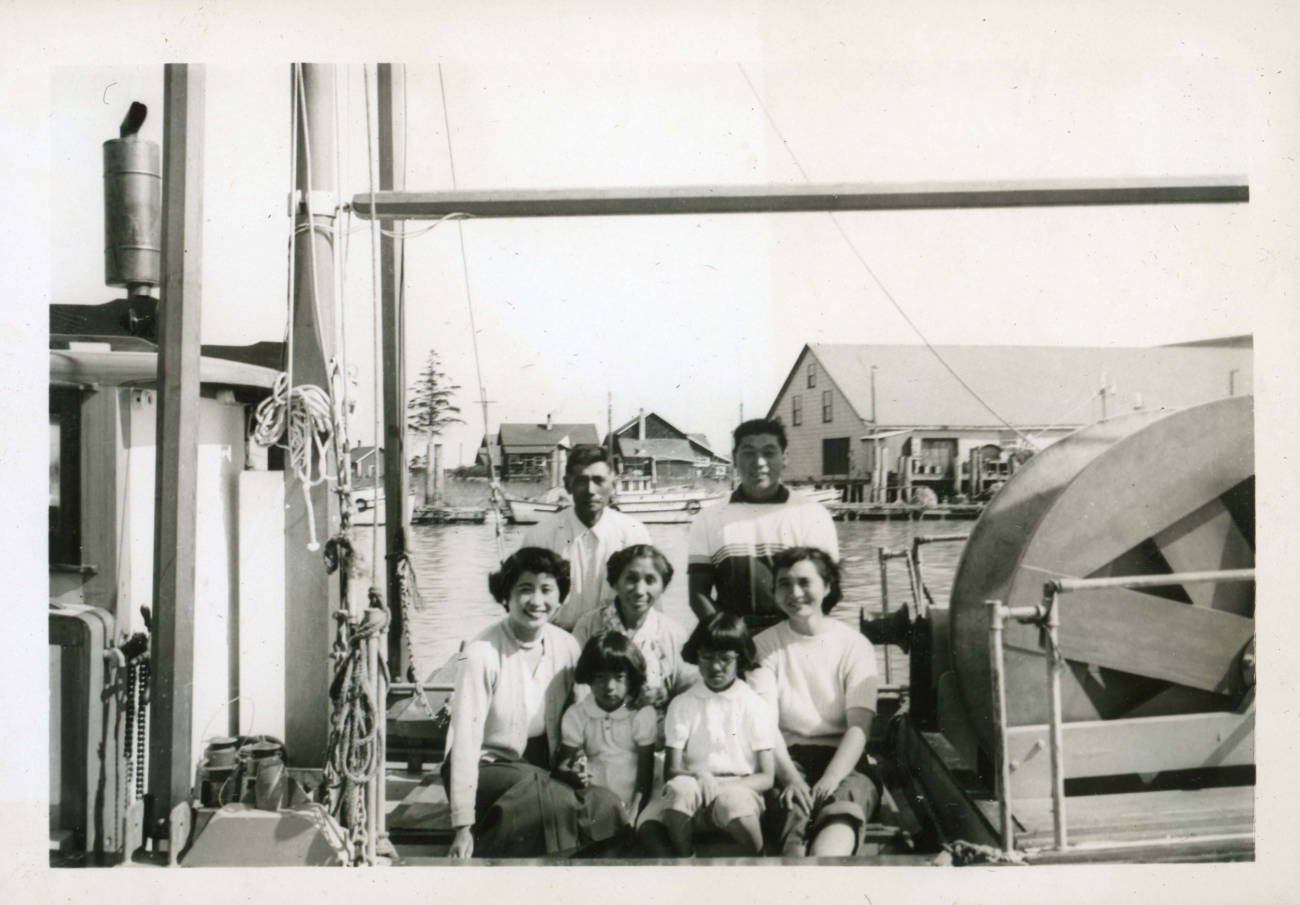
Harada family, between 1952 and 1957. From left to right, back row: Eikichi Harada and Eiichi Harada. Middle row: Junko (June) Ohiri, Tamae Harada and Akiko Harada. Front row: Linda Harada and Jeanne Harada. City of Richmond Archives photograph 2023 13 1 120.
The City of Richmond Archives is pleased to present an exhibit curated by Anouska and Jeanne Ryan featuring images from the Harada family photograph albums. The exhibit presents 14 carefully selected photographs grouped into four general categories: (1) Early 1900s Japanese Canadian Fishing Community; (2) Forced Displacement; (3) Rebuilding Community; and (4) New Beginnings. The exhibit can be viewed in person at the City of Richmond Archives entrance or online here.
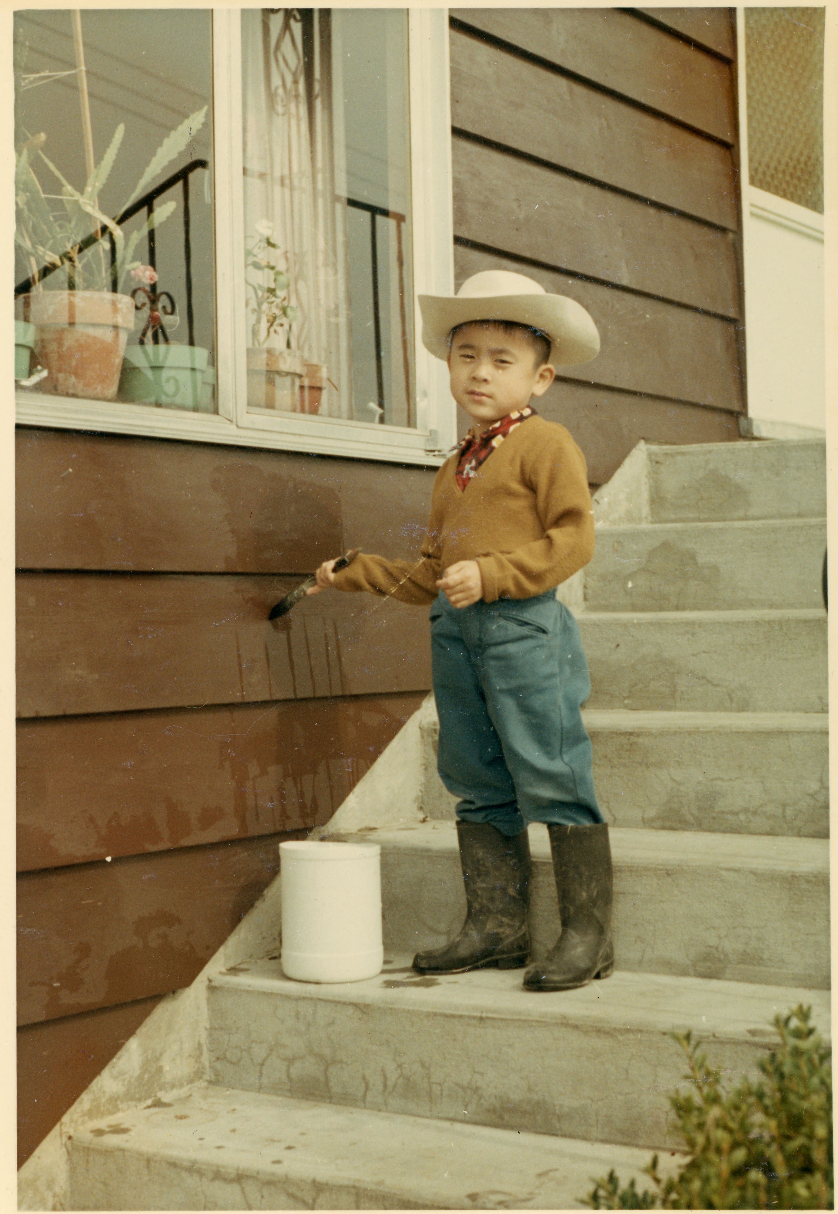
Glen Harada, 1968 at the Harada family home on Monteith Road, Steveston. City of Richmond Archives photograph 2023 13 10 178.
The Harada family photographs are incredibly significant. Documenting multiple generations of the Harada extended family, as well as friends and workmates, these photographic records pay tribute to the strength and resilience of the Japanese Canadian community. The digitized records can be searched on the City of Richmond Archives “Search Photographs” page here.
Credits
Jeanne Ryan and Anouska Kirby. City of Richmond Archives photograph.
Physical and online exhibition curated by Anouska Kirby and Jeanne Harada.
Photograph digitization by Bev Boyd.
The work of processing and describing the Harada family photographs was made possible with gratitude to the late Geraldine (Dody) Wray and family. Dody was a long-time member and director on the board of the Friends of the Richmond Archives (FOTRA). Her generous bequest to FOTRA, along with a Young Canada Works Building Careers in Heritage grant made the project a reality.
The City of Richmond is built on islands located on the flood plain of the Fraser River, surrounded by the river and exposed to the Strait of Georgia on the west. With an average elevation of just one metre above the present mean sea level, Richmond faces flooding from extreme storm surges, intense rainfall, high tides and seasonal rises in river flows and levels. It was not until the arrival of non-Indigenous settlers in the Lower Mainland that textual records of floods and the damage they caused to dykes, crops, livestock and structures were made, most often in the newspapers of the day. Early landowners in Richmond began the process of dyking the land, usually their own properties, and building flood boxes to allow drainage at low tide and blocking the ingress of water at high tide. Soon, dyking districts were formed which provided funds for dyking and drainage projects through taxation and by the mid 1930s these were amalgamated under the control of the Richmond Municipality. The improvements made by Richmond over the years, ditches, canals, electric pump stations, box culverts and dyke upgrades, have greatly lessened the impact of floods on the city. This post describes some of the floods that occurred through Richmond’s history and some of the steps taken to reduce their consequences.
Several men watch from what is probably the flood box at the north end of No.2 Road while children appear to swim in the outflow, ca. 1930. The No.2 Road flood box was the first in Richmond, built before incorporation. Flood boxes have a balanced gate that allows water to flow out during low tides but blocks water from flowing back in when the tide is high. City of Richmond Archives photograph 1987 104 38.
November 1871 – An intense storm blowing up the river combined with a high tide and storm surge caused dykes to be washed away in Ladner and flooding to occur. While Richmond, which was not incorporated until 1879, was not mentioned in reports, the storm did cause significant damage to the Sand Heads Light Ship, dismasting it and tearing up parts of its deck. It was towed to New Westminster for repairs.
May to June 1894 – The “Great Flood of 1894” caused extensive flooding and damage all through the Fraser Valley. An extreme spring runoff brought on by a cool summer of 1893 which failed to melt snow in the mountains, a record snowfall through the winter of 1893-94 and rain and a heat wave at the end of May raised river levels to the highest ever recorded, 25.75 feet at the Mission Bridge. Dykes were destroyed, bridges and wharves washed away and farms were inundated destroying crops and drowning cattle and causing substantial loss of human life. In Richmond by June 1st, the flood had scoured out the fill around the pilings on the newly completed North Arm (Fraser Street) Bridge, causing about 200 feet of it to be carried away a few days later. Lulu Island was reported to be seriously flooded due to breaks in the dyke at Scott’s Mill at the Queensborough end of the Island and then over the main dykes at high tide. Damage in Richmond Municipality was estimated to be $2000 to the North Arm Bridge and a further $7000 in crop loss due to the flooding.
Steveston, shown here in 1891, was flooded several times in its early history. Cannery floors were awash in water and the plank roads shown here were floated up and washed away. City of Richmond Archives photograph 1984 17 75.
January 1895 – Six months after the 1894 flood, Lulu Island was again hit by flooding, this time by a combination of high river flows and extreme high tides with a strong west wind. Dykes on Lulu Island were washed away in many places, flooding large areas of farmland. Root crops stored in pits were destroyed along with large quantities of potatoes. Houses and barns were flooded and bridges over ditches and canals were washed away. Sea Island was reported to be under as much as three and a half feet of water. In Steveston water flooded over the floors of canneries and some residents had to leave their houses. Steveston’s plank roads floated and were swept away by the water.
1900 – The first of Richmond dyking districts was formed when landowners petitioned the Provincial Government to allow taxation for the construction of dykes and drainage systems under the authority of the Drainage, Dyking and Development Act. The New Lulu Island Slough Dyking District was responsible for the land encompassing the slough complex from Francis Road south to the river. Before this time landowners dyked their own property with other areas being handled by the Township. Commissioners were elected to administer the district and an engineer was hired to draw up technical plans and assessments of the land.
Headlines in the December 27, 1901 Vancouver Daily Province describe some of the damage to Richmond in the 1901 flood.
December 26-27 1901 – Richmond was hammered by a severe gale directed squarely at the mouth of the Fraser combined with very high tides. This was the most extensive and damaging flood in Richmond since 1894. Several canneries were heavily damaged and one, the Labrador Cannery at Terra Nova, was completely destroyed. Miles of dykes were lost along the North and Middle Arms of the river, fishing boats were swept as far as half a mile into farmer’s fields and smashed up. The Japanese boarding house at Terra Nova collapsed with people trapped inside who were rescued by neighborhood residents. Another boarding house with nine men inside was swept into the river. They managed to get on to the roof of the building where they were rescued by men who braved the storm in two boats. Sea Island and the greater part of Lulu Island were reported to be flooded by two to four feet of water. Steveston was under water and the floors in the Gulf of Georgia cannery were completely covered. Outbuildings at the Colonial Cannery were washed away and the plank roads in Steveston and around Lulu Island floated away.
1905 – The second of the dyking districts was formed. The Lulu Island West Dyking District was formed with responsibility for the area west of No. 3 Road.
November 1913 – The highest tides in ten years combined with a storm surge and high winds caused dykes to give way in many places flooding hundreds of acres of farmland. On Lulu Island, the Bridgeport area was inundated. Water covered roads and fields up to two feet deep, while Bridgeport School was surrounded with about three feet of water. Sea Island was similarly affected with about 500 acres of land flooded after the North Arm dyke was breached at the Cooney property on No.13 (Miller) Road. Damage was fairly light at the north-east corner of Sea Island, although the store and meat market sustained significant damage.
January 1914 – Through January 1914 heavy rains and high tides rendered the municipal drainage systems useless causing high water all along No.20 (Cambie) Road from Bridgeport to No.5 Road. The Bridgeport, Cambie and Alexandra areas were flooded with up to two feet of water. Later in the month, the same conditions, worsened by a gale force wind, washed away 150 feet of the dyke on Sea Island, completely flooding the island. Mitchell island, along with smaller islands in the river were also completely flooded. At a ratepayer’s meeting after the flood, keynote speaker John Tilton stated that “…well dyked and well drained, this island would be a beauty spot of Canada. As it is, it is no better than a duck pond.”
Ditches were excavated along most roads in Richmond to help drain the land and gave rise to the municipality’s nickname of “Ditchmond,” As shown in this photograph, ca. 1920, they could pose a hazard to careless drivers as well. City of Richmond Archives photograph 1978 30 2.
January 1921 – Once again the double hit of heavy rain and high tides caused flooding in Richmond. The flood box on Twigg Island was washed away, resulting in the island being completely inundated every time the tide came in. On Mitchell Island a poorly reconstructed dyke, built after the construction of Union Cedar Mills, allowed tide water to surge over and flood the island. On Lulu Island unfinished dykes on the North Arm and on the South Arm at the London property allowed the water to wash over. Large parts of the Alexandra and Garden City areas were flooded. A public meeting held at Richmond Townhall saw citizens, who had already willingly taxed themselves for dyking and drainage to an amount equal to half the general taxes of the municipality, advocating for the installation of powerful electric pumps to drain the island.
January 1933 – The New Lulu Island Slough Dyking District installed the first electric pump in the dyking and drainage system on the South Arm between No. 3 and No. 4 Roads. The 60 horsepower pump would operate automatically only during the highest tides when the flood boxes become ineffective. The pump was expected to remove 16000 gallons per minute and would drain about 4300 acres of land.
People pose in front of the first electric pump in Richmond’s dyking and drainage system, located between No. 3 and 4 Roads on the South Arm. City of Richmond Archives photograph 1988 17 112.
January 1935 – Heavy snowfall followed by higher than normal temperatures and heavy rain caused flooding in the Fraser River Valley and drainage problems in Richmond. Lulu Island was reported to be a series of small lakes and Lansdowne and Brighouse Racetracks were completely flooded.
Water flows onto Lulu Island through a breach in the dyke in 1953. Tire tracks indicate attempts to block the flow by pushing mud into the break. City of Richmond Archives photograph 1977 1 4.
1936 – The Township of Richmond amalgamated its own works with the other two dyking districts, assuming control of all dyking and drainage activities within its boundaries. The work done on the dyking and drainage system was beginning to have a positive effect on flooding problems in Richmond. While some flooding due to high rainfall was still problematic at times, residents did not seem too concerned about the occasional time when one had to wear gumboots to go into their yards. The Richmond Review boasted in the October 6, 1936 edition, “Richmond the Dryest Place in the Valley.” “Richmond should let the world know that it is about the safest place in time of flood from Winnipeg west. Richmond is so near the sea that excess water can readily escape if given half a chance.” The attention given to improving and upgrading dyking and drainage systems was to continue up to the present day.
February 1945 – “The Great Storm of February 7, 1945” was claimed to have caused the worst flood in ten years. Vancouver newspaper reports said that Burkeville was a chain of lakes with about 25 houses surrounded by water, stranding the residents inside. Acres of Lulu Island were under water. However, the Richmond Review reported, “Flood of Short Duration Here.” The rain which caused ditches to fill and property to flood on Wednesday had all run off by Friday.
1948 – In January high tides and storm surge burst through the dykes on Twigg Island. On Lulu Island a few houses were subject to flooding. Then, in May and June the Fraser Valley was hit by the worst flood since 1894. The 1948 flood was one of the most destructive in BC history, causing widespread damage throughout the Fraser Valley. Richmond, however, got off relatively easily because of the the tremendous organization and mobilization of every available resource led by Reeve (Mayor) R.M. Grauer. With help from the military, volunteer labour from Richmond and other cities in the Lower Mainland and some paid labour, the dykes were monitored 24 hours a day, thousands of sandbags were filled, brush along the dykes was cleared and weak spots in the dykes were shored up. Organizing and supervising the workers on the dykes were Ken Fraser, who took care of Steveston to No.2 Road, Archie Blair, the area between No.2 Road and No. 4 Road, Leslie Gilmore, No. 4 to No.6 Roads, Matthew McNair, No.6 to No.7 Roads, Andy Gilmore, No.7 to No.9 Roads, E. Carncross, No.9 Road to Hamilton, Bob Ransford, Hamilton to the eastern boundary, and Doug and John Savage, the northern boundary to No.8 Road. G. Crosby monitored the Middle Arm dyke on Lulu Island and on Sea Island the Grauers watched the North Arm dyke to Cora Brown, Doug Gilmore, the rest of the North Arm Dyke, Cline Hoggard, the Middle Arm to the Airport and the rest was watched by the Airport Authorities.
Mrs. A. E. Vigar sits on a row of sandbags along the Fraser River in Richmond during the 1948 flood. City of Richmond Archives photograph 1987 30 29.
The logistics involved in the “Battle of the Dykes” were akin to a military operation. Hundreds of workers were mobilized and directed to their stations. Canteens were set up at the various command posts, supplied with coffee, sandwiches, soup, cigarettes, donuts, cases of pop and cookies provided by the Municipality, the Red Cross or donated by Lower Mainland businesses and churches. Drivers were busy delivering supplies to the dykes and the canteens. Businesses and private citizens donated the use of cars, trucks and tractors to the effort. The military provided manpower, vehicles, boats and powerful tugs, able to pull barges of rock and earth against the strong current in the river. To help with communications the BC Forest Service provided two mobile radio units, The BC Telephone Company installed temporary telephones at command posts and BC Electric provided power where necessary. All movement of deep sea vessels was suspended on the river. Towing companies were instructed to use only more powerful tugs, speed limits were imposed to prevent damage to dykes and the size of tows was restricted to single barges and booms with an assisting tug. Bridges were closed to traffic from two hours before until two hours after high tide slack.
A group of students from Richmond High School pose atop a stack of sandbags during the 1948 flood. Male students were excused from classes to help fill sandbags and work at the dykes. City of Richmond Archives photograph 2010 35 5.
To make sure that workers remained focused on the job at hand, the liquor licenses at the Steveston Hotel, the Steveston and Sea Island ANAFs and the Royal Canadian Legion were temporarily suspended. In the event that the worst happened, a train was stationed at New Westminster to assist in evacuating people from Richmond.
A notice published in the June 9, 1948 Richmond Review.
The constant monitoring, shoring up of low spots and reinforcing dykes that began to weep paid off in a minimum of damage in the Municipality. There was only one significant problem reported when a “geyser” erupted on the dyke at the Rice Mill resulting in a breach. About 100 yards of the dyke had collapsed into the river at high tide. Fortunately, as the tide receded the flooding stopped and the gap was filled using the Municipal dragline. Repair work was completed before the tide came back in and flooding didn’t penetrate past the CN Rail line.
A Universal Bren Carrier delivers sandbags to the dyke in this clip from a film taken during the 1948 flood in Richmond. To see the whole video visit https://www.youtube.com/watch?v=pR0czKKsehM .
November/December 1951 – In late November a near hurricane storm system and high tidal surge hit the Lower Mainland. At Richmond, River Road near the Sea Island bridge was under about 6 inches of water. Workers from the Lulu Island Canning Company were set to work packing the dykes with sandbags. In nearby low lying areas houses were surrounded by water up to 10 inches deep. The high tides and strong winds breached a low dyke at the end of No.2 Road in Steveston but the water was held back by a higher inside dyke. The ferry to Ladner was put out of service when a pontoon at the Richmond ferry terminal sank.
Strong winds and high tides wash against the dyke at the end of No.1 Road in Steveston during the November/December 1951 storm. City of Richmond Archives photograph 1977 1 24.
January 1953 – Dirt fill around the new $15000 flood box at Finn Slough washed away resulting in the destruction of the flood box. About 50 yards of the dyke near the foot of No.4 Road washed out “as if cut by a knife.” The location of the break was such that trucks could not be brought in so Councillor Archie Blair used his farm tractor to bring in sandbags and to push mud into the breach and a scow delivered a load of soil. Flooding caused significant damage to the Gilmore farm buildings and the family home. It was discovered that wing dams and modifications made by the Federal Government to the south shore of the river in an attempt to increase the water velocity and make the river “self-dredging,” redirected the flow, causing it to scour the area between Woodward’s Landing and Steveston and undermine the dyke. High seasonal tides then ended up breaching the dyke. The dyke was subsequently repaired and armoured with rock.
The brand new Finn Slough flood box was destroyed when soil around it was washed away in 1953. City of Richmond Archives photograph 1977 1 8.The Gilmore house is surrounded by water in this image from the 1953 flood. The area around Finn Slough could be problematic during high drainage loads and dyke breaches. City of Richmond Archives photograph 1977 1 10.
November 1954 – Very heavy rainfall overwhelmed the drainage system causing an accumulation of water in Richmond that filled ditches and backed up onto the surface of the land. The No.3 Road pump had lost a top main bearing making the situation worse. The most affected area was in the Grauer subdivision and the rest of the area drained by the No.4 Road canal. Crown Zellerbach helped out by placing nine large pumps at Finn Slough which assisted the municipality’s pumps by drawing an additional 22,000 gallons a minute.
Kids wearing gumboots wade in their yards on Dixon Avenue during the 1954 flooding. City of Richmond Archives photograph 1977 1 118.
November 1955 – Heavy rainfalls caused flooding around the Lower Mainland but, according to reports in the Vancouver Sun, flooding in Richmond was “much less than expected.” While some ditches overflowed onto roads, fields and lawns, the municipality’s canal drainage system speeded up the runoff significantly.
The use of natural drainage channels forms part of the strategy of removing water from Richmond. This aerial view, ca. 1980, shows Woodwards Slough which drains into the South Arm near Finn Slough. A flood box and pump station ensure efficient water removal. Horseshoe Slough and Bath Slough are also part of the drainage system. City of Richmond Archives photograph 1988 123 745.
December 1957, January 1958 – High tides, wind and heavy rain caused water to go over the dykes on Mitchell Island. About 100 homes in Richmond were surrounded by water due to blocked drains in the drainage system.
Drainage canals have been an effective way of moving large amounts of water out of Richmond. This image shows the north end of the Gilbert Road canal and pump station. The canal has since been replaced by a box culvert. City of Richmond Archives photograph 1988 123 689.
December 25-26 1972 – Water from rain melting snow caused flooding around Richmond, and damage at the municipal offices.
February 1976 – An exceptionally high tide caused flooding one foot deep around about fifty homes in the Cambie and River Road area when a temporary rock dam was breached where a new pumping station was being installed on the Middle Arm.
The large open drainage canals have been replaced for the most part by enormous box culverts like this one on Gilbert Road which replaced the canal shown in the previous photograph. City of Richmond Archives photograph 1988 123 445.
December 1979 – Once again, extremely heavy rainfall caused drainage problems around Richmond. The flooding caused sanitary sewers to back up at London Junior Secondary School, flooding the gym and closing the school. Wet cables caused the loss of telephone service to about 1000 customers.
To the present- The improvements made to Richmond’s dyking and drainage system have been continuous since the first hand built dykes in the 1800s. Today, around 49 km of dykes hold back water from the sea and the river. 598 km of drainage piping, 61 km of culverts and 151 km of open watercourses move water out of the city. Thirty-nine pump stations, capable of removing 5.3 million litres of water per minute, are ready to discharge rainwater to the river and ocean. Sensors provide real-time information about river levels, rainfall and the drainage of storm water and analysis of weather patterns, snowpack and predicted runoff warn of potential risks to the city. Regular inspection and maintenance of the whole dyking and drainage system takes place with increased patrols during higher risk periods. Richmond’s dyking and drainage system is designed to withstand a one in 500 year flooding event, something that has a 0.2% chance of occurring in any given year. A case in point is the 2021 atmospheric river event, which broke rainfall records around the Pacific Northwest and caused extensive damage in many places, was handled well by Richmond’s system although localized drainage problems did occur.
Many of Richmond’s upgraded pump stations feature public art displays. This image shows the Shell Road North Drainage Pump Station which was upgraded in 2020. The walls show large maps of Richmond with bridges, roads and highways, as well as the paths of some of the City’s historic slough waterways. City of Richmond Engineering and Public Works: Richmond’s Drainage Pump Stations, July 26, 2024. https://corportal1.richmond.ca/portal/apps/storymaps/stories/c4d06a030aa845c981117f95727a4e26
To the future- To prepare for climate change induced sea level rise and increased rainfall the City’s Engineering and Public Works Department has developed a flood protection strategy to prepare for emergencies. To ensure Richmond and its residents remain safe, the City has one of the most comprehensive flood protection systems in BC. To learn about it, visit the City of Richmond’s website at https://www.richmond.ca/services/water-sewer-flood/dikes.htm
The Archives and what goes on there is a mystery to most people so in this posting we will try to explain what the City of Richmond Archives is, where it is, and what it does.
An archival box is designed to exclude light and dust from the records stored within. In this blog we bring the records “Outside the Box” so that the public can see the history of their community. City of Richmond Archives photograph.
The City of Richmond Archives is the official repository for the inactive public (City) and private (donated by individuals) records of enduring and historic value to the City of Richmond and the community as a whole. The main work undertaken at the Archives follows two paths, namely, preservation (to preserve and protect records) and access (to make them accessible to City officials and to the public). The Archives is a section of the City Clerk’s Office which, among its other duties and responsibilities, is responsible for records management for the City.
History
The idea of creating an archives facility for Richmond was originally discussed in 1970. With the approach of Richmond’s Centennial year, a proposal had been put forward to publish a book to mark the event. The committees formed to organize the Centennial celebration and the book were made up of Richmond residents with an interest in archives and in establishing one for the Municipality because without the original documents and photographs of the community, it would be impossible to have a history.
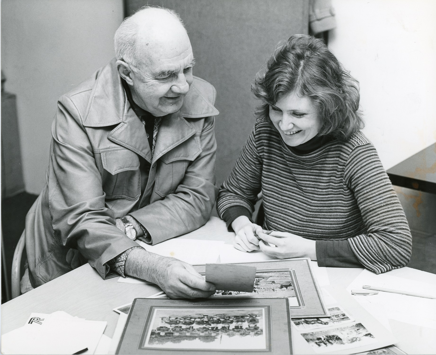
Ted Youngberg, Chair of the Richmond ’79 Centennial Society and Leslie Ross, author of the book “Richmond-Child of the Fraser” look over some archival images. City of Richmond Archives photograph 1987 30 92.
Before 1982, archival materials were collected and stored by the Richmond Museum and Historical Society which had been formed in 1961. In 1982, Richmond’s first City Archivist was hired, working with the City’s Leisure Services Department. In 1987, in recognition of the Archives’ growing role as a part of the City’s records management system, the Archives was transferred to the City Clerk’s Department.
In 1992 when the Richmond Cultural Centre was built, a dedicated space for the Archives was created allowing the Archives’ holdings to be stored in one place for the first time. On July 29, 2002 the Corporate Records Management Program Bylaw 7400 came into effect setting out the terms and scope of activities of the City of Richmond Archives. This link will take you to the text of Bylaw 7400 which provides a picture of the stewardship the City of Richmond exercises over City government and community records during their lifetime: http://www.richmond.ca/__shared/assets/bylaw_7400463.pdf
Where is it?
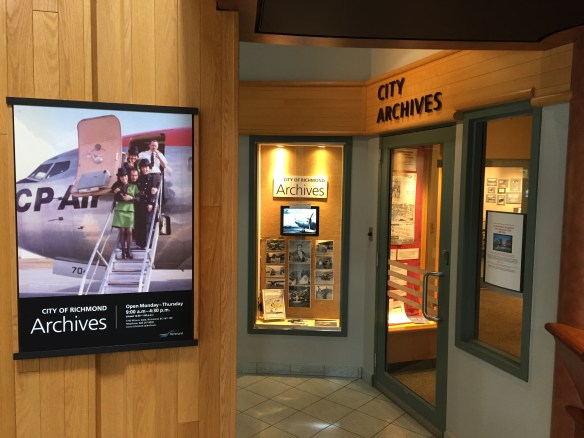
The City of Richmond Archives is located in the Richmond Cultural Centre. The door to the Archives is located between the Library entrance and the Front Desk in the Rotunda of the Centre. A window to the left of the door shows a display relating to some aspect of Richmond’s history using material sourced from the Archives. Just through the door is a vestibule, featuring a photographic display.
The front entrance to the Archives is located between the Library entrance and the Cultural Centre front desk. City of Richmond Archives photograph.
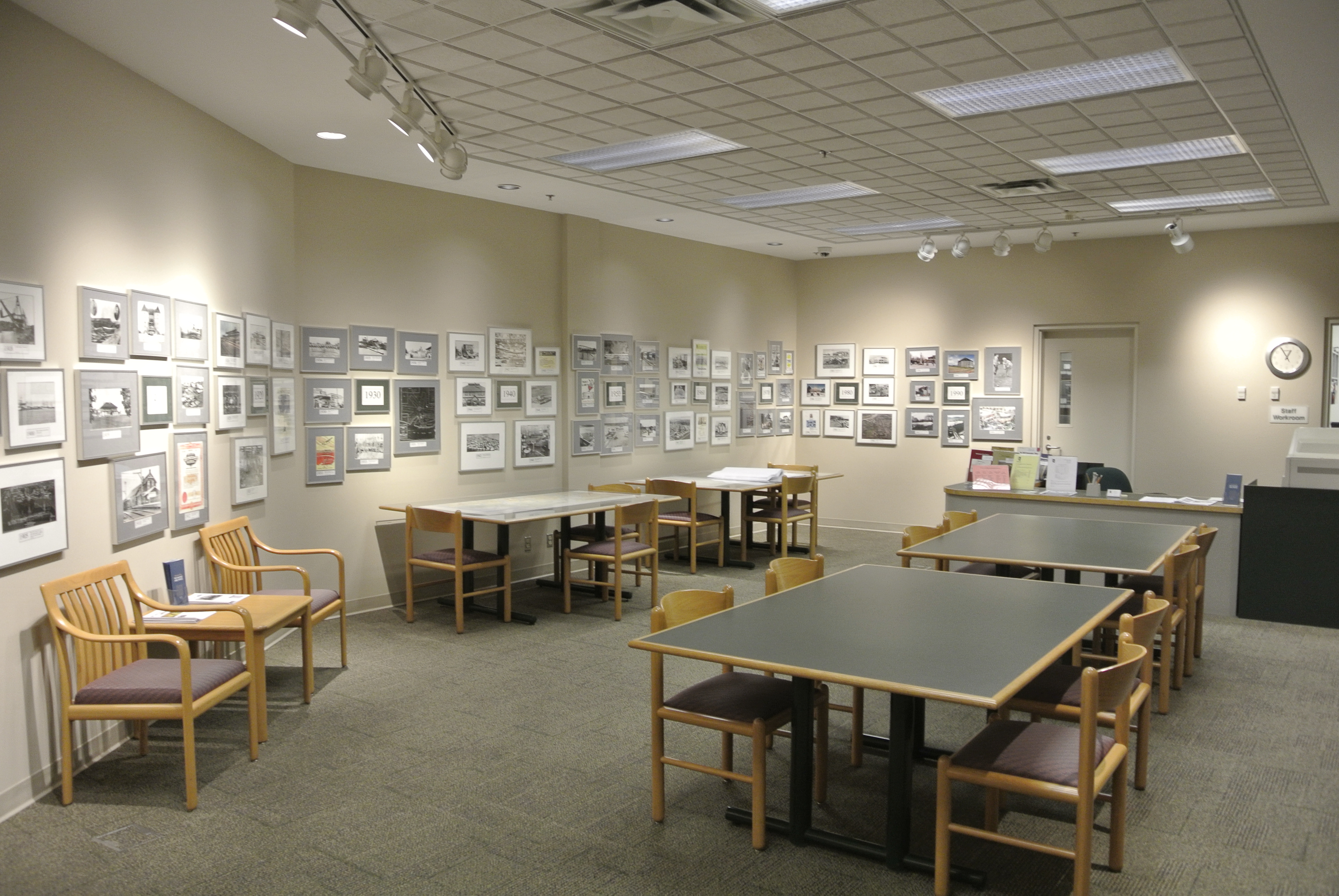
Past the second door, you enter the Reference Room where most researchers do their work. A photographic timeline on the walls shows images from Richmond’s history and digital photo frames present images from specific photograph collections. A research library offers books, research finding aids and telephone/street directories. A microfilm/microfiche reader is provided as well.
The Reference Room at the Archives features a historical photographic timeline on the walls. Space is provided for researchers to work. City of Richmond Archives photograph.
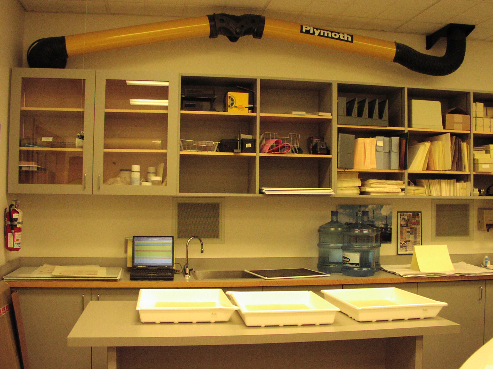
Past the service desk and through the door is the Archives office. Here is where Archives staff and volunteers work at several work stations and tables. More research material can be found here as well as equipment for the handling and conservation of records.
This work station in the Archives office is set up for conservation work and includes an exhaust system for the evacuation of fumes. City of Richmond Archives photograph.
Through the doors at the rear of the Archives office is the closed Archives storage area, commonly referred to as the stacks.
These sections of rolling shelves are used for the storage of textual records in the Archives. City of Richmond Archives photograph.
Here, in a temperature and humidity controlled environment, is where the records held in the City of Richmond Archives are stored for future generations. Each set of shelves or drawers are labelled, as are the boxes and files located there, allowing the Archivist to find a single item among the mass of material stored there.
Drawers like these are used for the storage of maps and plans. City of Richmond Archives photograph.
The Collection
The Archives acquires records for its collection in several ways. Public records are transferred from the City. Private records are received by public donation. The title of the material passes to the Archives with the understanding that ownership is held in trust for future generations.
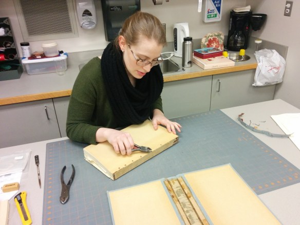
The conservation of documents is an important activity at the Archives. Here a Contract Archivist works at disbinding old by-laws for preservation and accessibility. City of Richmond Archives photograph.
The Archives holds more than one kilometer of textual records, 170,000 photographs, 20,000 maps and plans and over 500 sound and moving image recordings. There are also collections of subject and biography files and a small reference library.
Photographic negatives, which deteriorate over time, are shown here after being dehumidified, and sealed to prevent moisture incursion. They are then frozen to slow the rate of their decay. City of Richmond Archives photograph.
What goes on?
When records are acquired by the Archives, whether from the City or as a donation, they undergo a fairly complex and time consuming process to ensure their preservation and accessibility. If a member of the public decides to donate a group of photographs, the process is:
An accession number is given to the donation which consists of a four digit number indicating the year it was received and a second number indicating its order of donation, for example, a donation numbered 2019 5 would indicate the fifth accession of 2019. A Deed of Gift Agreement form is generated by the Archivist which includes a description of the photographs. By signing the Deed of Gift Agreement, the donor states that they are authorized to donate the material, that ownership of the material is transferred to the Archives and disposal instructions for the material are stated should the Archives decide not to keep it.
Once the ownership of the photographs is transferred to the Archives, the Archivist will create an entry in the Archives database. The accession can now be stored in the Archives.
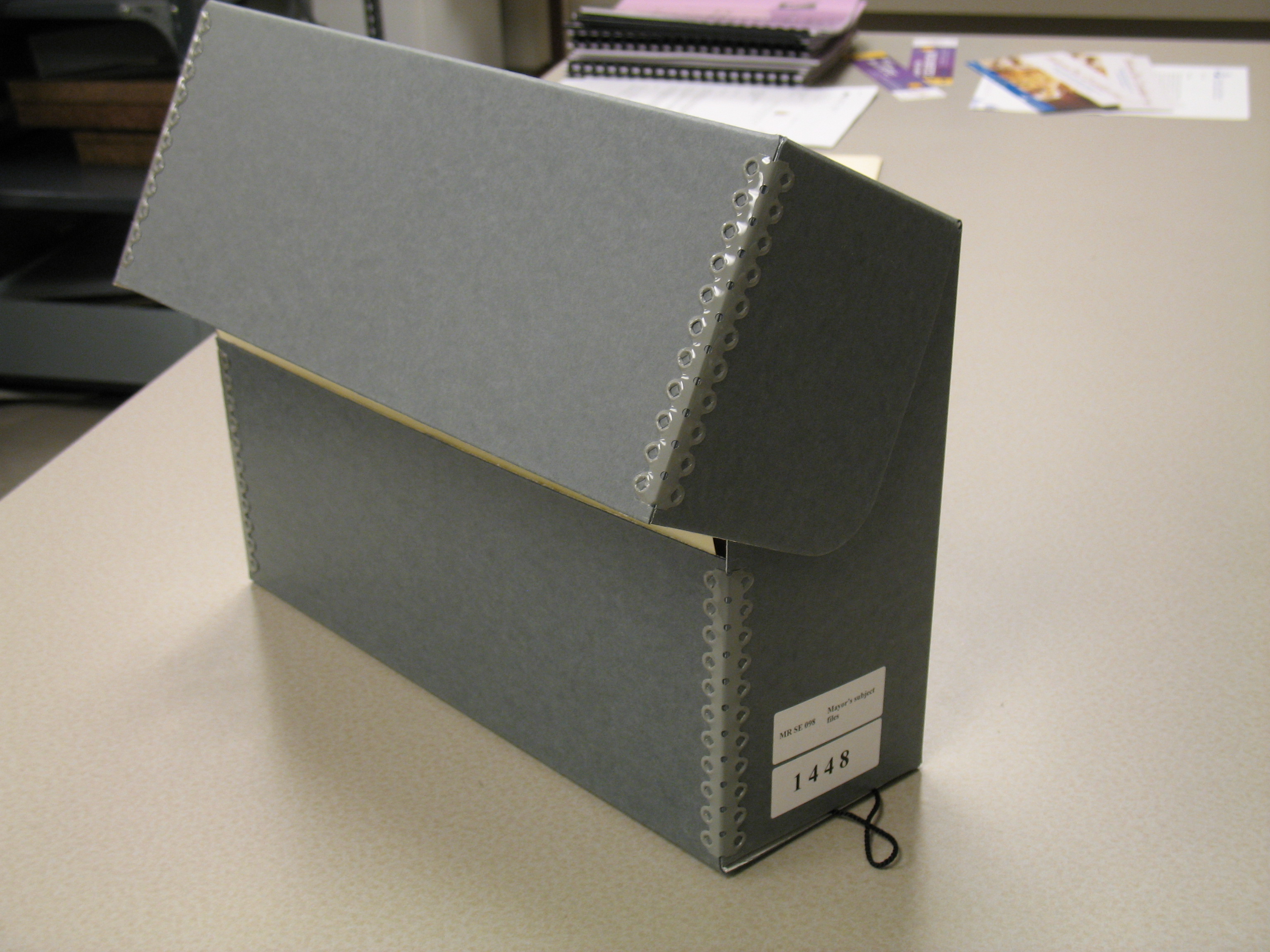
Each photograph will be given a specific item number and will be placed in an individual acid free envelope. The envelopes are then placed in archival boxes, designed to keep out light and dust, and the boxes are placed on the photograph shelves in the Archives.
Lastly, as time and staffing allow, the photos will be digitized. Once this is done they may be added to the Archives website allowing researchers to search the photos without actually coming to the Archives.
Volunteers at the Archives work at scanning some of the thousands of photographic images preserved there. Once digitized they can be made available online. City of Richmond Archives photograph.
The Friends of the Richmond Archives
The Friends of the Richmond Archives was formed in the fall of 1986 as a volunteer and non-profit organization by members of the Richmond ’79 Centennial Society Historical sub-committee. The Friends undertake a number of activities to support the City of Richmond Archives and to promote the preservation and understanding of Richmond’s history.
Members of the Friends of the Richmond Archives with a display at the annual Remembrance Day event at City Hall. City of Richmond Archives photograph.
Out of its membership of 216 people, a core group of volunteers take part in community outreach activities, support a publishing program for local history, and help fund the purchase of specialized archival equipment and projects at the City of Richmond Archives. The Friends have also endowed a UBC award for students in the Masters of Archival Studies Program and have supported a number of programs for local students in Richmond.
Richmond Mayor Malcolm Brodie speaks at the Annual Archives Tea, a popular event open to members and guests of the Friends of the Richmond Archives. City of Richmond Archives photo.
The funds managed by the Friends are raised through donations and membership fees. If you are interested in the preservation of your city’s history and want to support the Archives in its work consider becoming a member of the Friends of the Richmond Archives. The membership form is available at: https://www.richmond.ca/__shared/assets/FOTRA_Membership_Application_Form_201851284.pdf . As a member, you will receive in the mail the semi-annual Archives News (the newsletter of the City of Richmond Archives), notifications of special events at the Archives, opportunities for volunteer involvement with the Friends, and an invitation to the annual Archives Tea. A receipt for Income Tax purposes will be issued for donations over $10.
Some of the most interesting images at the City of Richmond Archives come from donations of family photograph collections. Family photographs are often thought to be of little interest to anyone outside of the family involved, but nothing could be further from the truth.
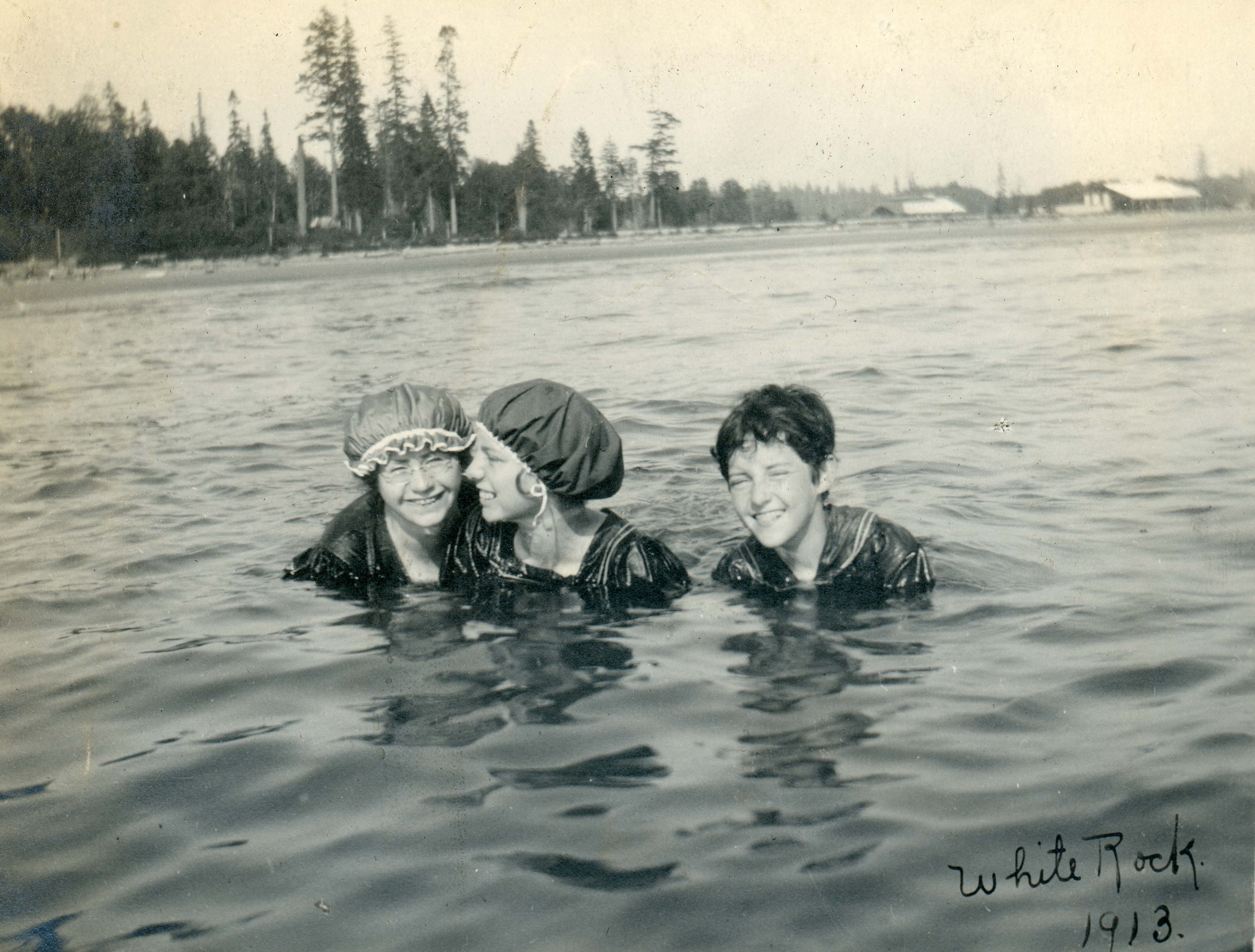
Three girls take a swim at Whiterock in 1913 in this image donated by the Thompson Family. City of Richmond Archives photograph 1985 39 287.
Family photograph collections may show locations of interest and significance, portray activities of historical value and add social context to Richmond’s history.
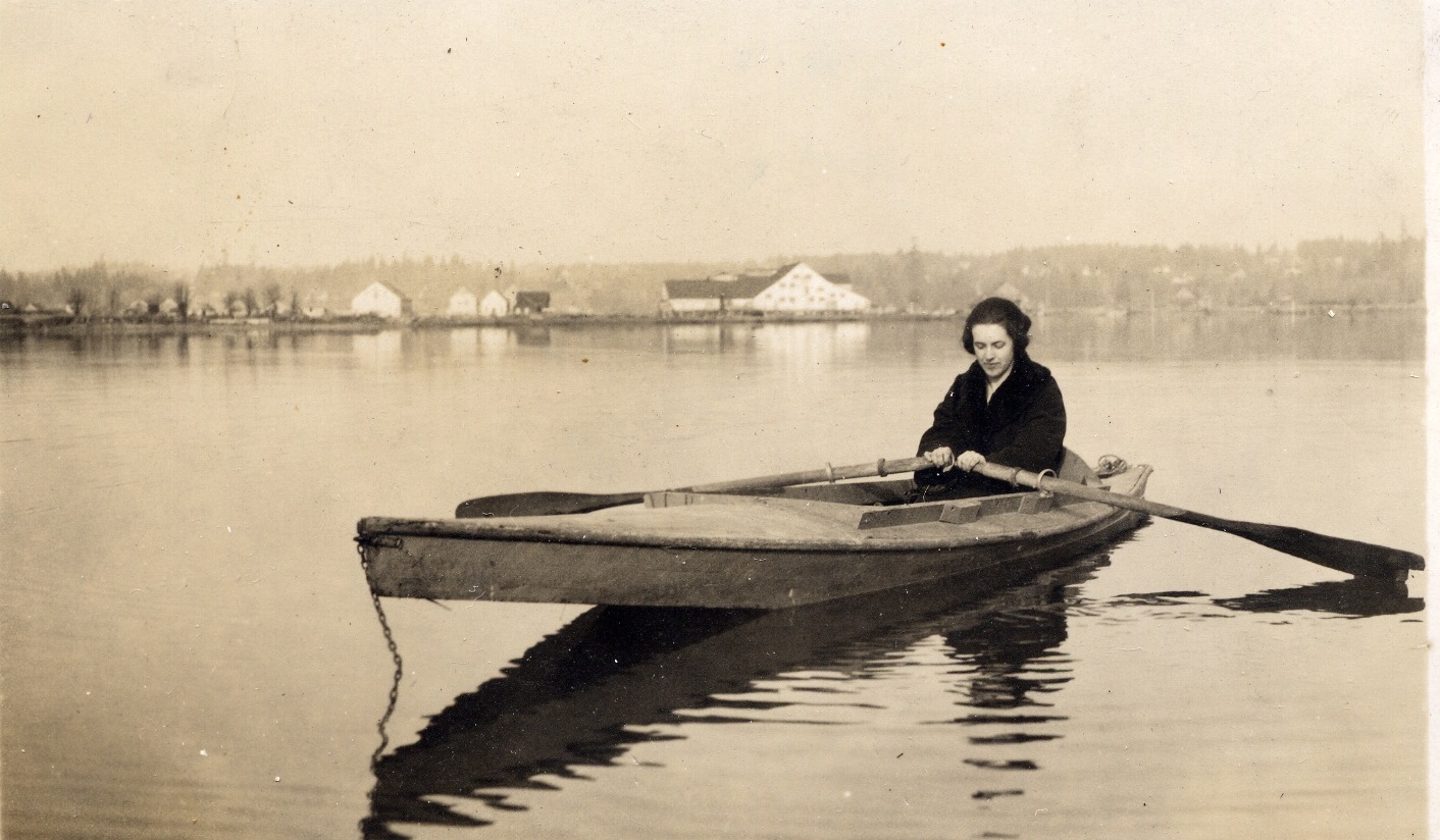
Irine McDonald is shown here in a duck punt on the still waters of the North Arm in 1924 in this McDonald Family photo. The Celtic Cannery can be seen in the background. City of Richmond Archives photograph 2013 47 4 5.
The City of Richmond Archives is the official repository for the inactive public and private records of enduring and historic value to the City of Richmond and the community as a whole.
This image of Richmond Photo is one of many donated to the Archives by the family of Noel McConnell, a well known and prolific Richmond photographer who worked out of this building. He took countless photographs in Richmond, from aerial photos to wedding, sports and school photos to pictures of life around the area. Much of his work is now preserved at the Archives. City of Richmond Archives photograph 2012 2 a.
It is the work of the City of Richmond Archives to preserve and protect these records and to make them accessible to City officials and the public, as set out in Corporate Records Management Program Bylaw 7400.
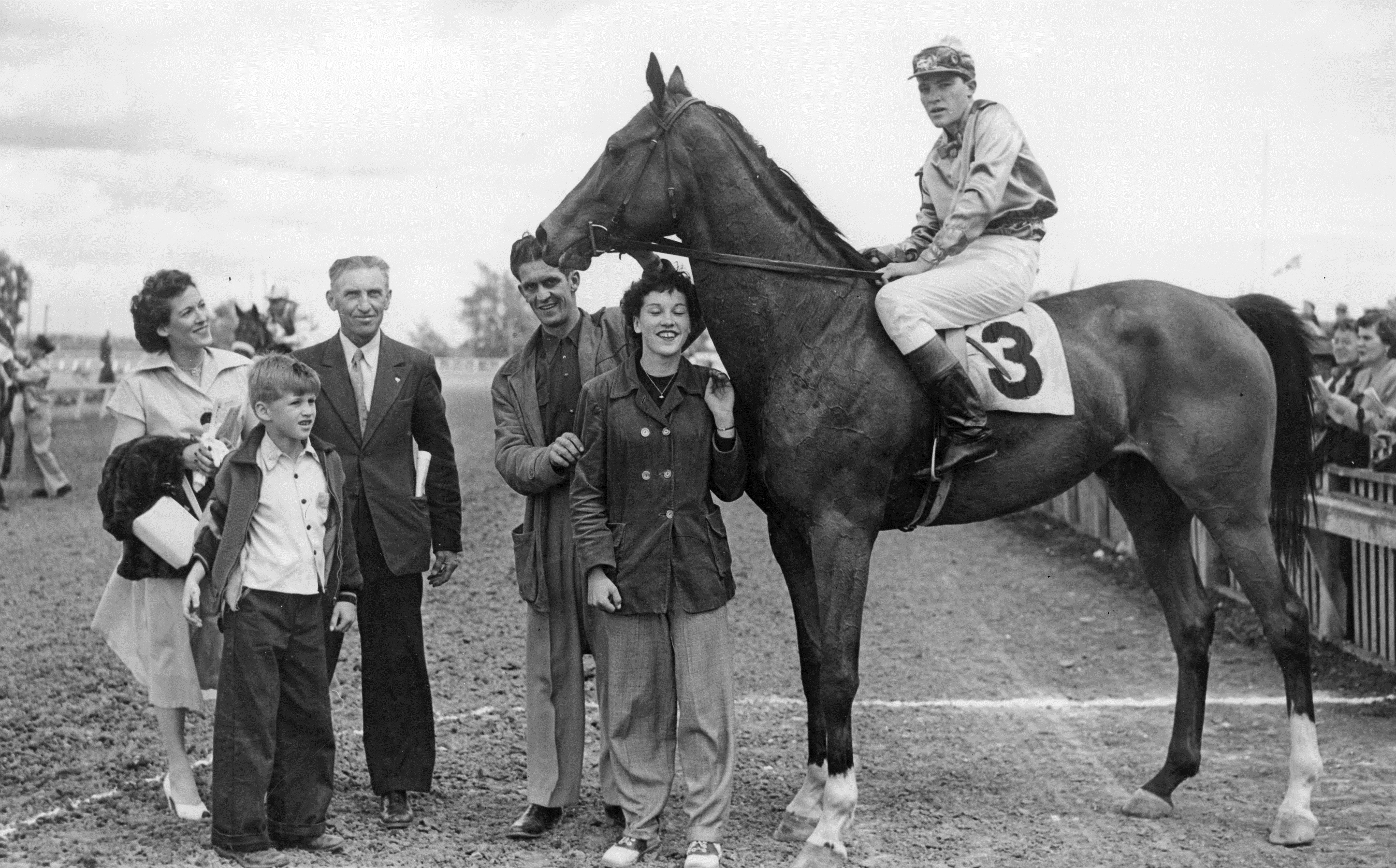
This image, donated to the Archives by the Russell Family, shows winning horse “Fair Ruffles” and jockey Wells at Lansdowne Park on June 21, 1952. Also shown are trainer Jackie Russell, Phyllis Russell, Barry Blair, Archie Blair and Roberta (Blair) Diamond. City of Richmond Archives photograph 1998 29 16.
The Archives acquires both public and private records by scheduled transfer, gift, bequest, purchase, exchange or any other action by which title to the material passes to the Archives, with the understanding that ownership is held in trust for future generations.
This photograph of young couple walking their dog near Garden City Road between Saunders and Francis Roads, ca. 1958, is a good example of a family photo that has been donated to the Archives. City of Richmond Archives photograph 1985 5 7.
Significant photos may come from any time period, right up to the present. If you have any photographs that relate to Richmond and you are not sure what to do with them, please do not throw them away!
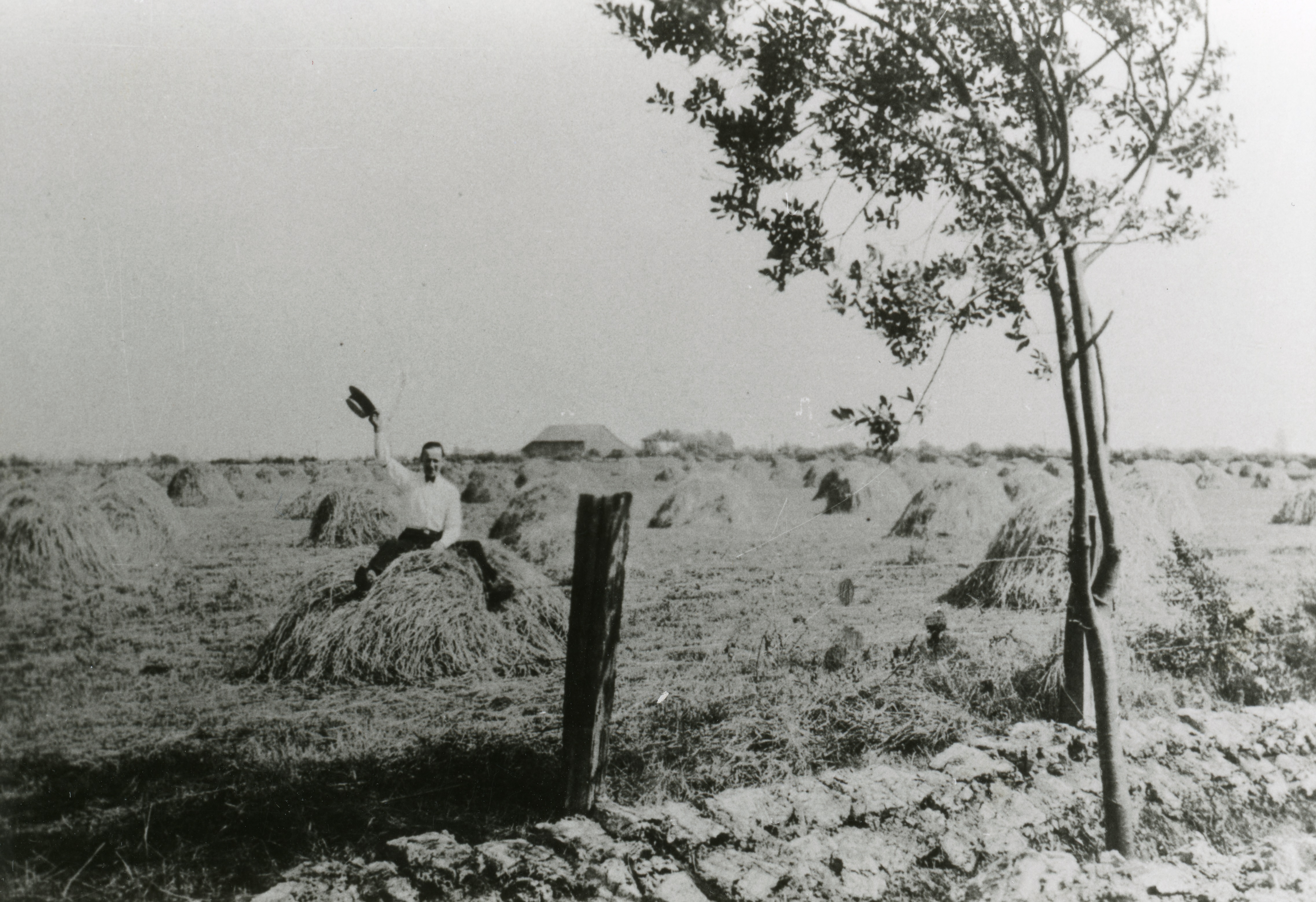
A farmer raises his hat while sitting on a haystack in this photo. City of Richmond Archives photograph 1978 35 13.
Donating your original family photographs to the Archives ensures their long-term preservation and accessibility by you and your family members for generations to come. Contact the Archivist by telephone at 604-247-8305 or by email at archives@richmond.ca to determine if they might become part of the Archives’ collection.
The City of Richmond is an island city, built on islands formed over millennia by the action of the Fraser River. The largest of these islands is Lulu Island, home to the great majority of the city’s population, farmland and industry. Even though it has been part of the Corporation of the Township of Richmond since 1879, people who were born and raised on the island will tell you that they are from Lulu Island, not Richmond, the name appearing on birth certificates, in telephone books up into the 1960s, in business names and even as an official mailing address through the 1950s. Where did this likeable if somewhat whimsical name come from?
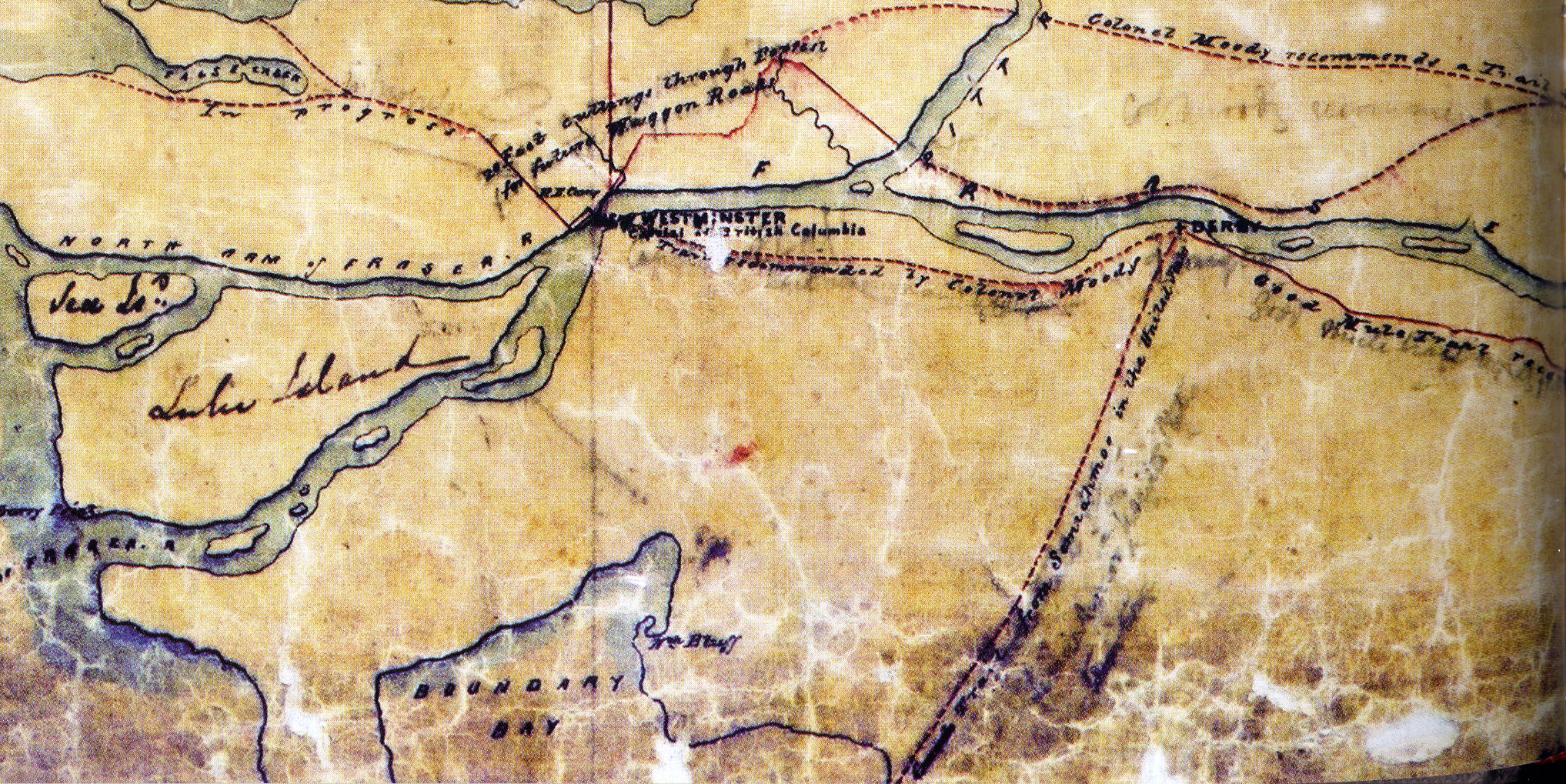
This map was sent by Col. Moody to BC Governor James Douglas and was dated June 29, 1860. It shows trails that were existing at the time, trails that were under construction and trails and roads that Moody recommended be built. It also shows the names of Lulu and Sea Islands, added at a later date in different handwriting. (City of Richmond Archives digital files)
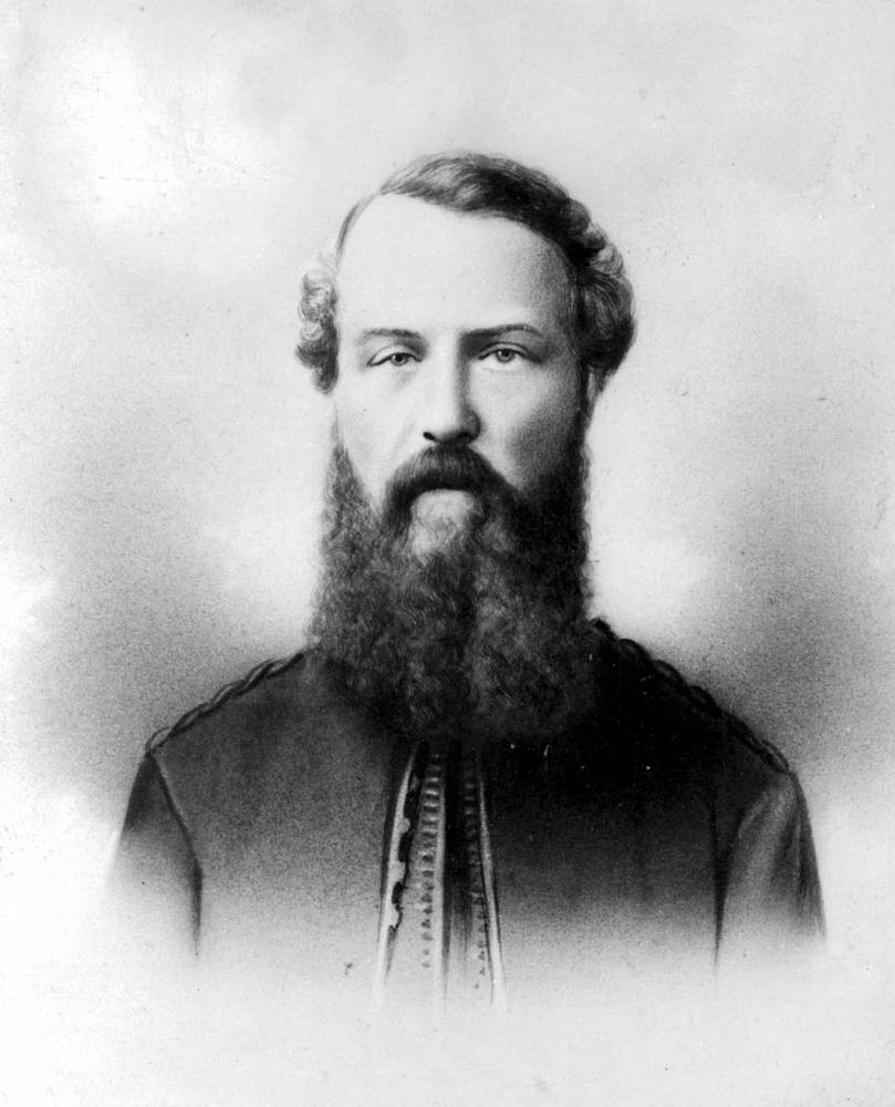
The person responsible for naming Lulu Island, and many other features of the Lower Mainland of British Columbia, was Colonel Richard Clement Moody, a pivotal figure in the history of British Columbia. Moody was made the Commander of the British Columbia detachment of the Royal Engineers in 1858 and was sworn in as the Chief Commissioner of Land and Works and Lieutenant-Governor of the Crown Colony of British Columbia in 1859. Under his command the Royal Engineers located and surveyed defendable town sites, surveyed country lands, built roads, examined harbours, and reported on mineral deposits, fisheries and other resources. Although police work was not part of the detachment’s mandate, they also took on the task of ensuring that the rule of law was upheld in the fledgling colony.
Colonel Richard Clement Moody, Royal Engineers, one of the most influential people in early BC history. (BC Archives photo A-01722)
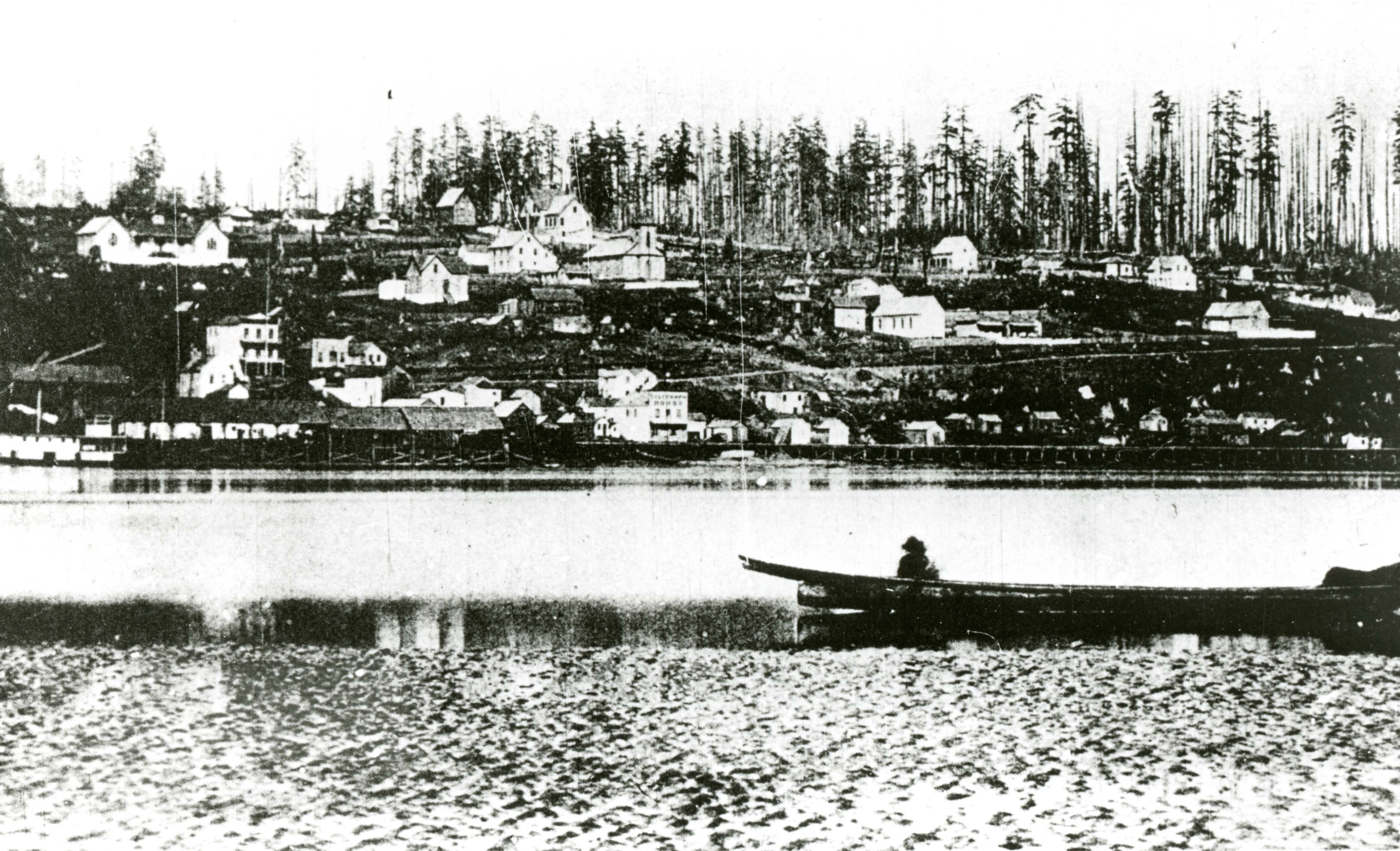
Moody selected New Westminster as the site of the Colony’s capitol, mostly due to its strategic location on the north bank of the river, defendable from an attack from the United States and able to be resupplied from Burrard Inlet through North Road, which was also built by the Engineers. By 1858 the New Westminster town site had been cleared and the streets were not even finished being laid out before town lots were being sold. No frontier town would be complete if some enterprising individual did not open a saloon, and so Mr. J.T. Scott opened the Pioneer Saloon in New Westminster, to which he soon built an addition “in the shape of an extended wooden shack” and called it the Pioneer Theatre. Into this rough frontier town in 1860 came the Potter Dramatic Troupe, who were dropped off on Burrard Inlet and had to walk to New Westminster along the trail which would become North Road, carrying all their costumes and set materials with them. The company’s leader, John S. Potter, was a well-known figure in early American theatre, having opened theatres and managed dramatic companies in virtually every corner of the United States. From 1855 to 1865 he operated in the Northwest, from California to British Columbia, and from October 1860 to May 1863 he was the most important figure in theatre in Victoria.
Moody’s capital, New Westminster, ca. 1864. A frontier town on the river. (City of Richmond Archives photo 1977 2 25)
Travelling theatre troupes often had to operate on a shoestring budget. Potter was held in custody in Victoria for an unpaid bill of $250 he left in Sacramento. A benefit performance for the relief of his debt was held, featuring members of the Stark Theatrical Troupe as well as members of his own company, including Lulu Sweet, and her mother and father. (The British Colonist, Feb 11, 1861)
Travelling theatrical troupes in the frontier lived a rigorous and hazardous existence. They performed in some of the most primitive theatres one can imagine, in front of audiences consisting of pioneers who were starved for entertainment, often well lubricated at the saloon to which the theatre was often attached. The troupes lived temporarily in boarding houses and cheap hotels, often had to eat poor food and were subjected to the social prejudice that was associated with theatrical people, especially actresses, during that time period. Travel was usually difficult, time consuming, and all the equipment for the shows had to be carried with them, leading to standardization of sets and costumes. A company would carry several sets, painted on canvas, such as a landscape, a fancy interior, a plain interior or a street scene. Costumes would also be adapted to serve for many roles with little attention to historical accuracy. Even the actors would play stereotypical characters for which they had developed a talent for portraying, regardless of the age or gender of the person.
Potter’s troupe played in the Pacific Coast States and Washington Territory, appearing in Vancouver Washington, Portland Oregon and many small California towns. They also performed in theatres in San Francisco and in 1860 made the sea voyage to Victoria, where the troupe boasted about “Being composed of Fifteen Ladies and Gentlemen of acknowledged talent and respectability, they are enabled to present a better series of legitimate entertainments than ever yet attempted in this city.”
The star of Potter’s troupe was young Lulu Sweet, “The Beautiful Juvenile Actress, Songstress and Danseuse.” Lulu, who was born around 1844, was accompanied in her travels with the troupe by her mother, Mrs. E. Sweet who was also an actress, and her father, Dr. John D. Sweet, a physician. Starting around age 12 Lulu was a child actress in the San Francisco Theatre circuit, performing with a company of 27 “juvenile comedians.” She had joined the Potter troupe by 1860, traveling to the western states with them and then to Victoria, where they performed to good reviews for several weeks before taking the trip to New Westminster for a three week engagement. Music for the production was taken care of by the Royal Engineers Band and performances were attended by all the local dignitaries, including Colonel Moody, who was apparently quite a fan of Miss Sweet’s.
Lulu Sweet, ca. 1865, actress, singer and dancer who gave her name to Lulu Island. (City of Richmond Archives photo RCF 21)
The Potter Troupe played in Victoria and made three trips to New Westminster during their stay in the colonies. It was on the trip back to Victoria on the steamer Otter in January 1861 that Lulu Sweet asked Colonel Moody the name of the large island they were passing. He told her that it had no name and then exclaimed that he would name it after her, and Lulu Island it has been ever since. It appears that Moody had second thoughts about the name he had chosen. A map he sent to the Colonial Office that same year had the name “Lulu” overwritten with the name “Palmer”, most likely hoping to rename the island after one of his officers, Lieutenant Henry Spencer Palmer but Lulu Island it remained.
This photo of Lulu Sweet was taken in 1863 at a studio beside Maguires Opera House in San Francisco, a theatre in which she performed for many years. She never returned to BC after leaving Victoria, and never set foot on the Island that was named for her. (Image from the City of Richmond Biography Files)
Lulu Sweet and the Potter Dramatic Troupe left the colonies in 1863 and returned to San Francisco where she continued to act, sing and dance in venues such as Maguire’s Opera House. She was a successful actress whose name shows up in many playbills and newspaper ads for theatres in San Francisco through 1865 as well as later newspaper articles about the history of theatre in San Francisco. Around that year it appears that she married a Mr. Smith, had four children, later divorcing. She lived with her daughters in Burlingame, a suburb of San Francisco until her death in 1914.


You must be logged in to post a comment.